MEaSUREs: Northern Hemisphere Terrestrial Snow Cover Extent Weekly 100km EASE-Grid 2.0

"This data set offers users weekly 100 km Northern Hemisphere snow cover extent represented by three different variables. Two of the variables are derived from individual source products: the NOAA/NCDC Northern Hemisphere Snow Cover Extent Climate Data Record and Defense Meteorological Satellite Program (DMSP) passive microwave brightness temperatures, respectively. The third variable merges the other two into a single representation of snow cover."
From the netCDF file: "This NASA MEaSUREs Earth System Data Record (ESDR) merges daily Northern Hemisphere snow cover extents over land derived from two independently produced sources. Variables include snow cover extent from the weekly NOAA/NCDC Northern Hemisphere Snow Cover Extent Climate Data Record (NH SCE CDR) and a gap-filled snow extent product derived from the Special Sensor Microwave/Imager (SSMI) and Special Sensor Microwave Imager/Sounder (SSMIS). The NSIDC Land-Ocean-Coast-Ice (LOCI) mask derived from BU-MODIS land cover data is consistently applied to each variable. Data are in a Northern Hemisphere equal area projection at 100 km resolution, and are contained in weekly netCDF files spanning from October 4, 1966 to December 31, 2012."
Cite this page
Acknowledgement of any material taken from or knowledge gained from this page is appreciated:
National Center for Atmospheric Research Staff (Eds). Last modified "The Climate Data Guide: MEaSUREs: Northern Hemisphere Terrestrial Snow Cover Extent Weekly 100km EASE-Grid 2.0.” Retrieved from https://climatedataguide.ucar.edu/climate-data/measures-northern-hemisphere-terrestrial-snow-cover-extent-weekly-100km-ease-grid-20 on 2026-02-18.
Citation of datasets is separate and should be done according to the data providers' instructions. If known to us, data citation instructions are given in the Data Access section, above.
Acknowledgement of the Climate Data Guide project is also appreciated:
Schneider, D. P., C. Deser, J. Fasullo, and K. E. Trenberth, 2013: Climate Data Guide Spurs Discovery and Understanding. Eos Trans. AGU, 94, 121–122, https://doi.org/10.1002/2013eo130001
Key Figures
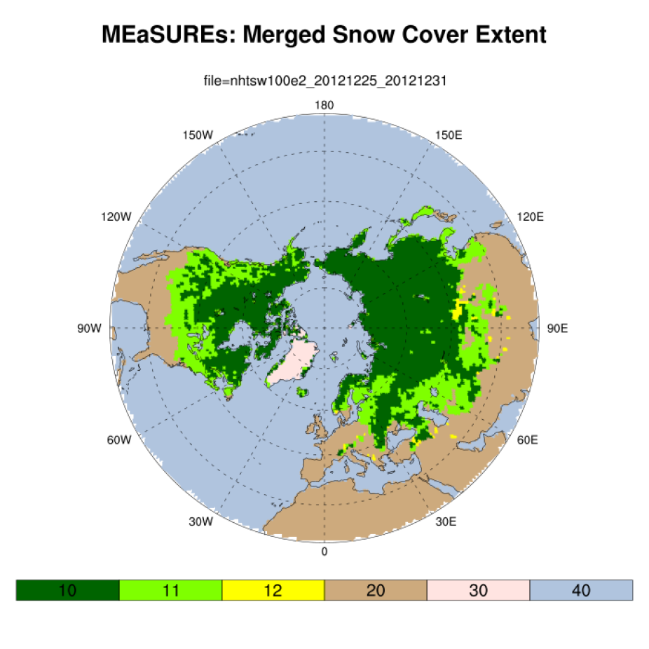
MEaSUReEs: snow extent for Dec. 25-31, 2012. Values:10: Snow cover reported by weekly_cdr, passive_microwave, 11: Snow cover reported b y weekly_cdr only, 12: Snow cover reported by passive_microwave only, 20: Snow free land, 30: Permanent ice covered land, 40: Ocean. (D. Shea; Climate Data Guide)