Climate data guide content with tag Cryosphere
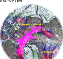 Arctic System Reanalysis (ASR)
Years of record
- to
The Arctic System Reanalysis is a multi-agency, university-led retrospective analysis (reanalysis) of the Greater Arctic. ASR is produced using high-resolution versions of the Polar Weather Forecast Model (PWRF) and the WRF-VAR and High Resolution Land Data Assimilation (HRLDAS) data assimilation systems that have been optimized for the Arctic. ASR is a comprehensive…
Experts contributing reviews
- N/A
 CERA-20C: ECMWF's Coupled Ocean-Atmosphere Reanalysis of the 20th Century
Years of record
- to
The CERA-20C is a global, coupled reanalysis spanning 1901-2010 with a focus on low-frequency climate variability. Similar to ERA-20C, the surface observations assimilated include surface pressures from the International Surface Pressure Databank v3.2.6 and ICOADS v 2.5.1, and surface winds over the oceans from ICOADSv2.5.1. Upper-air and satellite data are…
Main variables and Earth System components
Atmosphere Multiple variables Cryosphere Sea Ice Concentration OceanExperts contributing reviews
- Laloyaux, Patrick
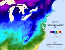 Daymet: Daily Surface Weather and Climatological Summaries
Years of record
- to
Daymet provides long-term, continuous, gridded estimates of daily weather and climatology variables by interpolating and extrapolating ground-based observations through statistical modeling techniques. The Daymet data products provide driver data for biogeochemical terrestrial modeling and have myriad applications in many Earth science, natural resource, biodiversity,…
Main variables and Earth System components
Atmosphere Maximum Air Temperature Minimum Air Temperature Precipitation Radiation Water Vapor Cryosphere Snow Water Equivalent-
Timestep
- Climatology, Daily
-
Domain
- North America
-
Collections
- N/A
Experts contributing reviews
- Thornton, Peter E
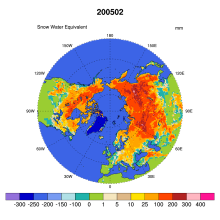 Global Monthly EASE-Grid Snow Water Equivalent Climatology: SSMR, SSMI
Years of record
- to
This data set comprises global, monthly satellite-derived snow water equivalent (SWE) climatologies from November 1978 through May 2007, and is updated with more recent data periodically. Global data are gridded to the Northern and Southern 25 km Equal-Area Scalable Earth Grids (EASE-Grids). Global snow water equivalent is derived from Scanning Multichannel Microwave…
-
Formats
- binary
-
Timestep
- Monthly
-
Collections
- N/A
Experts contributing reviews
- N/A
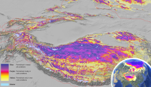 Global Permafrost Zonation Index Map
Years of record
- N/A
This data set contains a global (excluding Antarctica) 1 km map of permafrost zonation. It is an estimate of to what degree permafrost exists in a region nearly everywhere, or only in the most favorable conditions. These local conditions affecting permafrost occurrence will partly exhibit regional trends (e.g. mean snow cover characteristics or continentality), partly…
Experts contributing reviews
- Gruber, Stephan
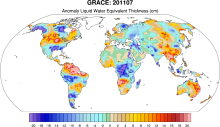 GRACE: Gravity Recovery and Climate Experiment: Surface mass, total water storage, and derived variables
Years of record
- to
The Gravity Recovery and Climate Experiment (GRACE) refers to a pair of NASA satellites that has flown in low-Earth orbit since 2002. The satellites use a precise microwave ranging system to measure the distance between themselves due to gravitational acceleration. Onboard GPS instruments determine the exact position of the satellites over the Earth. GRACE measures…
Main variables and Earth System components
Cryosphere Glaciers Ice Sheet Mass Land Groundwater surface water Water Storage Ocean Bottom pressure-
Timestep
- Daily, Monthly
-
Domain
- Global
-
Collections
- Diagnostic Data Sets, NCAR-DOE-CESM, landdiagnostics, landicediagnostics
Experts contributing reviews
- Swenson, Sean
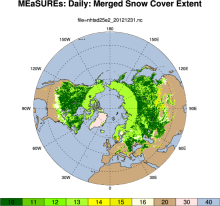 MEaSUREs Northern Hemisphere Terrestrial Snow Cover Extent Daily 25km EASE-Grid 2.0
Years of record
- to
"This data set offers users 25 km Northern Hemisphere snow cover extent represented by four different variables. Three of the snow cover variables are derived from the Interactive Multisensor Snow and Ice Mapping System, MODIS Cloud Gap Filled Snow Cover, and passive microwave brightness temperatures, respectively. The fourth variable merges the three source products…
-
Formats
- netCDF
-
Timestep
- Daily
-
Domain
- NH - Northern Hemisphere
-
Collections
- N/A
Experts contributing reviews
- N/A
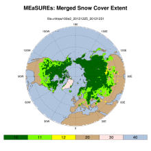 MEaSUREs: Northern Hemisphere Terrestrial Snow Cover Extent Weekly 100km EASE-Grid 2.0
Years of record
- to
"This data set offers users weekly 100 km Northern Hemisphere snow cover extent represented by three different variables. Two of the variables are derived from individual source products: the NOAA/NCDC Northern Hemisphere Snow Cover Extent Climate Data Record and Defense Meteorological Satellite Program (DMSP) passive microwave brightness temperatures, respectively. The…
-
Formats
- netCDF
-
Timestep
- Weekly
-
Domain
- NH - Northern Hemisphere
-
Collections
- Climate Data Record
Experts contributing reviews
- N/A
 Merged Hadley-NOAA/OI Sea Surface Temperature & Sea-Ice Concentration (Hurrell et al, 2008)
Years of record
- to
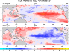
The merged Hadley-OI sea surface temperature (SST) and sea ice concentration (SIC) data sets were specifically developed as surface forcing data sets for AMIP style uncoupled simulations of the Community Atmosphere Model (CAM). The Hadley Centre's SST/SIC version 1.1 (HADISST1), which is derived gridded, bias-adjusted in situ observations, were merged with the NOAA-…
Main variables and Earth System components
Cryosphere Sea Ice Concentration Ocean SST - sea surface temperature-
Formats
- netCDF
-
Timestep
- Monthly
Experts contributing reviews
- N/A
 NSIDC Sea Ice Index
Years of record
- to
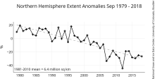
The NSIDC Sea Ice Index is a suite of easy-to-use sea ice analyses to track changes in Arctic and Antarctic sea ice. The product is produced and supported by the NOAA at NSIDC group and consists of browse imagery and data text files (CSV or Excel format). The input data is from two sources distributed by the NASA NSIDC Distributed Active Archive Center (DAAC): (1) Sea…
Experts contributing reviews
- Meier, Walter
 Observations of Glacier Mass Balance: The World Glacier Monitoring Service
Years of record
- to
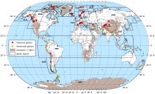
Mountain glaciers and ice caps have been studied as sensitive indicators of climate since the 19th century. The recognition of glacier sensitivity to climate led to the development of a global reporting system for glacier terminus change and glacier mass balance during the International Geophysical Year. The World Glacier Monitoring Service (WGMS) has been the…
-
Formats
- N/A
-
Timestep
- Annual
-
Domain
- Global
-
Collections
- BAMS State of the Climate
Experts contributing reviews
- Pelto, Mauri
 Pan-Arctic Ice Ocean Modeling and Assimilation System (PIOMAS)
Years of record
- to
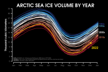
The Pan-Arctic Ice-Ocean Modeling and Assimilation System (PIOMAS) is a reanalysis data set that uses a coupled ice and ocean model to provide daily and monthly estimates of Arctic sea-ice thickness. The data is publicly available from January 1979 to in near-real time. The model is developed and maintained by the Polar Science Center (PSC) in the Applied Physics…
Experts contributing reviews
- Labe, Zachary
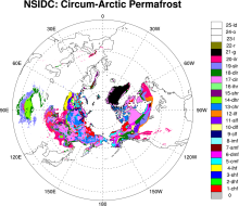 Permafrost: Circum-Arctic Map of Permafrost and Ground Ice Conditions
Years of record
- N/A
The circumpolar permafrost and ground ice data contribute to a unified international data set that depicts the distribution and properties of permafrost and ground ice in the Northern Hemisphere (20°N to 90°N). The re-gridded data set shows discontinuous, sporadic, or isolated permafrost boundaries.
-
Timestep
- Climatology
-
Domain
- NH - Northern Hemisphere
-
Collections
- N/A
Experts contributing reviews
- N/A
 Randolph Glacier Inventory data base of global glacier outlines
Years of record
- N/A
The Randolph Glacier Inventory (RGI) is a global data base of glacier outlines. It is intended for estimates of ice volume and glacier mass at regional and global scales. The data are organized into 19 large regions, with a shapefile provided for each region. The RGI is produced as part of the Global Land Ice Measurements from Space (GLIMS) initiative, a project to…
Experts contributing reviews
- N/A
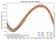 Sea Ice Concentration Climate Data Record from OSI SAF
Years of record
- to
The Ocean and Sea Ice Satellite Applications Facility (OSI SAF) of EUMETSAT provides sea ice concentration products for the Arctic and Antarctic based on satellite passive microwave data. The concentration value is expressed as the fractional percentage of the ice cover in a given grid cell. Since 2023, OSI-450-a and OSI-430-a constitute the third fully…
-
Formats
- netCDF
-
Timestep
- Daily
-
Collections
- N/A
Experts contributing reviews
- Aaboe, Signe, Lavergne, Thomas
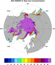 Sea Ice Concentration data from AMSR-E, AMSR2 & SSMIS, U Bremen and U Hamburg ASI algorithm
Years of record
- to
The sea ice data derived from AMSR-E using the ARTIST sea ice (ASI) algorithm offer a factor of 4 finer spatial resolution than most sea ice data sets from passive microwave satellite instruments. ASI is based on the difference of vertically and horizontally polarized brightness temperatures at 89 GHz; this difference is independent of temperature but depends on…
-
Timestep
- Daily
-
Collections
- N/A
Experts contributing reviews
- N/A
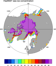 Sea Ice Concentration data from HadISST
Years of record
- to
Spanning 1871-present at monthly timesteps, HadISST provides the longest gridded sea ice data available for both the Arctic and Antarctic. It is a 1° x 1° spatially infilled data set that is It is intended as a consistent analyses for input into SST analyses or as boundary conditions for models. Version 1.1 is the currently available data set and is the one described…
-
Timestep
- Monthly
-
Collections
- Boundary Conditions
Experts contributing reviews
- N/A
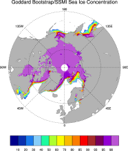 Sea Ice Concentration data from NASA Goddard and NSIDC based on Bootstrap algorithm
Years of record
- to
Bootstrap sea ice refers to a well-known algorithm used to estimate sea ice concentration from passive microwave brightness temperatures. It can be applied to data from many satellite instruments, such as SMMR, SSMI, and AMSR-E. This page discusses the algorithm itself and the long-term data set ("NSIDC 0079, version 2") produced by J. Comiso and distributed by NSIDC.…
-
Timestep
- Daily, Monthly
-
Collections
- N/A
Experts contributing reviews
- N/A
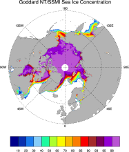 Sea Ice Concentration data from NASA Goddard and NSIDC based on NASA Team algorithm
Years of record
- to
NASA Team sea ice refers to a well-known algorithm used to estimate sea ice concentration from passive microwave brightness temperatures. This page discusses the algorithm itself and the long-term data set ("NSIDC 0051") produced by scientists at NASA Goddard and distributed by NSIDC. The NASA Team data are very widely used and are a key input into other data sets…
-
Timestep
- Daily, Monthly
-
Collections
- Diagnostic Data Sets, NCAR-DOE-CESM, seaicediagnostics
Experts contributing reviews
- N/A
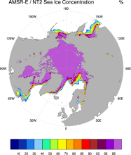 Sea Ice Concentration data from NASA Goddard and NSIDC using AMSR-E and NASA TEAM2 (NT2) algorithm
Years of record
- to
The AMSR-E/NASA Team 2 (NT2) data set of Arctic and Antarctic sea ice concentration is available at daily timesteps and 12.5 km (optionally 25km) spatial resolution for 2002-2011. NT2, an extension of the original NASA Team algorithm, uses AMSR-E 89GHz channels to help resolve ambiguity between low ice concentrations and areas with strong surface effects (due to snow…
Experts contributing reviews
- N/A
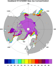 Sea ice concentration data from NASA Goddard based on SSMI and NASA Team (NT2) algorithm
Years of record
- to
The NASA Team 2 (NT2) / SSMI data set of Arctic and Antarctic sea ice concentration is available at daily timesteps and 25km spatial resolution for 1992-2008. NT2, an extension of the original NASA Team algorithm, uses SSMI 85GHz channels to help resolve ambiguity between low ice concentrations and areas with strong surface effects (due to snow layering and glazing).…
Experts contributing reviews
- N/A
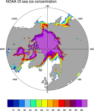 Sea Ice Concentration data from NOAA OI
Years of record
- to
The NOAA Optimal Interpolation (OI) v2 sea ice data set contains gridded, weekly or monthly resolution sea ice concentration estimates for both the Northern and Southern Hemispheres. It is intended as a consistent analyses for input into SST analyses (and is the basis for calculating SSTs in sea ice zones for the OI SST data) or as boundary conditions for atmospheric…
-
Formats
- netCDF
-
Timestep
- Monthly, Weekly
-
Collections
- Boundary Conditions
Experts contributing reviews
- N/A
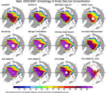 Sea Ice Concentration data: Overview, Comparison table and graphs
Years of record
- N/A
Sea ice concentration is both an indicator and driver of changes high-latitude climate with strong societal and ecological importance. It is a key boundary condition for atmospheric models (including those used in atmospheric reanalyses) and a benchmark for coupled climate models. As such, numerous methods have been developed to estimate sea ice concentration. The most…
-
Formats
- N/A
-
Timestep
- N/A
-
Collections
- Overview / Comparison page
Experts contributing reviews
- N/A
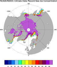 Sea Ice Concentration: NOAA/NSIDC Climate Data Record
Years of record
- to
The NOAA/NSIDC Climate Data Record (CDR) of sea ice concentration is available at 25 x 25 km spatial resolution in daily or monthly timesteps for 1987-2014. It provides a consistent interpretation of sea ice for the satellite record, with the intent of being suitable for studies of climate variability and change. The CDR is produced by an automated and independent…
-
Formats
- netCDF
-
Timestep
- Daily, Monthly
-
Collections
- Climate Data Record
Experts contributing reviews
- Meier, Walter
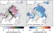 Sea Ice Thickness Data Sets: Overview & Comparison Table
Years of record
- to
While satellite observations of sea ice extent and concentration are available from 1979, long-term high quality (daily and high spatial resolution) observations of sea ice thickness remain limited as a result of few satellite and in situ observations. Reconstructions using numerous observational sources show a 65% decline in annual mean sea ice thickness in the central…
Experts contributing reviews
- Labe, Zachary, Tilling, Rachel
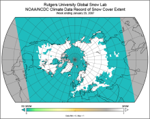 Snow Cover Extent (Northern Hemisphere) Climate Data Record, by Rutgers
Years of record
- to
The Snow Cover Extent Climate Data Record extends from the late 1960s to present. Historical analyses based on visual inspection have been digitized and combined with modern multi-spectral remote sensing to produce a seamless record on a hemispheric scale. The data are available at weekly and monthly resolutions in a variety of formats. The spatial resolution varies with…
-
Timestep
- Monthly, Weekly
-
Domain
- North America
-
Collections
- Climate Data Record, Diagnostic Data Sets, NCAR-DOE-CESM, landdiagnostics
Experts contributing reviews
- Estilow, Thomas W., Robinson, David
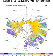 Snow Water Equivalent (AMSR-E)
Years of record
- to
The Advanced Microwave Scanning Radiometer-Earth Observing System (AMSR-E) distributes daily, weekly, and monthly products which includes snow water equivalent. Note: "On 04 October 2011, the AMSR-E instrument on board the Aqua satellite stopped producing data due to a problem with the rotation of its antenna."
-
Formats
- HDF-EOS
-
Timestep
- Daily, Monthly, Weekly
-
Domain
- NH - Northern Hemisphere
-
Collections
- N/A
Experts contributing reviews
- N/A
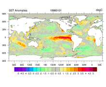 SST data: NOAA High-resolution (0.25x0.25) Blended Analysis of Daily SST and Ice, OISSTv2
Years of record
- to
"NOAA’s Optimum Interpolation Sea Surface temperature (OISST, also known as Reynolds’ SST) is a series of global analysis products, including the weekly OISST on a 1° grid to the more recent daily on a ¼° grid. An SST analysis is a spatially gridded product created by interpolating and extrapolating data, resulting in a smoothed complete field. OISST provides global…
Main variables and Earth System components
Cryosphere Sea Ice Concentration Ocean SST - sea surface temperatureExperts contributing reviews
- Banzon, Viva, Reynolds, Richard
 Walsh and Chapman Northern Hemisphere Sea Ice
Years of record
- to
The Walsh and Chapman Sea Ice Data Set provides a long record of Arctic sea ice concentrations on a monthly basis for 1870-2011. Historical observations were gridded and combined with satellite-derived sea ice concentrations for the recent decades. Mostly climatologies before the 1950s. The Walsh and Chapman sea ice data set is the main input data set into the HadiSST…
-
Formats
- ascii
-
Timestep
- Monthly
-
Domain
- NH - Northern Hemisphere, Arctic
-
Collections
- N/A
Experts contributing reviews
- Chapman, William