Surface Solar Radiation Data Set - Heliosat (SARAH) -Edition 1

"The Surface Solar Radiation Data Set - Heliosat (SARAH) is a satellite-based climatology of the solar surface irradiance (SIS), the surface direct normalized irradiance (DNI) and the effective cloud albedo (CAL) derived from satellite observations of the visible channels of the MVIRI and SEVIRI instruments onboard the geostationary Meteosat satellites. The data are available from 1983 to 2013 and cover the region ±65° longitude and ±65° latitude. The products are available as monthly, daily, and hourly averages on a regular latitude/longitude grid with a spatial resolution of 0.05° x 0.05°. The data set is complemented with a comprehensive documentation of the applied algorithms as well as validation studies and user guidance."
Key Strengths
Key Limitations
Cite this page
Acknowledgement of any material taken from or knowledge gained from this page is appreciated:
National Center for Atmospheric Research Staff (Eds). Last modified "The Climate Data Guide: Surface Solar Radiation Data Set - Heliosat (SARAH) -Edition 1.” Retrieved from https://climatedataguide.ucar.edu/climate-data/surface-solar-radiation-data-set-heliosat-sarah-edition-1 on 2026-02-23.
Citation of datasets is separate and should be done according to the data providers' instructions. If known to us, data citation instructions are given in the Data Access section, above.
Acknowledgement of the Climate Data Guide project is also appreciated:
Schneider, D. P., C. Deser, J. Fasullo, and K. E. Trenberth, 2013: Climate Data Guide Spurs Discovery and Understanding. Eos Trans. AGU, 94, 121–122, https://doi.org/10.1002/2013eo130001
Key Figures
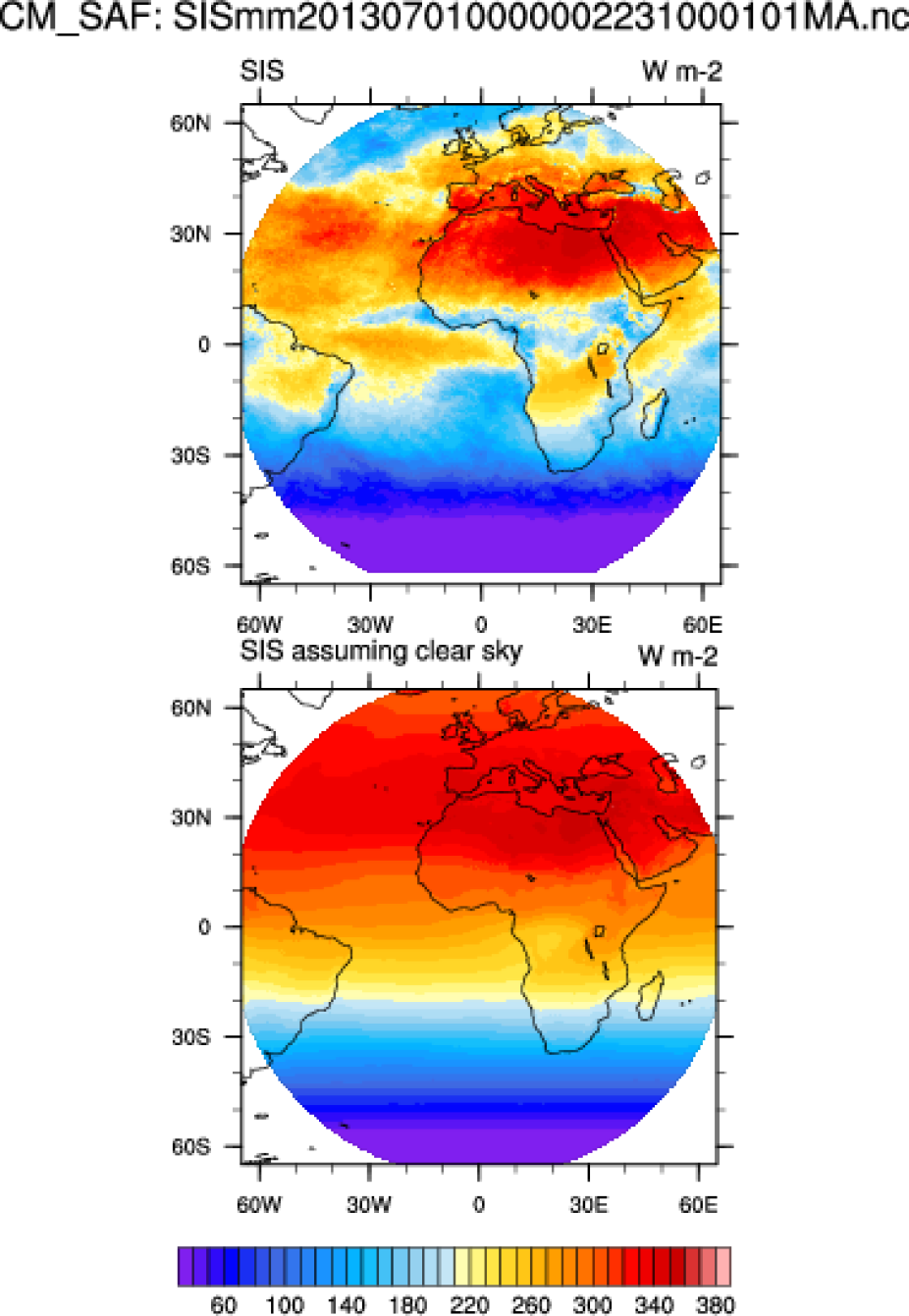
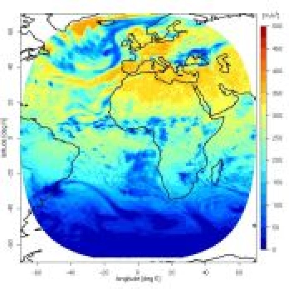
CM SAF: Solar Surface Irradiance (SSI) for July 2013
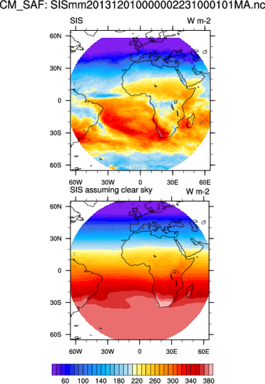
CM SAF: Solar Surface Irradiance (SSI) for December 2013
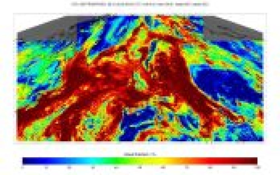
Daily mean of fractional cloud cover (22 January 2012), Source: CM SAF
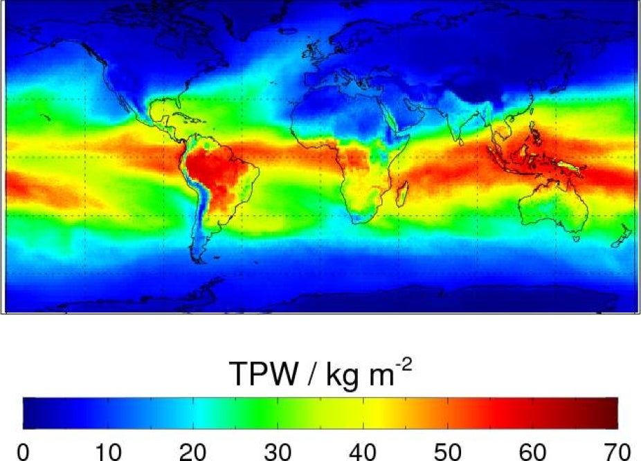
Monthly mean of vertically integrated water vapor (Jan 2010), Source: CM SAF
Daily mean of surfcae incoming surfcae radiation (8 July 1984). Source CM-SAF.