Climate data guide content with tag Satellite Data Products
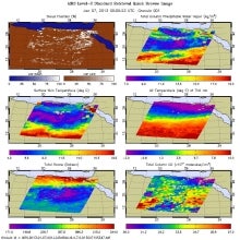 AIRS (Atmospheric InfraRed Sounder): Version 6 Level 2
Years of record
- to
AIRS Version 6 Level 2 data represent a significant improvement over AIRS Version 5 Level 2 products in terms of greater stability, yield, and quality. Several algorithmic improvements have been made by the AIRS Project in conjunction with the AIRS Science Team. Improvements include: (a) Improved soundings of Tropospheric and Sea Surface Temperatures, day and night…
Main variables and Earth System components
Atmosphere Aerosols Air Temperature CO Geopotential Height Ozone: Tropospheric Precipitable water Specific HumidityExperts contributing reviews
- N/A
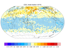 AIRS and AMSU: Trace Gases (CO2, CO, CH4, O3...); Level 3
Years of record
- N/A
AIRS provides satellite retrieval of mid-tropospheric carbon dioxide even under cloudy conditions, without the use of a priori information from models. AIRS retrievals use cloud-cleared thermal IR radiance spectra in the 15 micron band with an accuracy better than 2 ppm. AIRS retrievals have been used to produce global maps of carbon dioxide and other trace gases…
Main variables and Earth System components
Atmosphere CO Ozone: Tropospheric Biosphere CH4-Methane CO CO2-
Timestep
- Sub-daily, Daily, Monthly
-
Domain
- Global
-
Collections
- Carbon cycle
Experts contributing reviews
- N/A
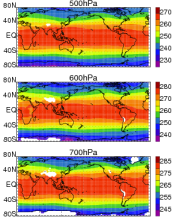 AIRS and AMSU: Tropospheric air temperature and specific humidity
Years of record
- to
The Atmospheric Infrared Sounder (AIRS) project has generated decadal-length, global, gridded data sets of temperature and specific humidity for several standard levels in the troposphere for the obs4MIPS project. This obs4MIPS version of the AIRS data are available at monthly resolution, 1ºx1º grids and formatted to facilitate easier comparisons with CMIP5 model output…
Experts contributing reviews
- Tian, Baijun
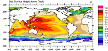 AVISO: Satellite derived Sea Surface Height above Geoid
Years of record
- to
The sea surface height relative to the geoid (the mean ocean surface of the Earth if the ocean is at rest) is derived from TOPEX/Poseidon, Envisat, Jason-1, and OSTM/Jason-2 altimetry measurements. Altimetry is a technique for measuring height. Satellite altimetry measures the time taken by a radar pulse to travel from the satellite antenna to the surface and back to…
Experts contributing reviews
- N/A
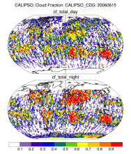 CALIPSO
Years of record
- to
CALIPSO (Cloud-Aerosol Lidar and Infrared Pathfinder Satellite Observations ) was launched on April 28, 2006 to study the impact of clouds and aerosols on the Earth's radiation budget and climate. It flies in formation with five other satellites in the international "A-Train" constellation for coincident Earth observations. The CALIPSO satellite comprises three…
Experts contributing reviews
- N/A
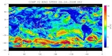 CCMP: Cross-Calibrated Multi-Platform wind vector analysis
Years of record
- to
The CCMP wind analysis is a near-global, high spatial and temporal resolution gridded dataset of surface wind vectors spanning 1987-present. The input data are a combination of inter-calibrated satellite data from numerous radiometers and scatterometers and in-situ data from moored buoys. An algorithm finds a best-fit solution to all of the available…
Experts contributing reviews
- Ricciardulli, Lucrezia
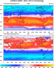 CERES EBAF: Clouds and Earth's Radiant Energy Systems (CERES) Energy Balanced and Filled (EBAF)
Years of record
- to
The CERES-EBAF product provides 1-degree regional, zonal and global monthly mean Top-of-Atmosphere (TOA) and surface (SFC) longwave (LW), shortwave (SW), and net (NET) fluxes under clear and all-sky conditions. EBAF is used for climate model evaluation, estimating the Earth's global mean energy budget, and to infer meridional heat transport. The data synthesized to…
Experts contributing reviews
- Loeb, Norman
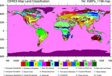 CERES: IGBP Land Classification
Years of record
- N/A
The International Geosphere–Biosphere Programme (IGBP) defines ecosystems surface classifications. The CERES (Clouds and Earth's Radiant Energy System)10-minute data can be used to derive the land categories.
Experts contributing reviews
- N/A
 CHIRPS: Climate Hazards InfraRed Precipitation with Station data (version 2)
Years of record
- to
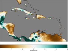
Note: CHIRPS v2 has been superseded by CHIRPS v3 as of June 2025. Climate Hazards Group InfraRed Precipitation with Station data (CHIRPS) is a quasi-global (50S - 50N), land-only rainfall dataset with a range of temporal and spatial resolutions depending on the region and the time period. Data can be found at 0.05 deg or 0.1 deg resolution, and can be found at 6-hourly…
Experts contributing reviews
- Touma, Danielle, Martinez, Carlos
 CHIRPS: Climate Hazards InfraRed Precipitation with Station data (Version 3)
Years of record
- to
Climate Hazards Group InfraRed Precipitation with Station data version 3 (CHIRPS v3)is a 1981-present, land-only, high resolution 0.05° gridded precipitation dataset. It combines thermal-infrared geostationary satellite-based estimates (CHIRP3), in situ observations from global, regional, and national meteorological networks, and a high-resolution climatology (CHPclim2…
Main variables and Earth System components
Precipitation-
Formats
- GeoTIFF
-
Timestep
- Climatology, Monthly, Annual, Pentad
-
Domain
- Africa, Global, South America
-
Collections
- N/A
Experts contributing reviews
- Alaso, Daniella
 CLARA-A1: Cloud properties, surface albedo and surface radiation products based on AVHRR
Years of record
- to
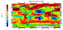
"CLARA-A1 (CLoud, Albedo and RAdiation dataset, AVHRR-based, version 1) is a global dataset of cloud properties, surface albedo and surface radiation products, generated by the EUMETSAT Satellite Application Facility on Climate Monitoring (CM SAF). The products are derived from measurements of the Advanced Very High Resolution Radiometer (AVHRR) onboard the polar…
Main variables and Earth System components
Atmosphere Cloud Properties Liquid Water Path Radiation Surface albedo-
Formats
- netCDF
-
Timestep
- Daily, Monthly, Pentad
-
Domain
- Global
-
Collections
- Climate Data Record
Experts contributing reviews
- Stengel, Martin
 Cloud Dataset Overview
Years of record
- to
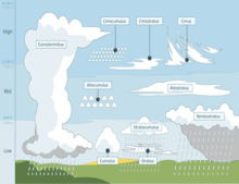
Clouds cover about 70% of the earth's surface. They are important components of the cliimate's water and energy budgets. Historically, cloud reports have come from station or ship observations. The satellite observation era, beginning in the 1980’s and spanning now more than 30 years, allows to capture clouds and their properties over the entire globe and across a…
-
Formats
- N/A
-
Timestep
- Climatology, Monthly
-
Domain
- Global
-
Collections
- Overview / Comparison page
Experts contributing reviews
- Stubenrauch, Claudia
 Cloud observations from MODIS
Years of record
- to
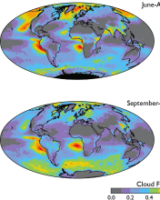
The Moderate Resolution Imaging Spectroradiometer (MODIS) is scanning instrument that makes measurements in 36 spectral bands from the visible to the thermal infrared at spatial resolutions from 250 m to 1 km. There are MODIS instruments aboard two sun-synchronous polar-orbiting NASA satellites: Terra, which has a daytime equatorial crossing at about 10:30 am local time…
-
Timestep
- Daily, Monthly, Weekly
-
Domain
- Global
-
Collections
- Diagnostic Data Sets, NCAR-DOE-CESM, atmosdiagnostics, Obs4MIPS
Experts contributing reviews
- Pincus, Robert
 CloudSat
Years of record
- to
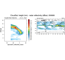
CloudSat is a satellite mission designed to measure the vertical structure of clouds from space. The radar data produces detailed images of cloud structures. CloudSat is one of a constellation of satellites known as the A-Train (Cloudsat, CALIPSO, PARASOL, Aqua, Aura, GCOM-W1). The satellites fly in a nearly circular orbit with an equatorial altitude of approximately…
Experts contributing reviews
- N/A
 CMAP: CPC Merged Analysis of Precipitation
Years of record
- to
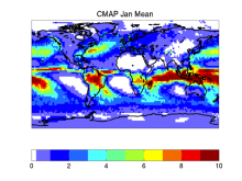
CMAP refers to a collection of precipitation data sets, though the 2.5°x2.5° global monthly version is probably the most widely used. This data set is constructed from an analysis of gauge data and satellite-derived precipitation estimates. An "enhanced" version (CMAP/A) is also available, which provides global coverage by filling in gaps with precipitation forecasts…
-
Timestep
- Monthly, Pentad
-
Domain
- Global
Experts contributing reviews
- Arkin, Phil, Xie, PIngping
 CMORPH (CPC MORPHing technique): High resolution precipitation (60S-60N)
Years of record
- to
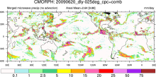
"CMORPH (CPC MORPHing technique) produces global precipitation analyses at very high spatial and temporal resolution. This technique uses precipitation estimates that have been derived from low orbiter satellite microwave observations exclusively, and whose features are transported via spatial propagation information that is obtained entirely from geostationary satellite…
Experts contributing reviews
- N/A
 Combined CloudSat spaceborne radar and CALIPSO spaceborne lidar cloud fraction dataset (3S-GEOPROF-COMB)
Years of record
- to
A global (82S-82N) cloud fraction data set, providing a unique view of cloud vertical structure, has been developed based on the complimentary spaceborne remote sensing capabilities of the CloudSat radar and the CALISPSO lidar. The data set provides monthly mean cloud fraction over several vertical layers for 2006-2019.
-
Formats
- netCDF
-
Timestep
- Monthly, Seasonal, Annual
-
Domain
- Global
-
Collections
- Diagnostic Data Sets, NCAR-DOE-CESM, atmosdiagnostics
Experts contributing reviews
- Bertrand, Leah, Kay, Jennifer
 COSP: Cloud Feedback Model Intercomparison Project (CFMIP) Observation Simulator Package
Years of record
- N/A
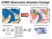
Cloud processes and feedbacks are recognized as the largest uncertainty in climate model projections. Progress in understanding the roles of clouds in the response of the Earth to changes in external forcing (GHG, aerosoles, etc.) has in part been hampered by the lack of a consistent definition of clouds and cloud types in models and observations. It has been difficult…
-
Formats
- N/A
-
Timestep
- N/A
-
Domain
- Global
-
Collections
- Diagnostic Data Sets, NCAR-DOE-CESM, atmosdiagnostics
Experts contributing reviews
- Kay, Jennifer
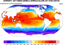 GHRSST: Group for High Resolution Sea Surface Temperature
Years of record
- to
The Group for High-Resolution Sea Surface Temperature (SST; GHRSST) provides a new generation of global high-resolution (10km) SST products to the operational oceanographic, meteorological, climate and general scientific community. The products are provided at a variety of processing levels including "gap-free" global grids. Each SST grid point must have associated with…
Experts contributing reviews
- N/A
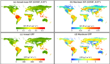 Global dataset of solar-induced chlorophyll fluorescence (GOSIF)
Years of record
- to
GOSIF is a global, gridded dataset of solar-induced chlorophyll fluorescence (SIF). SIF, an energy flux re-emitted by plants a few nanoseconds after light absorption, exhibits a strong linear relationship with gross primary production (GPP) at the ecosystem scale and thereby is a strong proxy of GPP. The GOSIF dataset (Li and Xiao, 2019a) provides 8-day SIF data…
Main variables and Earth System components
Biosphere GPP: Gross Primary Production solar-induced chlorophyll fluorescence (SIF) Land Gross Primary Production-
Formats
- N/A
-
Timestep
- Monthly, Weekly
-
Domain
- Global
-
Collections
- N/A
Experts contributing reviews
- Xiao, Jingfeng, Li, Xing
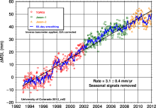 Global Mean Sea Level from TOPEX & Jason Altimetry
Years of record
- to
The global mean sea level timeseries is an excellent, integrative indicator of long-term global temperature trends, providing a record that is observed and processed independent of common metrics like global surface air temperature. The major contributions to the observed sea level trend of 3.3 mm/year include the ocean's thermal expansion, meltwater from mountain…
Experts contributing reviews
- Nerem, R.S.
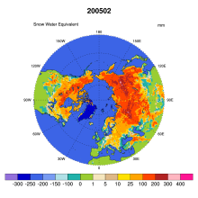 Global Monthly EASE-Grid Snow Water Equivalent Climatology: SSMR, SSMI
Years of record
- to
This data set comprises global, monthly satellite-derived snow water equivalent (SWE) climatologies from November 1978 through May 2007, and is updated with more recent data periodically. Global data are gridded to the Northern and Southern 25 km Equal-Area Scalable Earth Grids (EASE-Grids). Global snow water equivalent is derived from Scanning Multichannel Microwave…
-
Formats
- binary
-
Timestep
- Monthly
-
Collections
- N/A
Experts contributing reviews
- N/A
 GRACE: Gravity Recovery and Climate Experiment: Surface mass, total water storage, and derived variables
Years of record
- to
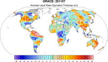
The Gravity Recovery and Climate Experiment (GRACE) refers to a pair of NASA satellites that has flown in low-Earth orbit since 2002. The satellites use a precise microwave ranging system to measure the distance between themselves due to gravitational acceleration. Onboard GPS instruments determine the exact position of the satellites over the Earth. GRACE measures…
Main variables and Earth System components
Cryosphere Glaciers Ice Sheet Mass Land Groundwater surface water Water Storage Ocean Bottom pressure-
Timestep
- Daily, Monthly
-
Domain
- Global
-
Collections
- Diagnostic Data Sets, NCAR-DOE-CESM, landdiagnostics, landicediagnostics
Experts contributing reviews
- Swenson, Sean
 HOAPS: Hamburg Ocean Atmosphere Parameters and Fluxes from Satellite Data
Years of record
- to
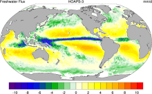
The Hamburg Ocean Atmosphere Parameters and Fluxes from Satellite Data (HOAPS) set is a satellite-based climatology of precipitation, evaporation and freshwater budget (evaporation minus precipitation) as well as related turbulent heat fluxes and atmospheric state variables over the global ice free oceans. All variables are derived from SSM/I passive microwave…
Main variables and Earth System components
Atmosphere Evaporation Evaporation-Precipitation Precipitation Radiation Specific Humidity Wind Latent & sensible heat flux Precipitable water Ocean SST - sea surface temperature-
Formats
- netCDF
-
Timestep
- Climatology, Sub-daily, Monthly, Pentad
-
Domain
- Global
-
Collections
- Boundary Conditions
Experts contributing reviews
- N/A
 IMERG precipitation algorithm and the Global Precipitation Measurement (GPM) Mission
Years of record
- to
IMERG (Integrated Multi-satellitE Retrievals for the Global Precipitation Measurement) is NASA's updated precipitation algorithm, while the Global Precipitation Measurement (GPM) mission is an international satellite mission launched by NASA and JAXA on Feb. 27, 2014. The GPM is a follow on to the TRMM satellite mission. NASA have applied the IMERG algorithm to both…
Experts contributing reviews
- Huffman, George J., Tan, Jackson
 ISCCP: International Satellite Cloud Climatology Project
Years of record
- to
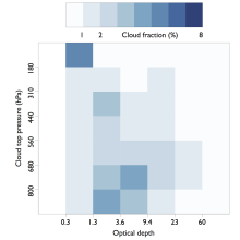
The International Satellite Cloud Climatology Project (ISCCP) makes use of routine observations by operational weather satellites to provide a long-term (1983-2009), gridded, global record of cloud properties. ISCCP uses observations in the visible and infrared window portions of the spectrum to determine cloud optical thickness and cloud top temperature, from which the…
-
Timestep
- Climatology, Sub-daily, Monthly
-
Domain
- Global
Experts contributing reviews
- Pincus, Robert
 Lake Water Storage: GloLakes
Years of record
- to
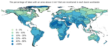
Lakes and reservoirs are critical components of the hydrological cycle, particularly due to their central role in many human systems. Long-term measurements of lakes is critical for understanding the dynamics linking lake volume to the climate system and human activities. The GloLakes dataset utilities remote sensing data to provide near real-time monitoring of the…
-
Formats
- N/A
-
Timestep
- Monthly
-
Domain
- Global
-
Collections
- BAMS State of the Climate
Experts contributing reviews
- N/A
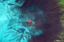 LANDSAT
Years of record
- to
"The Landsat Program provides the longest continuous space-based record of Earth’s land in existence. Since 1972, Landsat satellites have collected measurements of Earth’s continents and surrounding coastal regions that have enabled people to study forests, food production, water and land use, ecosystems, geology, and more. The long data record allows scientists to…
Main variables and Earth System components
Biosphere NPP: Net Primary Production Land Land Cover Type Vegetation Cover-
Formats
- N/A
-
Timestep
- Sub-daily
-
Domain
- Global
-
Collections
- Carbon cycle
Experts contributing reviews
- N/A
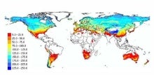 Landscape surface freeze/thaw status based on passive microwave remote sensing
Years of record
- to
A global data set of the frozen state of the land surface (free-thaw (FT) status) has been developed spanning 1979-present at a daily timestep and 25 x 25 km spatial resolution. Based on passive microwave remote sensing, the FT parameter is closely related to the surface energy budget, hydrologic cycle, trace gas exchanges, vegetation growth, and terrestrial carbon…
-
Timestep
- Daily
-
Domain
- Global
-
Collections
- Climate Data Record
Experts contributing reviews
- Kimball, John
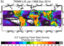 Lightning data from the TRMM and ISS Lightning Image Sounder (LIS): Towards a global lightning Climate Data Record
Years of record
- to
The Lightning Imaging Sensor (LIS) is an optically based spaceborne lightning detection instrument that has been hosted on two different platforms – the Tropical Rainfall Measuring Mission satellite (TRMM; 1998-2015; Kummerow et al. 1998) and the International Space Station (ISS; 2017-present; Blakeslee et al. 2020). Relative to TRMM LIS, which covered ±38 latitude, ISS…
Experts contributing reviews
- Lang, Timothy
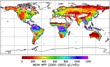 MODIS GPP/NPP Project (MOD17)
Years of record
- to
The goal of the MOD17 MODIS project is to provide continuous estimates of Gross/Net Primary Production (GPP/NPP) across Earth’s entire vegetated land surface. MOD17 GPP/NPP outputs are useful for natural resource and land management, global carbon cycle analysis, ecosystem status assessment, and environmental change monitoring. MOD17 is part of the NASA Earth…
Experts contributing reviews
- N/A
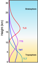 MSU/AMSU Atmospheric Temperature Climate Data Record, Remote Sensing Systems (RSS)
Years of record
- to
A long (30-year+) data set of atmospheric temperatures for 4 tropopsheric and lower stratopsheric layers has been derived from brightness temperatures measured by the Microwave Sounding Unit (MSU) and Advanced Microwave Sounding Unit (AMSU). This page describes the data sets developed by Remote Sensing Systems (RSS); other options exist for comparisons. One of the most…
-
Timestep
- Monthly
-
Domain
- Global
-
Collections
- Climate Data Record
Experts contributing reviews
- Mears, Carl
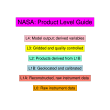 NASA Satellite Product Levels
Years of record
- N/A
NASA data products are categorized into different "Levels". These are product dependent but the following description for OMI (Ozone Monitoring Instrument) data products is a general guideline:Level-1B (L1B): Products containing geolocated and calibrated spectral radiance and solar irradiance data. Level-2 (L2): Atmospheric products derived from the L1B product.…
Main variables and Earth System components
N/A-
Formats
- N/A
-
Timestep
- N/A
-
Domain
- N/A
-
Collections
- N/A
Experts contributing reviews
- N/A
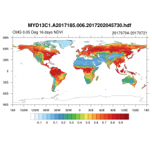 NDVI and EVI: Vegetation Indices (MODIS)
Years of record
- to
MODIS vegetation indices, produced on 16-day and monthly intervals and at multiple spatial resolutions, provide consistent spatial and temporal comparisons of vegetation canopy greenness, a composite property of leaf area, chlorophyll and canopy structure. Two vegetation indices are derived from atmospherically-corrected reflectance in the red, near-infrared, and blue…
Main variables and Earth System components
Land Enhanced Vegetation Index (EVI) NDVI" Normalized Difference Vegetation IndexExperts contributing reviews
- N/A
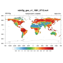 NDVI: Normalized Difference Vegetation Index-3rd generation: NASA/GFSC GIMMS
Years of record
- to
Normalized Difference Vegetation Index-3rd generation (NDVI) using the Global Inventory Monitoring and Modeling System (GIMMS): Vegetation indices are radiometric measures of photosynthetically active radiation absorbed by chlorophyll in the green leaves of vegetation canopies and are therefore good surrogate measures of the physiologically functioning surface…
Main variables and Earth System components
N/A-
Formats
- netCDF
-
Timestep
- Daily
-
Domain
- Global
-
Collections
- Climate Data Record
Experts contributing reviews
- N/A
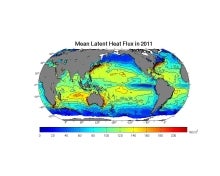 OAFlux: Objectively Analyzed air-sea Fluxes for the global oceans.
Years of record
- to
"The OAFlux project aims to provide consistent, multi-decade, global analysis of air-sea heat, freshwater (evaporation), and momentum fluxes for use in studies of global energy budget, water cycle, atmosphere and ocean circulation, and climate. The OAFlux project is so called because it applies objective analysis approach to take into account data errors in the…
Main variables and Earth System components
Atmosphere Latent & sensible heat flux Radiation Wind Ocean SST - sea surface temperature Surface Flux wind stress curlExperts contributing reviews
- N/A
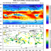 Outgoing Longwave Radiation (OLR): HIRS
Years of record
- to
"The new Climate Data Record (CDR) provides daily global climate data that are valuable as inputs into Radiation Budget Studies and verifying numerical models and can identify the variations in tropical clouds and rainfall that drive global weather patterns. The daily climate data of OLR can provide radiance observations at a 1.0x1.0 Degree resolution, creating…
-
Formats
- netCDF
-
Timestep
- Daily, Monthly
-
Domain
- Global
-
Collections
- Climate Data Record
Experts contributing reviews
- N/A
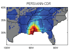 PERSIANN-CDR: Precipitation Estimation from Remotely Sensed Information using Artificial Neural Networks - Climate Data Record
Years of record
- to
The Precipitation Estimation from Remotely Sensed Information using Artificial Neural Networks- Climate Data Record (PERSIANN-CDR) provides daily rainfall estimates at a spatial resolution of 0.25 degrees in the latitude band 60S - 60N from 1983 to the near-present. The precipitation estimate is produced using the PERSIANN algorithm on GridSat-B1 infrared…
-
Timestep
- Sub-daily, Daily
-
Domain
- Global
-
Collections
- Climate Data Record
Experts contributing reviews
- Ashouri, Hamed, Gehne, Maria
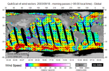 QuikSCAT: near sea-surface wind speed and direction
Years of record
- to
The QuikSCAT mission was intended to obtain sea-surface wind speed and direction data under all weather and cloud conditions over Earth's oceans. SeaWinds, an active radar scatterometer, is the main instrument on the QuikSCAT satellite. The microwave backscatter measured by SeaWinds is dependent on the surface roughness of the ocean, which in turn is related to wind…
Experts contributing reviews
- Ricciardulli, Lucrezia
 Randolph Glacier Inventory data base of global glacier outlines
Years of record
- N/A
The Randolph Glacier Inventory (RGI) is a global data base of glacier outlines. It is intended for estimates of ice volume and glacier mass at regional and global scales. The data are organized into 19 large regions, with a shapefile provided for each region. The RGI is produced as part of the Global Land Ice Measurements from Space (GLIMS) initiative, a project to…
Experts contributing reviews
- N/A
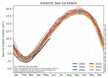 Sea Ice Concentration Climate Data Record from OSI SAF
Years of record
- to
The Ocean and Sea Ice Satellite Applications Facility (OSI SAF) of EUMETSAT provides sea ice concentration products for the Arctic and Antarctic based on satellite passive microwave data. The concentration value is expressed as the fractional percentage of the ice cover in a given grid cell. Since 2023, OSI-450-a and OSI-430-a constitute the third fully…
-
Formats
- netCDF
-
Timestep
- Daily
-
Collections
- N/A
Experts contributing reviews
- Aaboe, Signe, Lavergne, Thomas
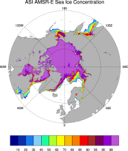 Sea Ice Concentration data from AMSR-E, AMSR2 & SSMIS, U Bremen and U Hamburg ASI algorithm
Years of record
- to
The sea ice data derived from AMSR-E using the ARTIST sea ice (ASI) algorithm offer a factor of 4 finer spatial resolution than most sea ice data sets from passive microwave satellite instruments. ASI is based on the difference of vertically and horizontally polarized brightness temperatures at 89 GHz; this difference is independent of temperature but depends on…
-
Timestep
- Daily
-
Collections
- N/A
Experts contributing reviews
- N/A
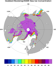 Sea Ice Concentration data from NASA Goddard and NSIDC based on Bootstrap algorithm
Years of record
- to
Bootstrap sea ice refers to a well-known algorithm used to estimate sea ice concentration from passive microwave brightness temperatures. It can be applied to data from many satellite instruments, such as SMMR, SSMI, and AMSR-E. This page discusses the algorithm itself and the long-term data set ("NSIDC 0079, version 2") produced by J. Comiso and distributed by NSIDC.…
-
Timestep
- Daily, Monthly
-
Collections
- N/A
Experts contributing reviews
- N/A
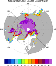 Sea Ice Concentration data from NASA Goddard and NSIDC based on NASA Team algorithm
Years of record
- to
NASA Team sea ice refers to a well-known algorithm used to estimate sea ice concentration from passive microwave brightness temperatures. This page discusses the algorithm itself and the long-term data set ("NSIDC 0051") produced by scientists at NASA Goddard and distributed by NSIDC. The NASA Team data are very widely used and are a key input into other data sets…
-
Timestep
- Daily, Monthly
-
Collections
- Diagnostic Data Sets, NCAR-DOE-CESM, seaicediagnostics
Experts contributing reviews
- N/A
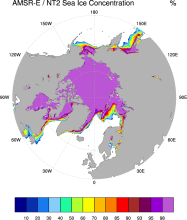 Sea Ice Concentration data from NASA Goddard and NSIDC using AMSR-E and NASA TEAM2 (NT2) algorithm
Years of record
- to
The AMSR-E/NASA Team 2 (NT2) data set of Arctic and Antarctic sea ice concentration is available at daily timesteps and 12.5 km (optionally 25km) spatial resolution for 2002-2011. NT2, an extension of the original NASA Team algorithm, uses AMSR-E 89GHz channels to help resolve ambiguity between low ice concentrations and areas with strong surface effects (due to snow…
Experts contributing reviews
- N/A
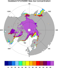 Sea ice concentration data from NASA Goddard based on SSMI and NASA Team (NT2) algorithm
Years of record
- to
The NASA Team 2 (NT2) / SSMI data set of Arctic and Antarctic sea ice concentration is available at daily timesteps and 25km spatial resolution for 1992-2008. NT2, an extension of the original NASA Team algorithm, uses SSMI 85GHz channels to help resolve ambiguity between low ice concentrations and areas with strong surface effects (due to snow layering and glazing).…
Experts contributing reviews
- N/A
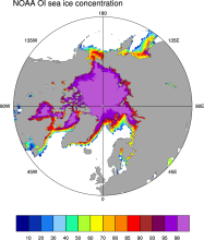 Sea Ice Concentration data from NOAA OI
Years of record
- to
The NOAA Optimal Interpolation (OI) v2 sea ice data set contains gridded, weekly or monthly resolution sea ice concentration estimates for both the Northern and Southern Hemispheres. It is intended as a consistent analyses for input into SST analyses (and is the basis for calculating SSTs in sea ice zones for the OI SST data) or as boundary conditions for atmospheric…
-
Formats
- netCDF
-
Timestep
- Monthly, Weekly
-
Collections
- Boundary Conditions
Experts contributing reviews
- N/A
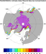 Sea Ice Concentration: NOAA/NSIDC Climate Data Record
Years of record
- to
The NOAA/NSIDC Climate Data Record (CDR) of sea ice concentration is available at 25 x 25 km spatial resolution in daily or monthly timesteps for 1987-2014. It provides a consistent interpretation of sea ice for the satellite record, with the intent of being suitable for studies of climate variability and change. The CDR is produced by an automated and independent…
-
Formats
- netCDF
-
Timestep
- Daily, Monthly
-
Collections
- Climate Data Record
Experts contributing reviews
- Meier, Walter
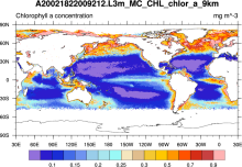 SeaWIFS: ocean bio-optical and carbon properties
Years of record
- to
The purpose of the Sea-viewing Wide Field-of-view Sensor (SeaWiFS) Project is to provide quantitative data on global ocean bio-optical properties and to assess the oceans' role in the global carbon cycle. SeaWiFS data are being used to help clarify the magnitude and variability of chlorophyll and primary production by marine phytoplankton, and to determine the…
-
Formats
- HDF
-
Timestep
- Climatology, Daily, Monthly, Seasonal, Annual
-
Domain
- Global
-
Collections
- Carbon cycle
Experts contributing reviews
- N/A
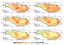 SMAP-Derived 1-km Downscaled Surface Soil Moisture
Years of record
- to
This data product contains global daily 1 km resolution surface soil moisture (SM) derived from the Soil Moisture Active Passive (SMAP) L-band radiometer observations. Specifically, Moderate Resolution Imaging Spectroradiometer (MODIS) land surface temperature and Normalized Difference Vegetation Index (NDVI) data were used with the SMAP Enhanced L2 radiometer Half-…
-
Formats
- N/A
-
Timestep
- Daily
-
Domain
- Global
-
Collections
- N/A
Experts contributing reviews
- Lakshmi, Venkataraman, Fang, Bin
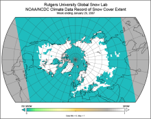 Snow Cover Extent (Northern Hemisphere) Climate Data Record, by Rutgers
Years of record
- to
The Snow Cover Extent Climate Data Record extends from the late 1960s to present. Historical analyses based on visual inspection have been digitized and combined with modern multi-spectral remote sensing to produce a seamless record on a hemispheric scale. The data are available at weekly and monthly resolutions in a variety of formats. The spatial resolution varies with…
-
Timestep
- Monthly, Weekly
-
Domain
- North America
-
Collections
- Climate Data Record, Diagnostic Data Sets, NCAR-DOE-CESM, landdiagnostics
Experts contributing reviews
- Estilow, Thomas W., Robinson, David
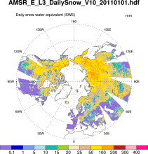 Snow Water Equivalent (AMSR-E)
Years of record
- to
The Advanced Microwave Scanning Radiometer-Earth Observing System (AMSR-E) distributes daily, weekly, and monthly products which includes snow water equivalent. Note: "On 04 October 2011, the AMSR-E instrument on board the Aqua satellite stopped producing data due to a problem with the rotation of its antenna."
-
Formats
- HDF-EOS
-
Timestep
- Daily, Monthly, Weekly
-
Domain
- NH - Northern Hemisphere
-
Collections
- N/A
Experts contributing reviews
- N/A
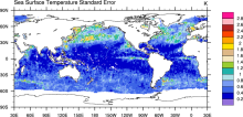 SST (AMSR-E): Sea Surface Temperature from Remote Sensing Systems
Years of record
- to
High resolution (0.25°) SSTs were derived from the AMSR-E, a passive microwave radiometer flying on NASA's AQUA satellite. Remote Sensing Systems distributes the data in high spatial and temporal (daily, weekly, monthly) resolutions for both daytime and nighttime averages. Monthly versions are available on a 1°x1° grid from JPL PO-DAAC as well as the CMIP5 obs4MIPS…
Experts contributing reviews
- N/A
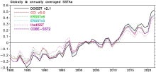 SST data: NOAA daily Optimum Interpolation Sea Surface Temperature version 2.1, OISSTv2.1
Years of record
- to
NOAA’s daily Optimum Interpolation Sea Surface Temperature (dOISST, also known as Reynolds’ SST or OISST) is a global SST analysis product. An SST analysis is a spatially gridded product created by interpolating and extrapolating data, resulting in a smoothed spatially-complete field. dOISST provides global fields that are based on a combination of ocean temperature…
Experts contributing reviews
- Huang, Boyin, Yin, Xungang
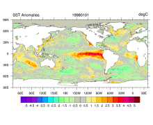 SST data: NOAA High-resolution (0.25x0.25) Blended Analysis of Daily SST and Ice, OISSTv2
Years of record
- to
"NOAA’s Optimum Interpolation Sea Surface temperature (OISST, also known as Reynolds’ SST) is a series of global analysis products, including the weekly OISST on a 1° grid to the more recent daily on a ¼° grid. An SST analysis is a spatially gridded product created by interpolating and extrapolating data, resulting in a smoothed complete field. OISST provides global…
Main variables and Earth System components
Cryosphere Sea Ice Concentration Ocean SST - sea surface temperatureExperts contributing reviews
- Banzon, Viva, Reynolds, Richard
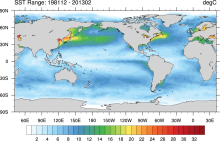 SST data: NOAA Optimal Interpolation (OI) SST Analysis, version 2 (OISSTv2) 1x1
Years of record
- to
The NOAA Optimal Interpolation SST analysis provides global, spatially complete SSTs on a weekly and monthly basis for 1982-present.
Experts contributing reviews
- Banzon, Viva, Reynolds, Richard
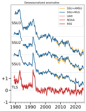 Stratospheric Temperature: Satellite Datasets Used to Quantify Lower, Middle, and Upper Stratospheric Temperatures
Years of record
- to
The temperature of the stratosphere is a key climate variable for understanding variability and change of the Earth's radiation budget, particularly due to sensitivity to changes in stratospheric ozone as well as aerosols from volcanoes and wildfires. While there are direct measurements of the lower stratosphere with weather balloons and field campaigns, complete…
-
Formats
- N/A
-
Timestep
- Monthly
-
Domain
- Global
-
Collections
- BAMS State of the Climate
Experts contributing reviews
- Randel, Bill, Starr, Jon
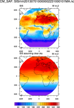 Surface Solar Radiation Data Set - Heliosat (SARAH) -Edition 1
Years of record
- to
"The Surface Solar Radiation Data Set - Heliosat (SARAH) is a satellite-based climatology of the solar surface irradiance (SIS), the surface direct normalized irradiance (DNI) and the effective cloud albedo (CAL) derived from satellite observations of the visible channels of the MVIRI and SEVIRI instruments onboard the geostationary Meteosat satellites. The data are…
-
Formats
- netCDF
-
Timestep
- Sub-daily, Daily, Monthly
-
Collections
- Climate Data Record
Experts contributing reviews
- N/A
 TRMM: Tropical Rainfall Measuring Mission
Years of record
- to
The Tropical Rainfall Measuring Mission (TRMM) is a joint space mission between NASA and Japan's National Space Development Agency designed to monitor and study tropical and subtropical precipitation and the associated release of energy. The mission uses 5 instruments: Precipitation Radar (PR), TRMM Microwave Imager (TMI), Visible Infrared Scanner (VIRS), Clouds &…
-
Timestep
- Sub-daily, Daily, Monthly
-
Domain
- Tropics
-
Collections
- Climate Analysis Section (CAS) Data Catalog, Obs4MIPS
Experts contributing reviews
- Huffman, George J., Pendergrass, Angeline
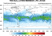 Water Isotopes from Satellites
Years of record
- to
Summary of 7 satellite-derived products providing a global snapshot of water isotope distribution in 3D, with good information on zonal gradients and seasonality.
Experts contributing reviews
- Risi, Camille