CALIPSO
CALIPSO (Cloud-Aerosol Lidar and Infrared Pathfinder Satellite Observations ) was launched on April 28, 2006 to study the impact of clouds and aerosols on the Earth's radiation budget and climate. It flies in formation with five other satellites in the international "A-Train" constellation for coincident Earth observations. The CALIPSO satellite comprises three instruments, the Cloud-Aerosol LIdar with Orthogonal Polarization (CALIOP), the Imaging Infrared Radiometer (IIR), and the Wide Field Camera (WFC). CALIPSO is a joint satellite mission between NASA and the French Agency, CNES.
The CALIPSO-GOCCP (GCM Oriented Cloud Calipso Product) is designed to evaluate GCM cloudiness. CALIPSO-GOCCP contains observational cloud diagnostics fully consistent with the ones simulated by the ensemble. See: COSP
Cite this page
Acknowledgement of any material taken from or knowledge gained from this page is appreciated:
National Center for Atmospheric Research Staff (Eds). Last modified "The Climate Data Guide: CALIPSO.” Retrieved from https://climatedataguide.ucar.edu/climate-data/calipso on 2026-02-14.
Citation of datasets is separate and should be done according to the data providers' instructions. If known to us, data citation instructions are given in the Data Access section, above.
Acknowledgement of the Climate Data Guide project is also appreciated:
Schneider, D. P., C. Deser, J. Fasullo, and K. E. Trenberth, 2013: Climate Data Guide Spurs Discovery and Understanding. Eos Trans. AGU, 94, 121–122, https://doi.org/10.1002/2013eo130001
Key Figures
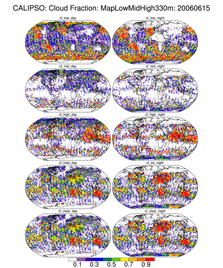
CALIPSO day and night cloud fraction estimates (low, middle, high, total, clear) for June, 15,2006. - MapLowMidHigh file contains maps of Low-Mid-High cloud fractions, total cloud fraction and clear fraction. [Climate Data Guide; D. Shea;http://www.ncl.ucar.edu/Applications/calipso.shtml]

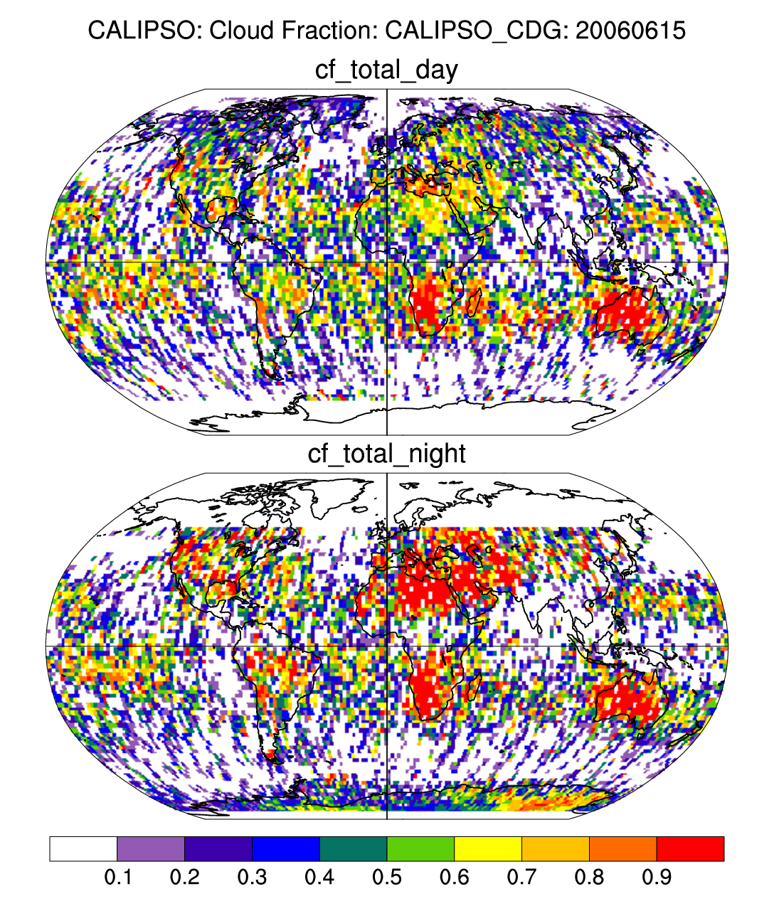
CALIPSO day and night total cloud fraction on June 6, 2006. [Climate Data Guide; D. Shea; http://www.ncl.ucar.edu/Applications/calipso.shtml
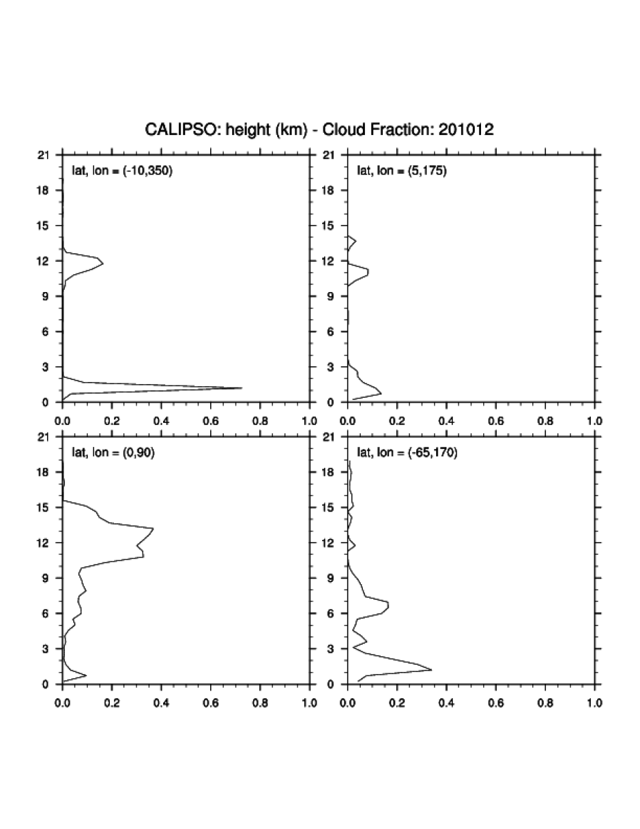
Monthly mean (December 2010) vertical profiles of cloud fraction. [Climate Data Guide; D. Shea; http://www.ncl.ucar.edu/Applications/calipso.shtml]
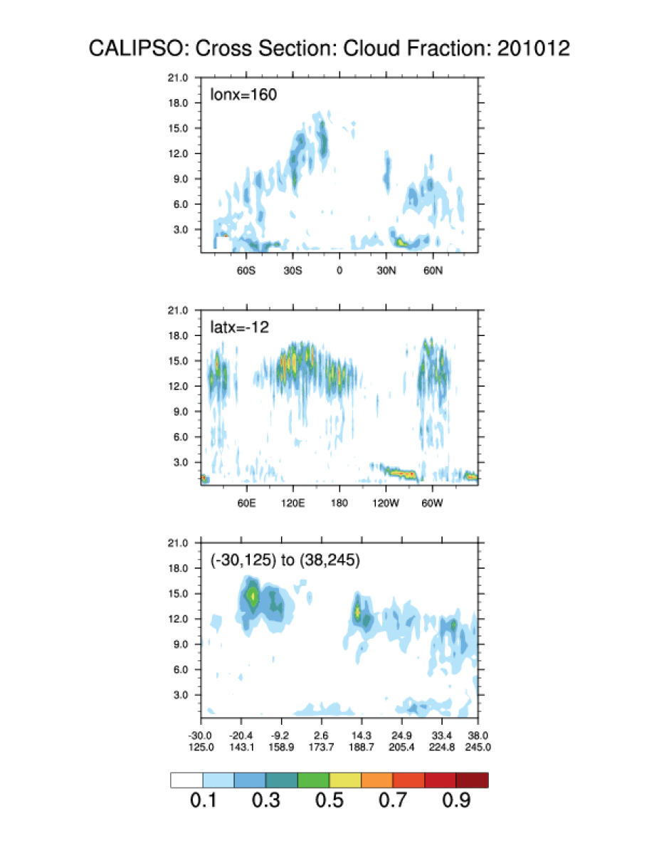
Monthly mean (December 2010) cross sections of cloud fraction. [Climate Data Guide; D. Shea; http://www.ncl.ucar.edu/Applications/calipso.shtml]
Other Information
- Chepfer H., S. Bony, D. Winker, G. Cesana, JL. Dufresne, P. Minnis, C. J. Stubenrauch, S. Zeng, 2010: The GCM Oriented Calipso Cloud Product (CALIPSO-GOCCP),J. Geophys. Res., 115, D00H16
- Chepfer, H., S. Bony, D. Winker, M. Chiriaco, J.-L. Dufresne, and G. Sèze, 2008: Use of CALIPSO lidar observations to evaluate the cloudiness simulated by a climate model, Geophys. Res. Lett., 35, L15704
- G. Cesana, H. Chepfer, 2009: "The GCM Oriented CALIPSO Cloud Product (CALIPSO-GOCCP)", poster, [PDF]
- Stubenrauch, C., W. Rossow and S. Kinne (2012), Assessment of Global Cloud Data Sets from Satellites, A Project of the World Climate Research Programme Global Energy and Water Cycle Experiment Radiation Panel, WCRP Report No. 23/2012, 176 pp (.pdf).
- Kato, S., et al. (2011), Improvements of top ‐ of ‐ atmosphere and surface irradiance computations with CALIPSO ‐ , CloudSat ‐ , and MODIS ‐ derived cloud and aerosol properties, J. Geophys. Res. , 116 , D19209