NASA Satellite Product Levels
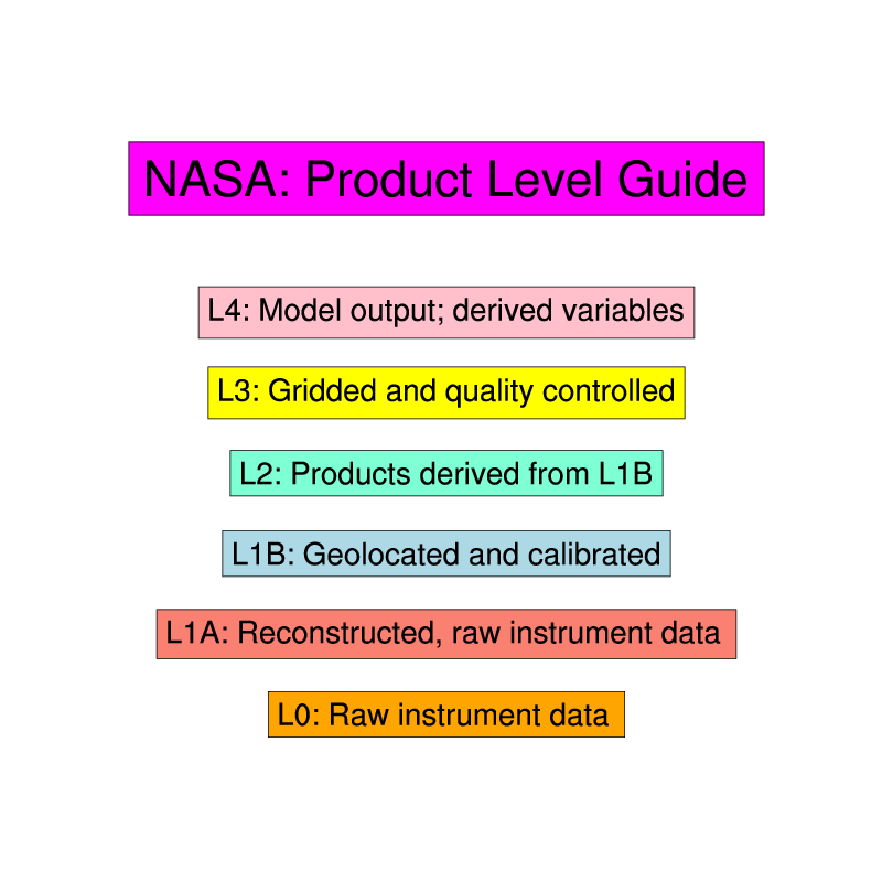
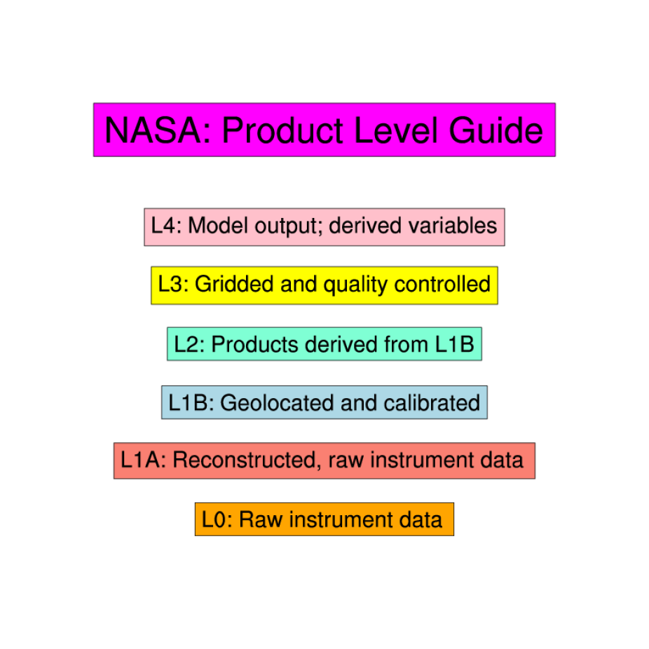
NASA data products are categorized into different "Levels". These are product dependent but the following description for OMI (Ozone Monitoring Instrument) data products is a general guideline:
Level-1B (L1B): Products containing geolocated and calibrated spectral radiance and solar irradiance data.
Level-2 (L2): Atmospheric products derived from the L1B product. One file per orbit.
L2G: Daily binned global products derived from the L2 products.
Level-3 (L3): Averaged global gridded products, screened for bad data points.
Post-Processing involves changes only in ancillary data or information.
Re-Processing indicates data processing due to changes in the Retrieval Algorithms.
See also: EOS-DIS data product levels.
Cite this page
Acknowledgement of any material taken from or knowledge gained from this page is appreciated:
National Center for Atmospheric Research Staff (Eds). Last modified "The Climate Data Guide: NASA Satellite Product Levels.” Retrieved from https://climatedataguide.ucar.edu/climate-data/nasa-satellite-product-levels on 2026-07-09.
Citation of datasets is separate and should be done according to the data providers' instructions. If known to us, data citation instructions are given in the Data Access section, above.
Acknowledgement of the Climate Data Guide project is also appreciated:
Schneider, D. P., C. Deser, J. Fasullo, and K. E. Trenberth, 2013: Climate Data Guide Spurs Discovery and Understanding. Eos Trans. AGU, 94, 121–122, https://doi.org/10.1002/2013eo130001
Key Figures
Guide to NASA product levels