GODAS: NCEP Global Ocean Data Assimilation System
GODAS is a real-time ocean analysis and a reanalysis. It is used for monitoring, retrospective analysis as well as for providing oceanic initial conditions for the CFS. Both temperature and synthetic salinity profiles are assimilated in a 3DVAR scheme. Beginning with March 2007, altimetry sea level is assimilated.
Key Strengths
Many variables are created
Key Limitations
Salinity is not good
Large biases in velocity fields
Cite this page
Acknowledgement of any material taken from or knowledge gained from this page is appreciated:
National Center for Atmospheric Research Staff (Eds). Last modified "The Climate Data Guide: GODAS: NCEP Global Ocean Data Assimilation System.” Retrieved from https://climatedataguide.ucar.edu/climate-data/godas-ncep-global-ocean-data-assimilation-system on 2026-05-24.
Citation of datasets is separate and should be done according to the data providers' instructions. If known to us, data citation instructions are given in the Data Access section, above.
Acknowledgement of the Climate Data Guide project is also appreciated:
Schneider, D. P., C. Deser, J. Fasullo, and K. E. Trenberth, 2013: Climate Data Guide Spurs Discovery and Understanding. Eos Trans. AGU, 94, 121–122, https://doi.org/10.1002/2013eo130001
Key Figures

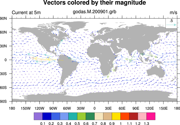
GODAS ocean current Januarry 2009 at 5 meter depth. (Climate Data Guide; D. Shea)

Ocean current and salinity for January, 2009 at 5 meter depth (India region). (Climate Data Guide; D. Shea)
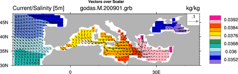
Ocean current and salinity for January, 2009 at 5 meter depth (Mediterranean region).
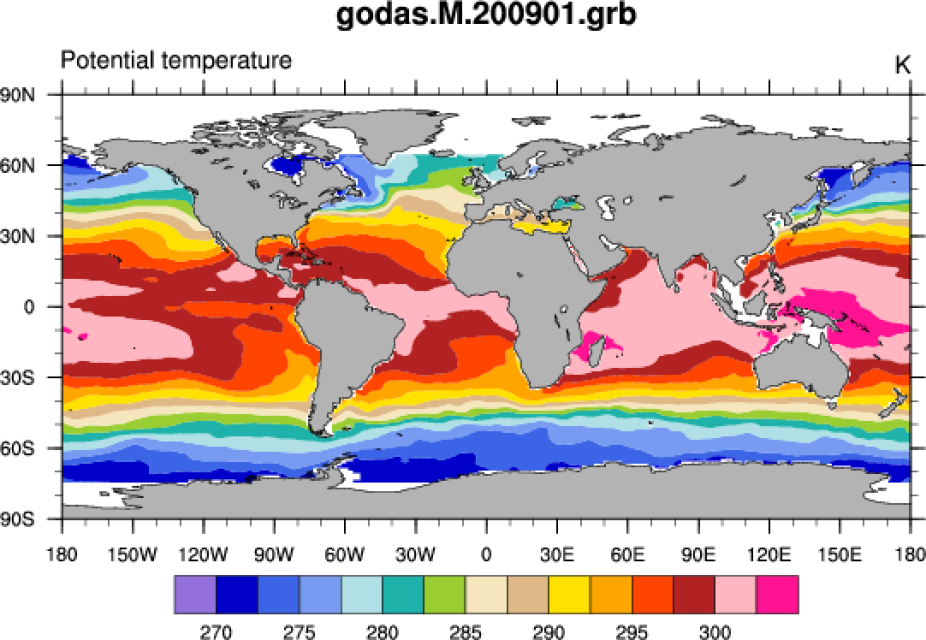
Ocean potential temperature for January, 2009 at 5 meter depth.

Geometric vertical velocity for January, 2009. A raster view is provided to facilitate visual view of the 40 level spacing. (Climate Data Guide; D. Shea)