Climate data guide content with tag sea surface height
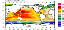 AVISO: Satellite derived Sea Surface Height above Geoid
Years of record
- to
The sea surface height relative to the geoid (the mean ocean surface of the Earth if the ocean is at rest) is derived from TOPEX/Poseidon, Envisat, Jason-1, and OSTM/Jason-2 altimetry measurements. Altimetry is a technique for measuring height. Satellite altimetry measures the time taken by a radar pulse to travel from the satellite antenna to the surface and back to…
Experts contributing reviews
- N/A
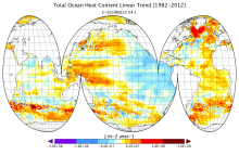 CMCC Global Ocean Reanalysis System (C-GLORS)
Years of record
- to
"The CMCC Global Ocean Physical Reanalysis System (C-GLORS) is used to simulate the state of the ocean in the last decades. It consists of a variational data assimilation system (OceanVar), capable of assimilating all in-situ observations along with altimetry data, and a forecast step performed by the ocean model NEMO coupled with the LIM2 sea-ice model…
Main variables and Earth System components
Ocean Ocean Heat Content SST - sea surface temperature Salinity Sub Surface Salinity Sub Surface Temperature mixed layer depth sea surface height u, v current componentsExperts contributing reviews
- Storto, Andrea
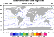 GODAS: NCEP Global Ocean Data Assimilation System
Years of record
- to
GODAS is a real-time ocean analysis and a reanalysis. It is used for monitoring, retrospective analysis as well as for providing oceanic initial conditions for the CFS. Both temperature and synthetic salinity profiles are assimilated in a 3DVAR scheme. Beginning with March 2007, altimetry sea level is assimilated.
Main variables and Earth System components
Ocean 3D Velocity SST - sea surface temperature Salinity heat flux isothermal layer depth mixed layer depth potential temperature salt flux sea surface height-
Timestep
- Monthly, Pentad
-
Domain
- Global
-
Collections
- Climate Analysis Section (CAS) Data Catalog
Experts contributing reviews
- N/A
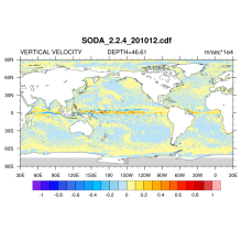 SODA: Simple Ocean Data Assimilation
Years of record
- to
The Simple Ocean Data Assimilation, or SODA, analysis is an ocean reanalysis data set consisting of gridded variables for the global ocean, as well as several derived fields. The goal is to provide an improved estimate of ocean state from those based solely on observations or numerical simulations.
Main variables and Earth System components
Wind Stress Ocean 3D Velocity potential temperature Salinity sea surface height SST - sea surface temperature u, v current componentsExperts contributing reviews
- N/A
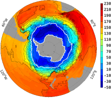 Southern Ocean State Estimate (SOSE)
Years of record
- to
The Southern Ocean State Estimate (SOSE) is a model-generated best fit to Southern Ocean observations. As such, it provides a quantitatively useful climatology of the mean-state of the Southern Ocean. Technically, SOSE is a solution to the MITgcm. SOSE is a gridded dataset at 1/6 ° horizontal resolution, available at timesteps from daily to annually.…
Main variables and Earth System components
Ocean 3D Velocity Bottom pressure SST - sea surface temperature Salinity Sub Surface Temperature mixed layer depth sea surface height u, v current components Wind Stress-
Formats
- binary
-
Timestep
- Daily, Monthly, Weekly, Annual
-
Collections
- N/A
Experts contributing reviews
- Mazloff, Matthew