Stratospheric & Tropospheric Ozone: ACC/SPARC (Atmospheric Chemistry and Climate / Stratospheric Processes and their Role in Climate)
Key Strengths
Key Limitations
Cionni, I. et al., Ozone database in support of CMIP5 simulations: results and corresponding radiative forcing, Atmos. Chem. Phys., 11, 11267-11292, doi:10.5194/acp-11-11267-2011, 2011.
Cite this page
Acknowledgement of any material taken from or knowledge gained from this page is appreciated:
National Center for Atmospheric Research Staff (Eds). Last modified "The Climate Data Guide: Stratospheric & Tropospheric Ozone: ACC/SPARC (Atmospheric Chemistry and Climate / Stratospheric Processes and their Role in Climate).” Retrieved from https://climatedataguide.ucar.edu/climate-data/stratospheric-tropospheric-ozone-accsparc-atmospheric-chemistry-and-climate on 2026-07-07.
Citation of datasets is separate and should be done according to the data providers' instructions. If known to us, data citation instructions are given in the Data Access section, above.
Acknowledgement of the Climate Data Guide project is also appreciated:
Schneider, D. P., C. Deser, J. Fasullo, and K. E. Trenberth, 2013: Climate Data Guide Spurs Discovery and Understanding. Eos Trans. AGU, 94, 121–122, https://doi.org/10.1002/2013eo130001
Key Figures

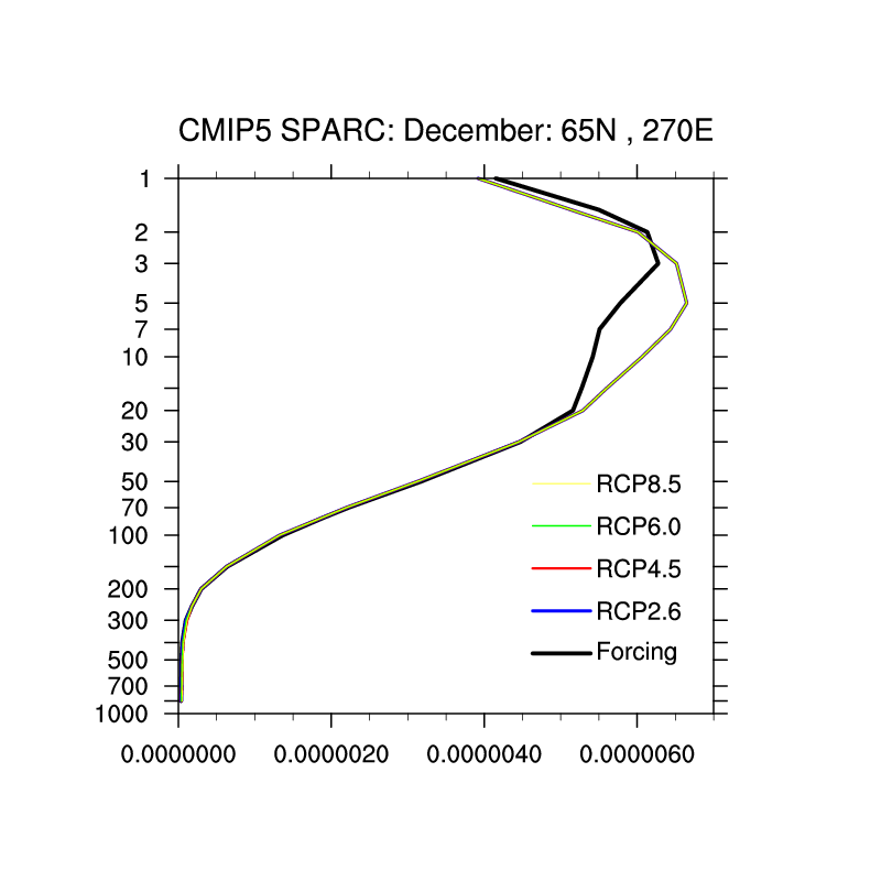
Vertical profile of December Forcing and RCP climatologies at (65N,270E). All the RPC are overlayed showing that they are identical. Units (mole/mole)
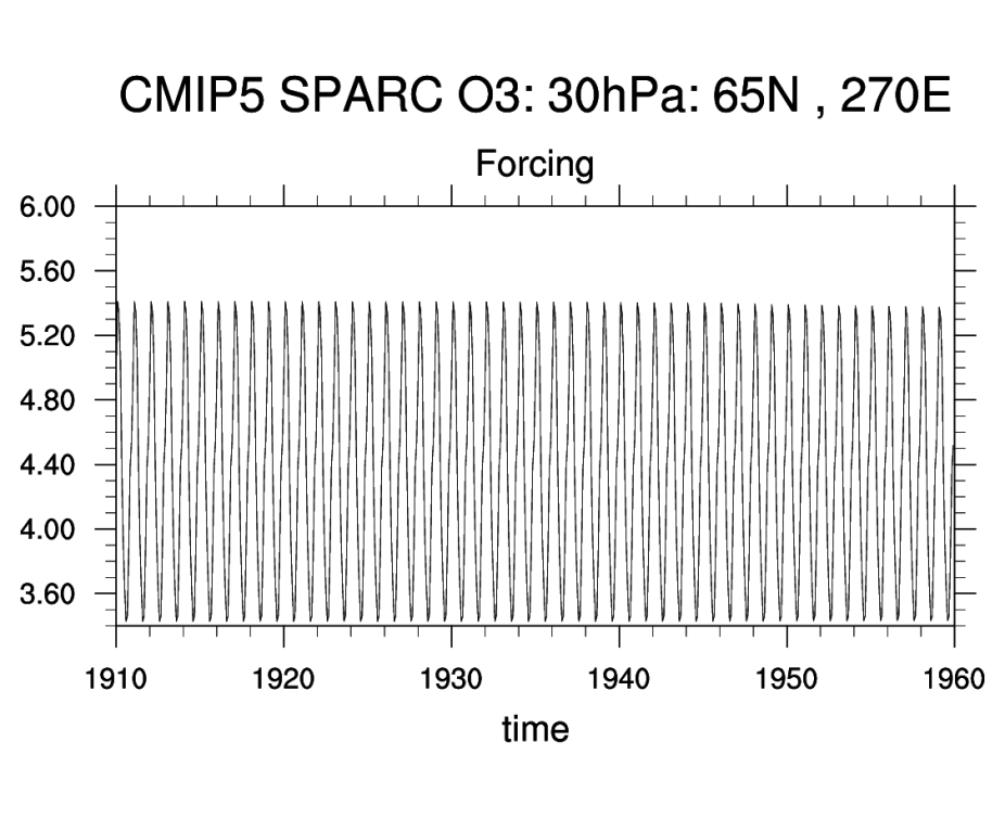
Time series of 'CMIP5 SPARC O3 Forcing' at 30 hPa at (65N,270E) for 1910-1959. Units (mole/mole) scaled by 10^6.
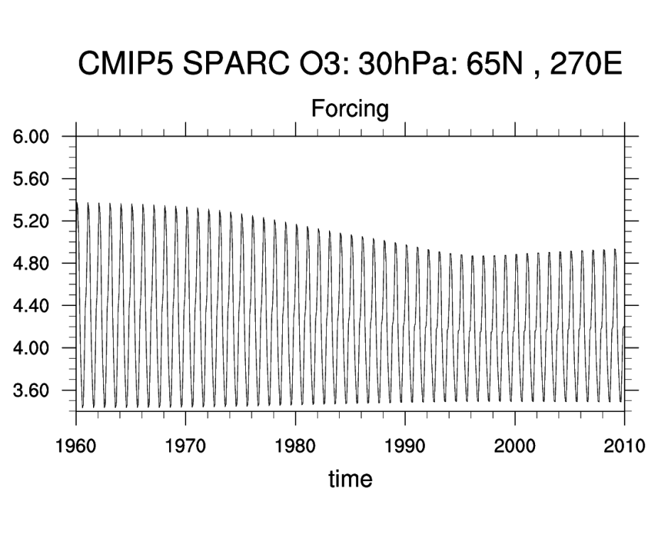
Time series of 'CMIP5 SPARC O3 Forcing' at 30 hPa at (65N,270E) for 1960-2009. Units (mole/mole) scaled by 10^6.

Time series of 'CMIP5 SPARC O3 RCP' at 30 hPa at (65N,270E) for 2010-2059. Units (mole/mole) scaled by 10^6.
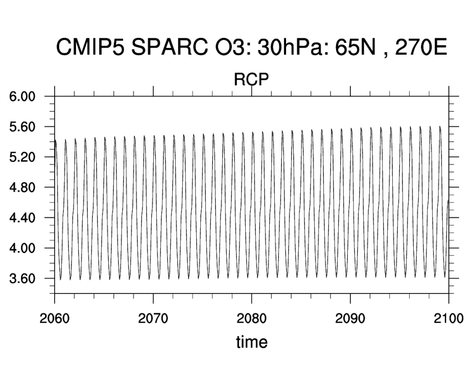
Time series of 'CMIP5 SPARC O3 RCP' at 30 hPa at (65N,270E) for 2060-2099. Units (mole/mole) scaled by 10^6.
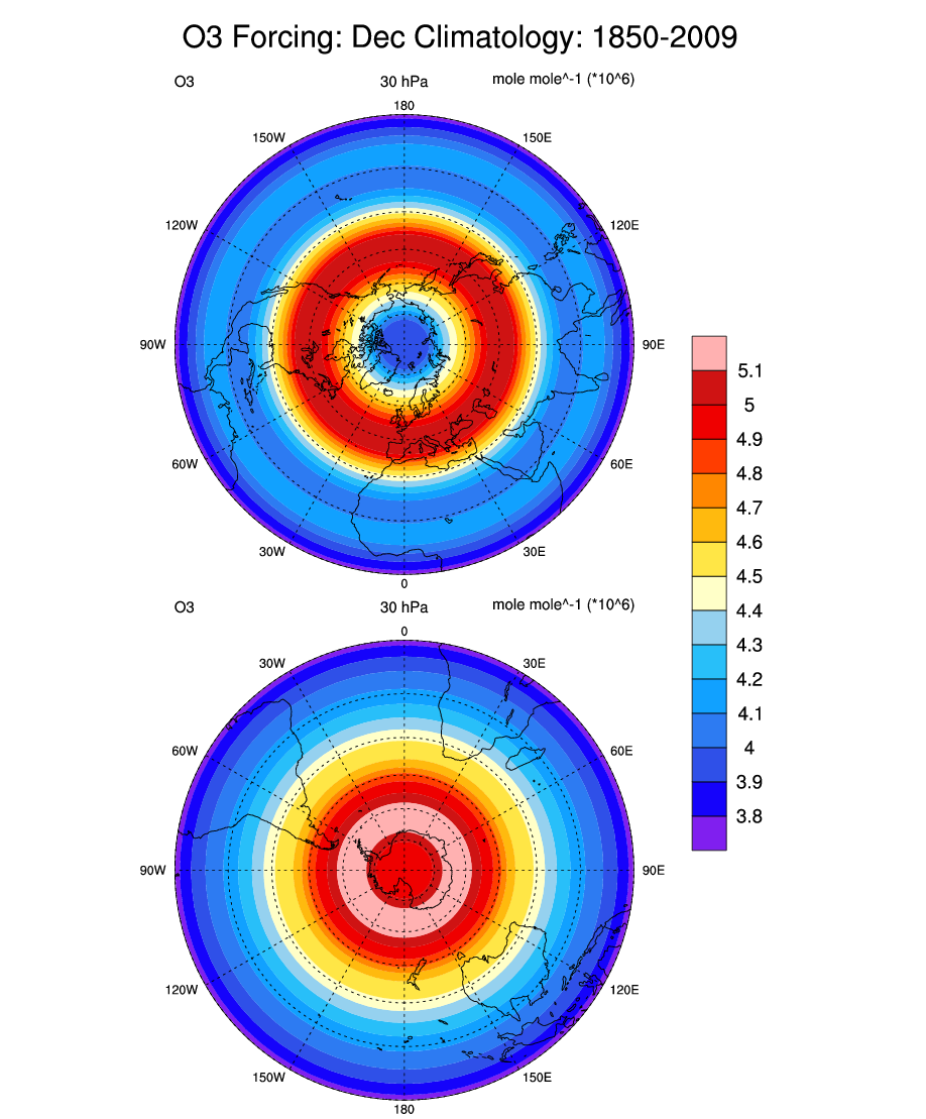
O3 'CMIP5 SPARC O3 Forcing' climatology (1850-2009) for the Northern (top) and Southern (bottom) hemispheres. Units (mole/mole) scaled by 10^6.
Other Information
- Cionni, I. et al., Ozone database in support of CMIP5 simulations: results and corresponding radiative forcing, Atmos. Chem. Phys., 11, 11267-11292, doi:10.5194/acp-11-11267-2011, 2011.
- B. Hassler, P. J. Young, R. W. Portmann et al (2013), Comparison of three vertically resolved ozone data sets: climatology, trends and radiative forcings, Atmos. Chem. Phys., 13, 5533-5550.
- Eyring, V., et al. (2013), Long-term ozone changes and associated climate impacts in CMIP5 simulations, J. Geophys. Res. Atmos., 118, 5029–5060, doi:10.1002/jgrd.50316.
- Solomon, S., P. J. Young, and B. Hassler (2012), Uncertainties in the evolution of stratospheric ozone and implications for recent temperature changes in the tropical lower stratosphere, Geophys. Res. Lett., 39, L17706, doi:10.1029/2012GL052723.
- Lamarque, J.F. et al (2010): Historical (1850-2000) gridded anthropogenic and biomass burning emissions of reactive gases and aerosols: methodology and application. Atmos. Chem. Phys., 10