Climate data guide content with tag Gridded from obs
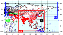 APHRODITE: Asian Precipitation - Highly-Resolved Observational Data Integration Towards Evaluation of Water Resources
Years of record
- to
APHRODITE’s (Asian Precipitation - Highly-Resolved Observational Data Integration Towards Evaluation) gridded precipitation is a set of long-term (1951 onward) continental-scale daily products that is based on a dense network of rain-gauge data for Asia including the Himalayas, South and Southeast Asia and mountainous areas in the Middle East. The gridded products are…
Experts contributing reviews
- Maeda, Mio, Yasutomi, Natsuko, Yatagai, Akiyo
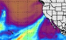 Atmospheric Rivers: The Atmospheric River Tracking Method Intercomparison Project (ARTMIP)
Years of record
- to
ARTMIP is the Atmospheric River Tracking Method Intercomparison Project. The goal of ARTMIP is to provide the community with the data necessary to quantify Atmospheric River (AR) uncertainty due to how ARs are defined or identified in gridded datasets. Atmospheric rivers (ARs) are dynamically driven, filamentary structures that account for ~90% of poleward water vapor…
Main variables and Earth System components
AtmosphereExperts contributing reviews
- N/A
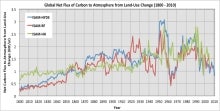 Carbon Emissions from Historical Land-Use and Land-Use Change
Years of record
- to
Annual net land-atmosphere carbon flux and net flux of carbon to the atmosphere due to land-use and land-use change (LULUC) are estimated using an integrated assessment model and three historical reconstructions of land use and land use conversion. The data span 1800-2010 and are aggregated for nine regions of the globe.
Main variables and Earth System components
Biosphere CO2 Land CO2 Land-Atmosphere flux Land Cover Type Land Use ConversionExperts contributing reviews
- Meiyappan, Prasanth
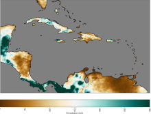 CHIRPS: Climate Hazards InfraRed Precipitation with Station data (version 2)
Years of record
- to
Note: CHIRPS v2 has been superseded by CHIRPS v3 as of June 2025. Climate Hazards Group InfraRed Precipitation with Station data (CHIRPS) is a quasi-global (50S - 50N), land-only rainfall dataset with a range of temporal and spatial resolutions depending on the region and the time period. Data can be found at 0.05 deg or 0.1 deg resolution, and can be found at 6-hourly…
Experts contributing reviews
- Touma, Danielle, Martinez, Carlos
 CHIRPS: Climate Hazards InfraRed Precipitation with Station data (Version 3)
Years of record
- to
Climate Hazards Group InfraRed Precipitation with Station data version 3 (CHIRPS v3)is a 1981-present, land-only, high resolution 0.05° gridded precipitation dataset. It combines thermal-infrared geostationary satellite-based estimates (CHIRP3), in situ observations from global, regional, and national meteorological networks, and a high-resolution climatology (CHPclim2…
Main variables and Earth System components
Precipitation-
Formats
- GeoTIFF
-
Timestep
- Climatology, Monthly, Annual, Pentad
-
Domain
- Africa, Global, South America
-
Collections
- N/A
Experts contributing reviews
- Alaso, Daniella
 CMAP: CPC Merged Analysis of Precipitation
Years of record
- to
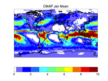
CMAP refers to a collection of precipitation data sets, though the 2.5°x2.5° global monthly version is probably the most widely used. This data set is constructed from an analysis of gauge data and satellite-derived precipitation estimates. An "enhanced" version (CMAP/A) is also available, which provides global coverage by filling in gaps with precipitation forecasts…
-
Timestep
- Monthly, Pentad
-
Domain
- Global
Experts contributing reviews
- Arkin, Phil, Xie, PIngping
 Combined CloudSat spaceborne radar and CALIPSO spaceborne lidar cloud fraction dataset (3S-GEOPROF-COMB)
Years of record
- to
A global (82S-82N) cloud fraction data set, providing a unique view of cloud vertical structure, has been developed based on the complimentary spaceborne remote sensing capabilities of the CloudSat radar and the CALISPSO lidar. The data set provides monthly mean cloud fraction over several vertical layers for 2006-2019.
-
Formats
- netCDF
-
Timestep
- Monthly, Seasonal, Annual
-
Domain
- Global
-
Collections
- Diagnostic Data Sets, NCAR-DOE-CESM, atmosdiagnostics
Experts contributing reviews
- Bertrand, Leah, Kay, Jennifer
 CPC Unified Gauge-Based Analysis of Global Daily Precipitation
Years of record
- to
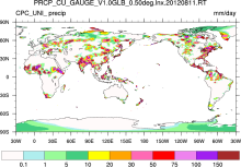
A gauge-based analysis of daily precipitation has been constructed over the global land areas. Gauge reports from over 30,000 stations are collected from multiple sources including GTS, COOP, and other national and international agencies. Quality control is performed through comparisons with historical records and independent information from measurements at nearby…
Experts contributing reviews
- N/A
 CRU sc-PDSI (self-calibrating PDSI) over Europe & North America
Years of record
- to
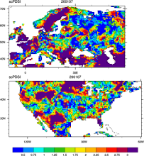
Maps of the monthly self-calibrating Palmer drought severity index (SCPDSI) have been calculated for the period 1901–2002 for the contiguous United States (20°–50°N and 130°–60°W) and Europe (35°–70°N, 10°W–60°E) with a spatial resolution of 0.5° × 0.5°
-
Formats
- ascii
-
Timestep
- Monthly
-
Domain
- Europe, North America
-
Collections
- N/A
Experts contributing reviews
- N/A
 CRU TS Gridded precipitation and other meteorological variables since 1901
Years of record
- to
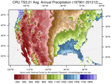
The CRU TS series of data sets (CRU TS = Climatic Research Unit Time series) contain gridded monthly fields of precipitation, daily maximum and minimum temperatures, cloud cover, and other variables covering Earth's land areas for 1901-2022 (CRU TS4.0 is the recent major release). The data set is gridded to 0.5x0.5 degree resolution, based on analysis of over 4000…
Main variables and Earth System components
Atmosphere Air Temperature Cloud Properties Maximum Air Temperature Minimum Air Temperature Potential Evapotranspiration PrecipitationExperts contributing reviews
- N/A
 E-OBS: High-resolution gridded mean/max/min temperature, precipitation and sea level pressure for Europe & Northern Africa
Years of record
- to
E-OBS is a high spatial resolution daily gridded data that covers the European region and is based on the station data collated by the ECA&D initiative (Klein Tank et al., 2002). These data are supplied by many European National Meteorological Services and other data providers across Europe and the Middle East. The dataset spans the period 1 January 1950 to the…
Main variables and Earth System components
Atmosphere Air Temperature Maximum Air Temperature Minimum Air Temperature Precipitation Sea Level PressureExperts contributing reviews
- van der Schrier, Gerard
 EN4 subsurface temperature and salinity for the global oceans
Years of record
- to
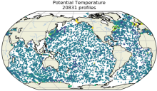
EN4 is a subsurface temperature and salinity dataset for the global oceans, spanning 1900 to present at a monthly timestep. It includes two types of data products: (1) a database of quality-controled in situ profiles and (2) a spatially complete analyses at 1 by 1 degree horizontal resolution and 42 depth levels for 83S to 90N. Input data include Argo (Argo, 2000), ASBO…
Main variables and Earth System components
Ocean potential temperature Sub Surface Salinity Sub Surface Temperature Sub-surface dataExperts contributing reviews
- Killick, Rachel
 Equivalent Temperature: HadISDH.land and ERA5
Years of record
- to
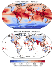
Equivalent temperature is a measure of heat in the atmosphere that accounts for the latent heat stored in water vapor in addition to sensible heat as measured by temperature. The equivalent temperature ($T_e$) scales linearly with the moist enthalpy (i.e., the temperature and humidity) of the atmosphere. Te is computed from: $$T_e = T + \frac{L_v}{C_p} q \tag{1}$$ in…
-
Formats
- N/A
-
Timestep
- Monthly
-
Domain
- Global
-
Collections
- BAMS State of the Climate
Experts contributing reviews
- Matthews, Tom
 Extended Edited Synoptic Cloud Reports Archive (EECRA) from Ships and Land Stations Over the Globe
Years of record
- to
"The Extended Edited Synoptic Cloud Reports Archive makes use of routine synoptic observations made by humans on ships over the ocean and at weather stations over land. Following the synoptic code (WMO, 1974), observers report the fraction of sky dome covered by all clouds, the fraction of sky dome covered by clouds in the lowest layer, the cloud type at low, mid, and…
Experts contributing reviews
- Norris, Joel
 Freshwater Discharge: 1948-2004
Years of record
- to
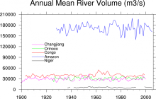
"A dataset of historical monthly streamflow at the farthest downstream stations for the world’s 925 largest ocean-reaching rivers has been created for community use. Compared with previous studies, the new dataset has improved homogeneity and enables more reliable assessments of decadal and long-term changes in continental freshwater discharge into the oceans." The data…
-
Timestep
- Monthly
-
Domain
- Global
-
Collections
- Climate Analysis Section (CAS) Data Catalog
Experts contributing reviews
- N/A
 GHCN (Global Historical Climatology Network) Related Gridded Products
Years of record
- to
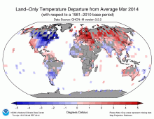
Long time series of gridded surface temperature and precipitation data derived from homongenized station data. The gridded anomalies were produced from GHCN-M bias corrected data. GHCN data and CAMS (Climate Anomaly Monitoring System) are combined to produce a high resolution 'real-time' product.
Main variables and Earth System components
N/AExperts contributing reviews
- N/A
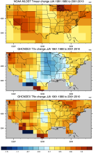 GHCNDEX: Gridded Temperature and Precipitation Climate Extremes Indices (CLIMDEX data)
Years of record
- to
GHCNDEX provides gridded, station-based indices of temperature- and precipitation- related climate extremes. It is intended for detection and attribution studies, climate model evaluation, and operational monitoring of extreme climatic events. Twenty-six indices, including daily maximum and minimum temperatures, number of frost days, maximum 1-day precipitation, and…
Main variables and Earth System components
Atmosphere Maximum Air Temperature Minimum Air Temperature Land Freeze/ThawExperts contributing reviews
- N/A
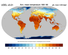 Global (land) precipitation and temperature: Willmott & Matsuura, University of Delaware
Years of record
- to
A series of gridded temperature and precipitation data sets. Station records that served as bases for the Terrestrial Air Temperature: 1900-2014 Gridded Monthly Time Series (Version 4.01) and Terrestrial Precipitation: 1900-2014 Gridded Monthly Time Series (Version 4.01) archives are used here to help create new gridded climatologies of monthly and annual average air…
Main variables and Earth System components
Atmosphere Air Temperature Air Temperature at 2m Precipitation-
Timestep
- Climatology, Monthly
-
Domain
- Global
-
Collections
- Diagnostic Data Sets, NCAR-DOE-CESM, atmosdiagnostics
Experts contributing reviews
- Matsuura, Kenji
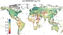 Global high-resolution precipitation: MSWEP
Years of record
- to
Multi-Source Weighted-Ensemble Precipitation (MSWEP) is a sub-daily precipitation dataset with full global coverage at 0.1° resolution, spanning the period 1979 to present. It is updated in near real-time with a latency of three hours, making it suitable for operational applications and for taking a quick look at recent anomalous precipitation events and placing…
Experts contributing reviews
- Beck, Hylke
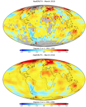 Global land-ocean surface temperature data: HadCRUT5
Years of record
- to
HadCRUT5 is one of the main datasets used to monitor global and regional surface temperature variability and trends. It is a global surface temperature product that combines land surface air temperatures from CRUTEM5 with SSTs from HadSST4. HadCRUT5 is a departure from its predecessors (HadCRUT4, HadCRUT3, etc.) in that two different versions are offered. Both versions…
Main variables and Earth System components
Atmosphere Air Temperature at 2m Ocean SST - sea surface temperature-
Formats
- netCDF
-
Timestep
- Monthly
-
Domain
- Global
-
Collections
- Diagnostic Data Sets
Experts contributing reviews
- Hausfather, Zeke
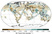 Global near-surface humidity data: HadISDH
Years of record
- to
HadISDH (Met Office Hadley Centre International Surface Dataset of Humidity) is a gridded 5°x5° monthly mean product beginning in January 1973, and updated annually. It provides monthly gridded specific humidity (q), relative humidity (RH), vapor pressure (e), dew point temperature (Td), wet-bulb temperature (Tw), dew point depression (DPD), equivalent temperature (Te…
Main variables and Earth System components
Atmosphere Air Temperature at 2m Relative Humidity Specific HumidityExperts contributing reviews
- Willett, Kate
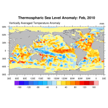 Global Ocean Heat and Thermospheric Sea Level Change
Years of record
- to
Using updated data from the World Ocean Database (Boyer et al, 2009) and improved ARGO profiling data, new estimates of ocean heat content and thermospheric sea level change (0-2000m) for the period 1955-2010 are derived.
Experts contributing reviews
- N/A
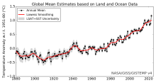 Global surface temperature data: GISTEMP: NASA Goddard Institute for Space Studies (GISS) Surface Temperature Analysis
Years of record
- to
NASA Goddard's Global Surface Temperature Analysis (GISTEMP) combines land surface air temperatures from GHCN-M version 4 with SSTs of the ERSSTv5 analysis into a comprehensive, global surface temperature data set spanning 1880 to the present at monthly resolution, on a 2x2 degree latitude-longitude grid. As such, it is one of the main data sets used to monitor global…
Main variables and Earth System components
Atmosphere Air Temperature Ocean SST - sea surface temperature-
Timestep
- Monthly
-
Domain
- Global
Experts contributing reviews
- Lenssen, Nathan
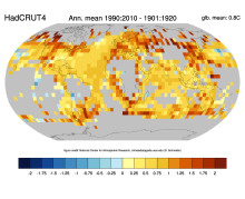 Global surface temperature data: HadCRUT4 and CRUTEM4
Years of record
- to
Extending back to 1850 and frequently updated, HadCRUT4 is the longest data set of its type. HadCRUT4 is a combination of the global land surface temperature data set, CRUTEM4 and the global SST data set, HadSST3. HadCRUT4 is different from the most closely comparable products (e.g. NASA GISTEMP and NOAA MLOST) in that no interpolation is performed. As such, there are…
Main variables and Earth System components
Atmosphere Air Temperature Ocean SST - sea surface temperature-
Timestep
- Climatology, Monthly
-
Domain
- Global
Experts contributing reviews
- N/A
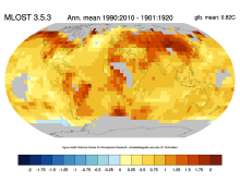 Global surface temperature data: MLOST: NOAA Merged Land-Ocean Surface Temperature Analysis
Years of record
- to
NOAA's Merged Land-Ocean Surface Temperature Analysis (MLOST) combines land surface air temperatures primarily from the Global Historical Climatology Network, Monthly (GHCN-M) version 3 with SSTs of the ERSSTv3b analysis into a comprehensive global surface temperature data set spanning 1880 to the present at monthly resolution, on a 5x5 degree latitude-longitude grid.…
Main variables and Earth System components
Atmosphere Air Temperature Ocean SST - sea surface temperature-
Timestep
- Monthly
-
Domain
- Global
Experts contributing reviews
- N/A
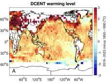 Global surface temperature data: The Dynamically Consistent ENsemble of Temperature (DCENT)
Years of record
- to
The Dynamically Consistent ENsemble of Temperature (DCENT) provides monthly, global, gridded, surface temperature anomalies since 1850. This product provides combined land surface air temperature (LSAT) and sea surface temperature (SST) anomalies at monthly 5° x 5° resolution. An important feature of DCENT is that both land and ocean measurements are used when bias-…
Main variables and Earth System components
Atmosphere Air Temperature at 2m Ocean SST - sea surface temperatureExperts contributing reviews
- Chan, Duo
 Global surface temperature: Maximum Likelihood Estimates of Temperatures using HadCRUT5 (Version 1.2)
Years of record
- to
The Maximum Likelihood Estimates of Temperatures using HadCRUT5 Version 1.2 (HadCRU_MLE_v1.2) dataset provides global complete surface temperature estimates since 1850, with monthly 5°x5° resolution. It uses more sophisticated statistical models to fill data gaps in the non-infilled version of HadCRUT5. The statistical models used in HadCRU_MLE_v1.2 better…
Main variables and Earth System components
Atmosphere Air Temperature at 2m Ocean SST - sea surface temperatureExperts contributing reviews
- Chan, Duo
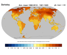 Global surface temperatures: BEST: Berkeley Earth Surface Temperatures
Years of record
- to
The Berkeley Earth Surface Temperatures (BEST) are a set of data products, originally a gridded reconstruction of land surface air temperature records spanning 1701-present, and now including an 1850-present merged land-ocean data set that combines the land analysis with an interpolated version of HadSST3. The land station data are available in an archive, and…
Main variables and Earth System components
Atmosphere Air Temperature Maximum Air Temperature Minimum Air Temperature Ocean SST - sea surface temperatureExperts contributing reviews
- Cowtan, Kevin
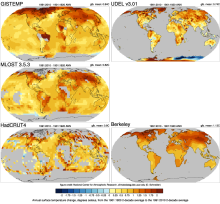 Global Temperature Data Sets: Overview & Comparison Table
Years of record
- to
Global surface temperature data sets are an essential resource for monitoring and understanding climate variability and long-term trends. The most commonly used data sets combine historical observations of near surface air temperatures at land stations with global data sets of sea surface temperatures (SST) obtained from a changing mix of ship-based and buoy…
Main variables and Earth System components
Atmosphere Air Temperature Air Temperature at 2m Ocean SST - sea surface temperature-
Timestep
- Climatology, Monthly
-
Domain
- Global
-
Collections
- Overview / Comparison page
Experts contributing reviews
- N/A
 GLODAP: GLobal Ocean Data Analysis Project for Carbon
Years of record
- N/A
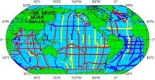
The GLobal Ocean Data Analysis Project (GLODAP) is a cooperative effort to coordinate global synthesis projects funded through the National Oceanic and Atmospheric Administration (NOAA), the U.S. Department of Energy (DOE), and the National Science Foundation (NSF) as part of the Joint Global Ocean Flux Study - Synthesis and Modeling Project (JGOFS-SMP). Cruises…
-
Timestep
- Climatology
-
Domain
- Global
-
Collections
- Carbon cycle
Experts contributing reviews
- N/A
 GPCP (Daily): Global Precipitation Climatology Project
Years of record
- to
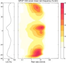
The 1DD product provides precipitation estimates on a 1-degree grid over the entire globe at 1-day (daily) for the period October 1996 - present. Both the Pentad and 1DD products are consistent with the Version 2 monthly product in the sense that the Pentad and 1DD approximately sum to the monthly SG estimate. All three precipitation products are produced by optimally…
Experts contributing reviews
- Pendergrass, Angeline
 GPCP (Monthly): Global Precipitation Climatology Project
Years of record
- to
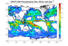
Data from rain gauge stations, satellites, and sounding observations have been merged to estimate monthly rainfall on a 2.5-degree global grid from 1979 to the present. The careful combination of satellite-based rainfall estimates provides the most complete analysis of rainfall available to date over the global oceans, and adds necessary spatial detail to the rainfall…
-
Timestep
- Climatology, Monthly
-
Domain
- Global
Experts contributing reviews
- Pendergrass, Angeline, Wang, Jian-Jian
 Gridded Climatology of Clouds from Surface Observations Worldwide (1971-2008)
Years of record
- to
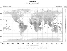
This digital archive provides multi-year monthly, seasonal, and annual averages in 5x5-degree grid boxes (or 10x10-degree boxes for some quantities over the ocean). Daytime and nighttime averages, as well as the diurnal average (average of day and night), are given. Nighttime averages were computed using only those reports that met an "illuminance criterion" (i.e., made…
-
Formats
- ascii
-
Timestep
- Climatology, Monthly, Seasonal
-
Domain
- Global
-
Collections
- Diagnostic Data Sets, NCAR-DOE-CESM, atmosdiagnostics
Experts contributing reviews
- Norris, Joel
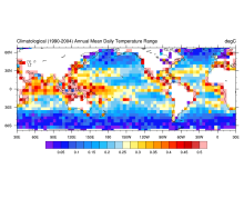 HadDTR: Hadley Centre sea-surface temperature diurnal temperature range climatology
Years of record
- N/A
The Hadley Centre sea-surface temperature diurnal temperature range climatology is a 5x5 degree gridded climatology of the diurnal range of sea surface temperature as measured by drifting buoys.
Experts contributing reviews
- N/A
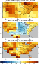 HadEX2: Gridded Temperature and Precipitation Climate Extremes Indices (CLIMDEX data)
Years of record
- to
Note: HadEX2 has been superseded by HadEX3. HadEX2 provides gridded, station-based indices of temperature- and precipitation- related climate extremes. It is intended for detection and attribution studies and climate model evaluation. Twenty-nine indices, including daily maximum and minimum temperatures, number of frost days, maximum 1-day precipitation, and growing…
Main variables and Earth System components
Atmosphere Maximum Air Temperature Minimum Air Temperature Land Freeze/ThawExperts contributing reviews
- N/A
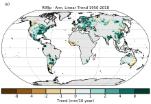 HadEX3: Gridded Temperature and Precipitation Climate Extremes Indices (CLIMDEX data)
Years of record
- to
HadEX3 provides gridded, station-based indices of temperature- and precipitation- related climate extremes and supersedes HadEX2. It is intended for global and continental climate monitoring, detection and attribution studies and climate model evaluation. Twenty-nine indices, including daily maximum and minimum temperatures, number of frost days, maximum 1-day…
Main variables and Earth System components
Atmosphere Air Temperature at 2m Maximum Air Temperature Minimum Air Temperature Land Freeze/ThawExperts contributing reviews
- Dunn, Robert
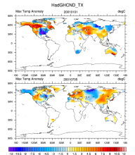 HadGHCNDEX - Gridded Daily Temperature Extremes
Years of record
- to
HadGHCND (aka HadGHCNDEX) is a gridded daily dataset of near-surface maximum (TX) and minimum (TN) temperature observations. Anomalies (departures from 1961-1990 climatology) and actual temperatures are distributed in two separate files. The dataset is designed primarily for the analysis of climate extremes and also for climate model evaluation. It spans the years 1950…
Main variables and Earth System components
Atmosphere Maximum Air Temperature Minimum Air TemperatureExperts contributing reviews
- N/A
 Historical land-cover changes and land-use conversions global data set by Meiyappan and Jain
Years of record
- to
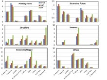
A set of three estimates of land-cover types and annual transformations of land use are provided on a global 0.5°x0.5° grid at annual timesteps. The longest of the three estimates spans 1770-2010. The three estimates use three different data sets of cropland and pastureland. Common input data sets are of wood harvest and urban land. The three estimates use a consistent…
Main variables and Earth System components
Land Land Cover Type Land Use Conversion Vegetation CoverExperts contributing reviews
- Meiyappan, Prasanth
 ICOADS Surface Marine Weather Observations
Years of record
- N/A
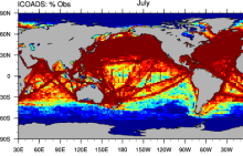
ICOADS (International Comprehensive Ocean-Atmosphere Data Set) is the most comprehensive archive of global marine surface climate observations available. Variables include SST, SLP, air temperature, wind speed, cloud amount, and others. There is no processing beyond initial quality control. ICOADS data are packaged in several different formats with different time…
Main variables and Earth System components
Atmosphere Air Temperature Budget Cloud Properties Latent & sensible heat flux Sea Level Pressure Specific Humidity Wind Ocean SST - sea surface temperatureExperts contributing reviews
- Deser, Clara
 Kaplan Sea Surface Temperature Anomalies
Years of record
- to
The most up-to-date version is known as Kaplan Extended SST v2, which combines statistically infilled grids of UK Met Office SSTs for 1856-1981 with a statistically reduced and coarser resolution version of Smith and Reynolds Optimally Interpolated (OI) SSTs for 1981 to present. Those desiring only recent data should use another product.
Experts contributing reviews
- Kaplan, Alexy
 Livneh gridded precipitation and other meteorological variables for continental US, Mexico and southern Canada
Years of record
- to
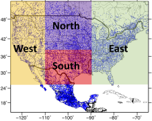
The Livneh et al. (2015) hydrometeorological dataset consists of gridded daily and monthly precipitation, maximum and minimum air temperature, and wind speed for the continental US, southern Canada, and Mexico for the period 1950-2013. Gridded at 1/16° horizontal resolution (~ 6km), the data have been used as training data for GCM downscaling, as validation for…
Main variables and Earth System components
Atmosphere Maximum Air Temperature Minimum Air Temperature Precipitation Wind-
Formats
- netCDF
-
Timestep
- Daily, Monthly
-
Domain
- North America
-
Collections
- N/A
Experts contributing reviews
- Livneh, Ben
 Merged Hadley-NOAA/OI Sea Surface Temperature & Sea-Ice Concentration (Hurrell et al, 2008)
Years of record
- to
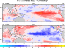
The merged Hadley-OI sea surface temperature (SST) and sea ice concentration (SIC) data sets were specifically developed as surface forcing data sets for AMIP style uncoupled simulations of the Community Atmosphere Model (CAM). The Hadley Centre's SST/SIC version 1.1 (HADISST1), which is derived gridded, bias-adjusted in situ observations, were merged with the NOAA-…
Main variables and Earth System components
Cryosphere Sea Ice Concentration Ocean SST - sea surface temperature-
Formats
- netCDF
-
Timestep
- Monthly
Experts contributing reviews
- N/A
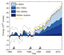 Ocean temperature analysis and heat content estimate from Institute of Atmospheric Physics
Years of record
- to
The Institute of Atmospheric Physics (IAP) ocean temperature analysis features global coverage of the oceans, at 1° x1° horizontal resolution on 41 vertical levels from 1-2000m, and monthly resolution from 1940 to present. As such, it is aimed at studies of climate variability and change, from large regional to global scales, on timescales of months to decades.…
Main variables and Earth System components
Ocean Ocean Heat Content Sea Level Sub Surface TemperatureExperts contributing reviews
- Cheng, Lijing
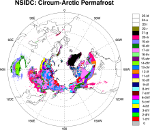 Permafrost: Circum-Arctic Map of Permafrost and Ground Ice Conditions
Years of record
- N/A
The circumpolar permafrost and ground ice data contribute to a unified international data set that depicts the distribution and properties of permafrost and ground ice in the Northern Hemisphere (20°N to 90°N). The re-gridded data set shows discontinuous, sporadic, or isolated permafrost boundaries.
-
Timestep
- Climatology
-
Domain
- NH - Northern Hemisphere
-
Collections
- N/A
Experts contributing reviews
- N/A
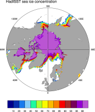 Sea Ice Concentration data from HadISST
Years of record
- to
Spanning 1871-present at monthly timesteps, HadISST provides the longest gridded sea ice data available for both the Arctic and Antarctic. It is a 1° x 1° spatially infilled data set that is It is intended as a consistent analyses for input into SST analyses or as boundary conditions for models. Version 1.1 is the currently available data set and is the one described…
-
Timestep
- Monthly
-
Collections
- Boundary Conditions
Experts contributing reviews
- N/A
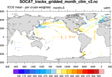 SOCAT: Surface Ocean CO2 Atlas
Years of record
- to
SOCAT (Surface Ocean CO2 Atlas) represents an effort to "provide a comprehensive, publicly available, regularly updated, global data set of marine surface CO2, which had been subject to quality control (QC)." The data sets are comprised of observations (ship track) and gridded data.
-
Formats
- netCDF
-
Timestep
- Climatology, Monthly, Annual
-
Domain
- Global
-
Collections
- Carbon cycle
Experts contributing reviews
- N/A
 SST data: COBE: Centennial in situ Observation-Based Estimates
Years of record
- to
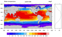
The COBE data set is a spatially complete, interpolated 1°x1° SST product for 1891 to present. It combines SSTs from ICOADS release 2.0, the Japanese Kobe collection, and reports from ships and buoys. Data are gridded using optimal interpolation. As in HadISST, data up to 1941 were bias-adjusted using the "bucket correction." Prior to the interpolation analyses, data…
Experts contributing reviews
- N/A
 SST Data: COBEv3: Centennial in situ Observation-Based Estimates Version 3
Years of record
- to
The Centennial in situ Observation-Based Estimates of Sea Surface Temperature version 3 (COBE-SST3) is a SST analysis produced by the Japanese Meteorological Agency (JMA). The main COBE-SST3 reconstruction provides spatially complete estimates of SST over the global oceans, seas, and large lakes at daily temporal resolution on a regular 0.25° grid. The product currently…
Experts contributing reviews
- Ishii, Masayoshi
 SST data: HadiSST v1.1
Years of record
- to
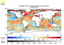
The Hadley Centre Global Sea Ice and Sea Surface Temperature (HadISST) is a combination of monthly globally complete fields of SST and sea ice concentration for 1871-present. This page focuses on the SST data; see the separate page for discussion of HadISST sea ice. HadISST uses reduced space optimal interpolation applied to SSTs from the Marine Data Bank (mainly ship…
-
Timestep
- Monthly
-
Domain
- Global
Experts contributing reviews
- N/A
 SST data: HadSST3
Years of record
- to
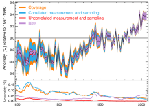
HadSST3 provides monthly SST anomalies on a 5°x5° grid for 1850-present. The anomalies are derived from a 30-year climatology spanning 1961-90.Coverage is global but there is no interpolation; Thus, missing data occur in the final product. The primary input data are from ICOADS release 2.5. Bias adjustments to the ICOADS SSTs account for changes in measurement methods (…
-
Timestep
- Monthly
-
Domain
- Global
Experts contributing reviews
- Kennedy, John
 SST data: HadSST4
Years of record
- to
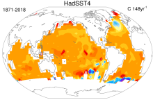
HadSST4 provides monthly SST anomalies on a 5°x5° grid for 1850-present. The anomalies are derived from a 30-year climatology spanning 1961-90. Coverage is global but there is no interpolation; Thus, missing data occur in the final product. This means that uncertainties due to limited spatial coverage and systematic errors are relatively easy to identify compared with…
-
Formats
- netCDF
-
Timestep
- Monthly
-
Domain
- Global
-
Collections
- Diagnostic Data Sets
Experts contributing reviews
- Kennedy, John
 SST data: NOAA daily Optimum Interpolation Sea Surface Temperature version 2.1, OISSTv2.1
Years of record
- to
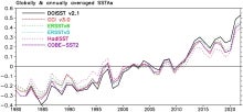
NOAA’s daily Optimum Interpolation Sea Surface Temperature (dOISST, also known as Reynolds’ SST or OISST) is a global SST analysis product. An SST analysis is a spatially gridded product created by interpolating and extrapolating data, resulting in a smoothed spatially-complete field. dOISST provides global fields that are based on a combination of ocean temperature…
Experts contributing reviews
- Huang, Boyin, Yin, Xungang
 SST Data: NOAA Extended Reconstruction SSTs Version 5 (ERSSTv5)
Years of record
- to
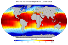
Note: ERSST is currently on version 6. See the ERSSTv6 page here. The NOAA Extended Reconstruction Sea Surface Temperature (ERSST) provides global, spatially complete SST data at a monthly timestep for 1854-present. Version5 is based upon statistical interpolation of the ICOADS release 3.0 data. Argo float data are used in the recent years (since ~2000). The data…
-
Timestep
- Climatology, Monthly
-
Domain
- Global
-
Collections
- Diagnostic Data Sets
Experts contributing reviews
- Hausfather, Zeke
 SST Data: NOAA Extended Reconstruction SSTs Version 6 (ERSSTv6)
Years of record
- to
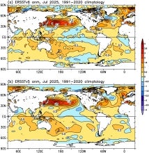
The NOAA Extended Reconstruction Sea Surface Temperature version 6 (ERSSTv6) is a global, spatially complete SST data at monthly 2°×2° resolutions based on in situ observations for 1850-present. Version 6 is based upon statistical interpolation of the ICOADS release 3.0.2 SST data. Argo float data are also used in the recent years (since ~2000). The data are distributed…
Experts contributing reviews
- Huang, Boyin, Yin, Xungang
 SST data: NOAA Extended Reconstruction SSTs, version 3 (ERSSTv3 & 3b)
Years of record
- to
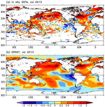
Note: ERSST is currently on version 6. See the ERSSTv6 page here. The NOAA Extended Reconstruction Sea Surface Temperature (ERSST) provides global, spatially complete SST data at a monthly timestep for 1854-present. Version3 is based upon statistical interpolation of the ICOADS release 2.4 data. Version 3 includes satellite AVHRR SST data for 1985 onwards. Version…
-
Timestep
- Monthly
-
Domain
- Global
Experts contributing reviews
- Huang, Boyin, Livermore, Jay, Smith, Tom
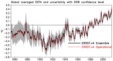 SST data: NOAA Extended Reconstruction SSTs, Version 4
Years of record
- to
Note: ERSST is currently on version 6. See the ERSSTv6 page here. The NOAA Extended Reconstruction Sea Surface Temperature (ERSST) provides global, spatially complete SST data at a monthly timestep for 1854-present. Compared to the previous version, Version 4 uses the more extensive ICOADS Release 2.5 data and revised quality control, bias adjustment, and…
Experts contributing reviews
- Huang, Boyin
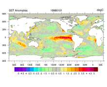 SST data: NOAA High-resolution (0.25x0.25) Blended Analysis of Daily SST and Ice, OISSTv2
Years of record
- to
"NOAA’s Optimum Interpolation Sea Surface temperature (OISST, also known as Reynolds’ SST) is a series of global analysis products, including the weekly OISST on a 1° grid to the more recent daily on a ¼° grid. An SST analysis is a spatially gridded product created by interpolating and extrapolating data, resulting in a smoothed complete field. OISST provides global…
Main variables and Earth System components
Cryosphere Sea Ice Concentration Ocean SST - sea surface temperatureExperts contributing reviews
- Banzon, Viva, Reynolds, Richard
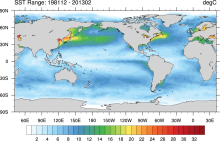 SST data: NOAA Optimal Interpolation (OI) SST Analysis, version 2 (OISSTv2) 1x1
Years of record
- to
The NOAA Optimal Interpolation SST analysis provides global, spatially complete SSTs on a weekly and monthly basis for 1982-present.
Experts contributing reviews
- Banzon, Viva, Reynolds, Richard
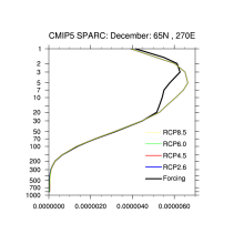 Stratospheric & Tropospheric Ozone: ACC/SPARC (Atmospheric Chemistry and Climate / Stratospheric Processes and their Role in Climate)
Years of record
- to
"The AC&C/SPARC ozone database covers the period 1850 to 2100 and can be used as forcing in climate models that do not include interactive chemistry. The historical part of the AC&C/SPARC ozone database spans the period 1850 to 2009 and consists of separate stratospheric and tropospheric data sources: (1) A multiple linear regression analysis of SAGE I+II…
-
Formats
- netCDF
-
Timestep
- Monthly
-
Domain
- Global
-
Collections
- Boundary Conditions, CMIP5-recommended, AC&C/SPARC ozone
Experts contributing reviews
- N/A
 Stratospheric Ozone: Randel & Wu 2007
Years of record
- to
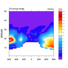
This is a monthly, zonal-mean ozone profile data set spanning 1979–2005 for altitudes from the tropopause up to 50 km. Interannual variability is based on a combination of SAGE (Stratospheric Aerosol and Gas Experiment) satellite profile measurements and polar ozonesondes. The interannual anomalies were added to a climatology from Fortuin and Kelder (1998). …
-
Formats
- binary
-
Timestep
- Monthly
-
Domain
- Global
-
Collections
- Boundary Conditions
Experts contributing reviews
- Randel, Bill
 TerraClimate: Global, high-resolution gridded temperature, precipitation, and other water balance variables
Years of record
- to
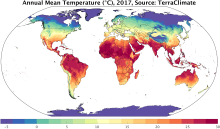
TerraClimate is a global gridded dataset of meteorological and water balance variables for 1958-present, available on a monthly timestep. Its relatively fine spatial resolution, global extent, and long length are a unique combination that fills a void in climate data. TerraClimate combines spatial climatology from WorldClim with time-varying information from the…
Main variables and Earth System components
Atmosphere Air Temperature Maximum Air Temperature Minimum Air Temperature Potential Evapotranspiration Precipitation Wind Snow Water Equivalent Land evapotranspiration Runoff and Streamflow Soil MoistureExperts contributing reviews
- Abatzoglou, John
 Total Column Ozone: Bodeker Scientific
Years of record
- N/A
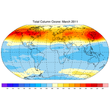
Bodeker Scientific produces global, daily, total column ozone database by combining measurements from a number of different satellite-based instruments. Offsets and drifts between the different datasets are resolved through comparisons with the Dobson and Brewer ground-based instruments and through inter-satellite instrument comparisons. Three versions with different…
Experts contributing reviews
- N/A
 WASWind: Wave and Anemometer-based Sea Surface Wind
Years of record
- to
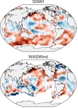
"WASWind (Wave and Anemometer-based Sea Surface Wind) provides a bias-corrected marine surface wind dataset over the global oceans. Variables include scalar, zonal and meridional winds at 10-meter high, and zonal and meridional components of wind stress. WASWind has been constructed from wind observations in ICOADS (International Comprehensive Ocean-Atmosphere Data Set…
Experts contributing reviews
- Tokinaga, Hiroki
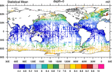 World Ocean Atlas (WOA09)
Years of record
- N/A
World Ocean Atlas 2009 (WOA09) is a set of objectively analyzed (1 degree grid) climatological fields of in situ temperature, salinity, dissolved oxygen, Apparent Oxygen Utilization (AOU), percent oxygen saturation, phosphate, silicate, and nitrate at standard depth levels for annual, seasonal, and monthly compositing periods for the World Ocean. It also includes…
Main variables and Earth System components
Ocean Dissolved Oxygen SST - sea surface temperature Salinity Sub Surface Salinity Sub Surface Temperature oxygen saturation phosphate silicate-
Timestep
- Climatology, Monthly, Seasonal, Annual
-
Domain
- Global
-
Collections
- Diagnostic Data Sets, NCAR-DOE-CESM, oceandiagnostics
Experts contributing reviews
- N/A
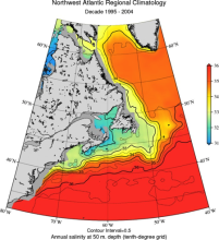 World Ocean Atlas 2013 (WOA13)
Years of record
- to
The World Ocean Atlas (WOA) is a set of climatological mean, gridded fields of oceanographic variables based on in-situ measurements from a wide variety of sources. Global, decadal averages of temperature, salinity, oxygen and nutrients are provided at monthly, seasonal and annual averaging periods on 102 standard depth levels from 0 to 5500m, and at 0.25° (…
Main variables and Earth System components
Ocean Dissolved Oxygen phosphate potential temperature silicate SST - sea surface temperature Sub Surface Salinity Sub Surface Temperature Sub-surface data-
Timestep
- Climatology, Monthly, Seasonal
-
Domain
- Global
-
Collections
- Diagnostic Data Sets, NCAR-DOE-CESM, oceandiagnostics
Experts contributing reviews
- Mishonov, Alexey