SOCAT: Surface Ocean CO2 Atlas

SOCAT (Surface Ocean CO2 Atlas) represents an effort to "provide a comprehensive, publicly available, regularly updated, global data set of marine surface CO2, which had been subject to quality control (QC)." The data sets are comprised of observations (ship track) and gridded data.
Key Strengths
Cite this page
Acknowledgement of any material taken from or knowledge gained from this page is appreciated:
National Center for Atmospheric Research Staff (Eds). Last modified "The Climate Data Guide: SOCAT: Surface Ocean CO2 Atlas .” Retrieved from https://climatedataguide.ucar.edu/climate-data/socat-surface-ocean-co2-atlas on 2026-07-07.
Citation of datasets is separate and should be done according to the data providers' instructions. If known to us, data citation instructions are given in the Data Access section, above.
Acknowledgement of the Climate Data Guide project is also appreciated:
Schneider, D. P., C. Deser, J. Fasullo, and K. E. Trenberth, 2013: Climate Data Guide Spurs Discovery and Understanding. Eos Trans. AGU, 94, 121–122, https://doi.org/10.1002/2013eo130001
Key Figures
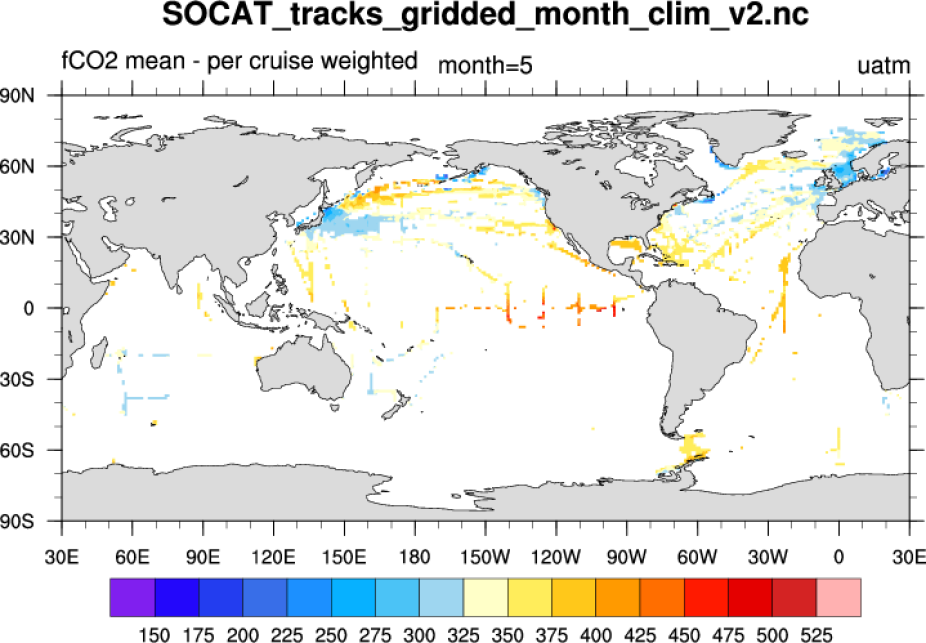
SOCAT May climatology. (Climate Data Guide; D. Shea)
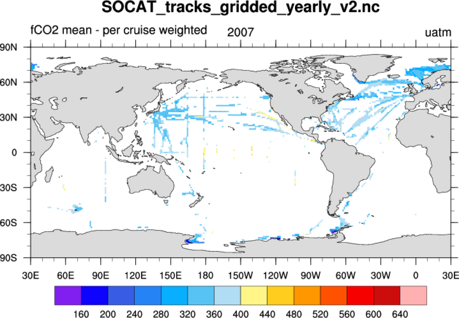
SOCAT 2007 yearly file. (Climate Data Guide; D. Shea)
Other Information
- Bakker, D.C.C. and Coauthors, 2014: An update to the Surface Ocean CO2 Atlas (SOCAT version 2), Earth Syst. Sci. Data, 6, 69-90.
- Pfeil, B. and Coauthors, 2013: A uniform, quality controlled Surface Ocean CO2 Atlas (SOCAT), Earth Syst. Sci. Data, 5, 125-143.
- Sabine, C.L. and Coauthors, 2013: Surface Ocean CO2 Atlas (SOCAT) gridded data products, Earth Syst. Sci. Data, 5, 145-153.
- Pfeil, B., A. Olsen, D.C.E. Bakker, et al. (2011) A uniform, quality controlled, Surface Ocean CO2 Atlas (SOCAT).: Earth Syst. Sci. Data, 5, 125-143, 2013
- Sabine, S.L. et al (2012): Surface Ocean CO2 Atlas (SOCAT) gridded data products, Earth Syst. Sci. Data, 5, 145-153