MODIS GPP/NPP Project (MOD17)
The goal of the MOD17 MODIS project is to provide continuous estimates of Gross/Net Primary Production (GPP/NPP) across Earth’s entire vegetated land surface. MOD17 GPP/NPP outputs are useful for natural resource and land management, global carbon cycle analysis, ecosystem status assessment, and environmental change monitoring. MOD17 is part of the NASA Earth Observation System (EOS) program and is the first satellite-driven dataset to monitor vegetation productivity on a global scale. (source: http://www.ntsg.umt.edu/project/mod17)
Cite this page
Acknowledgement of any material taken from or knowledge gained from this page is appreciated:
National Center for Atmospheric Research Staff (Eds). Last modified "The Climate Data Guide: MODIS GPP/NPP Project (MOD17).” Retrieved from https://climatedataguide.ucar.edu/climate-data/modis-gppnpp-project-mod17 on 2026-04-30.
Citation of datasets is separate and should be done according to the data providers' instructions. If known to us, data citation instructions are given in the Data Access section, above.
Acknowledgement of the Climate Data Guide project is also appreciated:
Schneider, D. P., C. Deser, J. Fasullo, and K. E. Trenberth, 2013: Climate Data Guide Spurs Discovery and Understanding. Eos Trans. AGU, 94, 121–122, https://doi.org/10.1002/2013eo130001
Key Figures

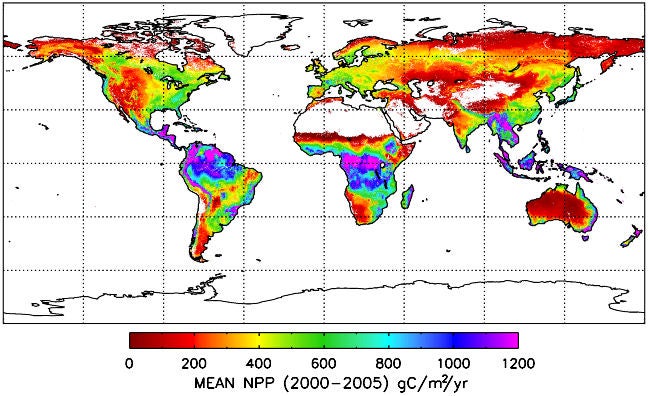
Climatological (2000-2005) net primary production. Source: http://www.ntsg.umt.edu/project/mod17
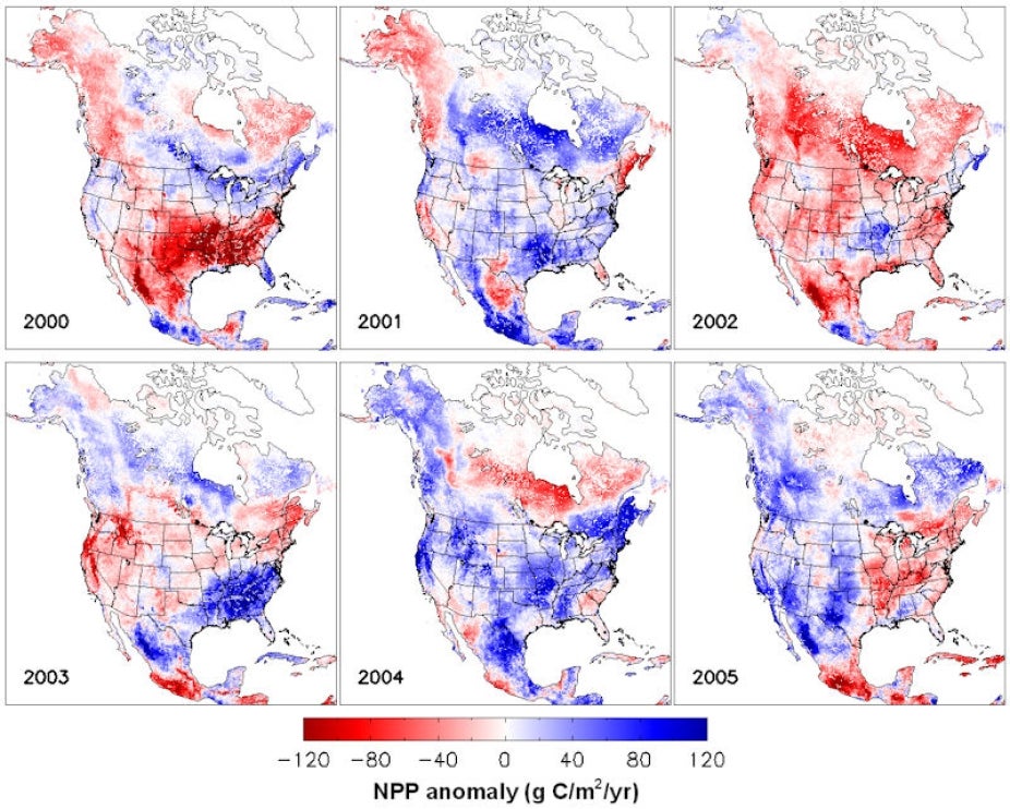
nterannual variability of NPP over the North American Carbon Program (NACP). http://www.ntsg.umt.edu/project/mod17 domain.