Climate data guide content with tag MODIS
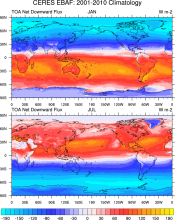 CERES EBAF: Clouds and Earth's Radiant Energy Systems (CERES) Energy Balanced and Filled (EBAF)
Years of record
- to
The CERES-EBAF product provides 1-degree regional, zonal and global monthly mean Top-of-Atmosphere (TOA) and surface (SFC) longwave (LW), shortwave (SW), and net (NET) fluxes under clear and all-sky conditions. EBAF is used for climate model evaluation, estimating the Earth's global mean energy budget, and to infer meridional heat transport. The data synthesized to…
Experts contributing reviews
- Loeb, Norman
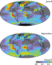 Cloud observations from MODIS
Years of record
- to
The Moderate Resolution Imaging Spectroradiometer (MODIS) is scanning instrument that makes measurements in 36 spectral bands from the visible to the thermal infrared at spatial resolutions from 250 m to 1 km. There are MODIS instruments aboard two sun-synchronous polar-orbiting NASA satellites: Terra, which has a daytime equatorial crossing at about 10:30 am local time…
-
Timestep
- Daily, Monthly, Weekly
-
Domain
- Global
-
Collections
- Diagnostic Data Sets, NCAR-DOE-CESM, atmosdiagnostics, Obs4MIPS
Experts contributing reviews
- Pincus, Robert
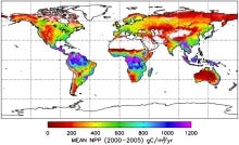 MODIS GPP/NPP Project (MOD17)
Years of record
- to
The goal of the MOD17 MODIS project is to provide continuous estimates of Gross/Net Primary Production (GPP/NPP) across Earth’s entire vegetated land surface. MOD17 GPP/NPP outputs are useful for natural resource and land management, global carbon cycle analysis, ecosystem status assessment, and environmental change monitoring. MOD17 is part of the NASA Earth…
Experts contributing reviews
- N/A
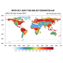 NDVI and EVI: Vegetation Indices (MODIS)
Years of record
- to
MODIS vegetation indices, produced on 16-day and monthly intervals and at multiple spatial resolutions, provide consistent spatial and temporal comparisons of vegetation canopy greenness, a composite property of leaf area, chlorophyll and canopy structure. Two vegetation indices are derived from atmospherically-corrected reflectance in the red, near-infrared, and blue…
Main variables and Earth System components
Land Enhanced Vegetation Index (EVI) NDVI" Normalized Difference Vegetation IndexExperts contributing reviews
- N/A
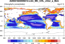 SeaWIFS: ocean bio-optical and carbon properties
Years of record
- to
The purpose of the Sea-viewing Wide Field-of-view Sensor (SeaWiFS) Project is to provide quantitative data on global ocean bio-optical properties and to assess the oceans' role in the global carbon cycle. SeaWiFS data are being used to help clarify the magnitude and variability of chlorophyll and primary production by marine phytoplankton, and to determine the…
-
Formats
- HDF
-
Timestep
- Climatology, Daily, Monthly, Seasonal, Annual
-
Domain
- Global
-
Collections
- Carbon cycle
Experts contributing reviews
- N/A