Climate data guide content with tag Aqua
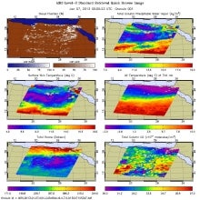 AIRS (Atmospheric InfraRed Sounder): Version 6 Level 2
Years of record
- to
AIRS Version 6 Level 2 data represent a significant improvement over AIRS Version 5 Level 2 products in terms of greater stability, yield, and quality. Several algorithmic improvements have been made by the AIRS Project in conjunction with the AIRS Science Team. Improvements include: (a) Improved soundings of Tropospheric and Sea Surface Temperatures, day and night…
Main variables and Earth System components
Atmosphere Aerosols Air Temperature CO Geopotential Height Ozone: Tropospheric Precipitable water Specific HumidityExperts contributing reviews
- N/A
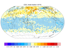 AIRS and AMSU: Trace Gases (CO2, CO, CH4, O3...); Level 3
Years of record
- N/A
AIRS provides satellite retrieval of mid-tropospheric carbon dioxide even under cloudy conditions, without the use of a priori information from models. AIRS retrievals use cloud-cleared thermal IR radiance spectra in the 15 micron band with an accuracy better than 2 ppm. AIRS retrievals have been used to produce global maps of carbon dioxide and other trace gases…
Main variables and Earth System components
Atmosphere CO Ozone: Tropospheric Biosphere CH4-Methane CO CO2-
Timestep
- Sub-daily, Daily, Monthly
-
Domain
- Global
-
Collections
- Carbon cycle
Experts contributing reviews
- N/A
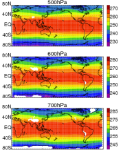 AIRS and AMSU: Tropospheric air temperature and specific humidity
Years of record
- to
The Atmospheric Infrared Sounder (AIRS) project has generated decadal-length, global, gridded data sets of temperature and specific humidity for several standard levels in the troposphere for the obs4MIPS project. This obs4MIPS version of the AIRS data are available at monthly resolution, 1ºx1º grids and formatted to facilitate easier comparisons with CMIP5 model output…
Experts contributing reviews
- Tian, Baijun
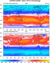 CERES EBAF: Clouds and Earth's Radiant Energy Systems (CERES) Energy Balanced and Filled (EBAF)
Years of record
- to
The CERES-EBAF product provides 1-degree regional, zonal and global monthly mean Top-of-Atmosphere (TOA) and surface (SFC) longwave (LW), shortwave (SW), and net (NET) fluxes under clear and all-sky conditions. EBAF is used for climate model evaluation, estimating the Earth's global mean energy budget, and to infer meridional heat transport. The data synthesized to…
Experts contributing reviews
- Loeb, Norman
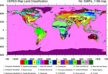 CERES: IGBP Land Classification
Years of record
- N/A
The International Geosphere–Biosphere Programme (IGBP) defines ecosystems surface classifications. The CERES (Clouds and Earth's Radiant Energy System)10-minute data can be used to derive the land categories.
Experts contributing reviews
- N/A
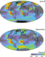 Cloud observations from MODIS
Years of record
- to
The Moderate Resolution Imaging Spectroradiometer (MODIS) is scanning instrument that makes measurements in 36 spectral bands from the visible to the thermal infrared at spatial resolutions from 250 m to 1 km. There are MODIS instruments aboard two sun-synchronous polar-orbiting NASA satellites: Terra, which has a daytime equatorial crossing at about 10:30 am local time…
-
Timestep
- Daily, Monthly, Weekly
-
Domain
- Global
-
Collections
- Diagnostic Data Sets, NCAR-DOE-CESM, atmosdiagnostics, Obs4MIPS
Experts contributing reviews
- Pincus, Robert
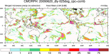 CMORPH (CPC MORPHing technique): High resolution precipitation (60S-60N)
Years of record
- to
"CMORPH (CPC MORPHing technique) produces global precipitation analyses at very high spatial and temporal resolution. This technique uses precipitation estimates that have been derived from low orbiter satellite microwave observations exclusively, and whose features are transported via spatial propagation information that is obtained entirely from geostationary satellite…
Experts contributing reviews
- N/A
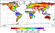 MODIS GPP/NPP Project (MOD17)
Years of record
- to
The goal of the MOD17 MODIS project is to provide continuous estimates of Gross/Net Primary Production (GPP/NPP) across Earth’s entire vegetated land surface. MOD17 GPP/NPP outputs are useful for natural resource and land management, global carbon cycle analysis, ecosystem status assessment, and environmental change monitoring. MOD17 is part of the NASA Earth…
Experts contributing reviews
- N/A
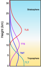 MSU/AMSU Atmospheric Temperature Climate Data Record, Remote Sensing Systems (RSS)
Years of record
- to
A long (30-year+) data set of atmospheric temperatures for 4 tropopsheric and lower stratopsheric layers has been derived from brightness temperatures measured by the Microwave Sounding Unit (MSU) and Advanced Microwave Sounding Unit (AMSU). This page describes the data sets developed by Remote Sensing Systems (RSS); other options exist for comparisons. One of the most…
-
Timestep
- Monthly
-
Domain
- Global
-
Collections
- Climate Data Record
Experts contributing reviews
- Mears, Carl
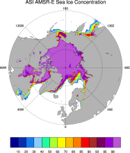 Sea Ice Concentration data from AMSR-E, AMSR2 & SSMIS, U Bremen and U Hamburg ASI algorithm
Years of record
- to
The sea ice data derived from AMSR-E using the ARTIST sea ice (ASI) algorithm offer a factor of 4 finer spatial resolution than most sea ice data sets from passive microwave satellite instruments. ASI is based on the difference of vertically and horizontally polarized brightness temperatures at 89 GHz; this difference is independent of temperature but depends on…
-
Timestep
- Daily
-
Collections
- N/A
Experts contributing reviews
- N/A
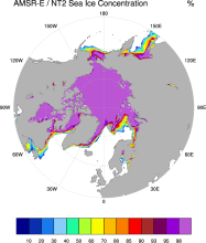 Sea Ice Concentration data from NASA Goddard and NSIDC using AMSR-E and NASA TEAM2 (NT2) algorithm
Years of record
- to
The AMSR-E/NASA Team 2 (NT2) data set of Arctic and Antarctic sea ice concentration is available at daily timesteps and 12.5 km (optionally 25km) spatial resolution for 2002-2011. NT2, an extension of the original NASA Team algorithm, uses AMSR-E 89GHz channels to help resolve ambiguity between low ice concentrations and areas with strong surface effects (due to snow…
Experts contributing reviews
- N/A
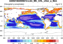 SeaWIFS: ocean bio-optical and carbon properties
Years of record
- to
The purpose of the Sea-viewing Wide Field-of-view Sensor (SeaWiFS) Project is to provide quantitative data on global ocean bio-optical properties and to assess the oceans' role in the global carbon cycle. SeaWiFS data are being used to help clarify the magnitude and variability of chlorophyll and primary production by marine phytoplankton, and to determine the…
-
Formats
- HDF
-
Timestep
- Climatology, Daily, Monthly, Seasonal, Annual
-
Domain
- Global
-
Collections
- Carbon cycle
Experts contributing reviews
- N/A
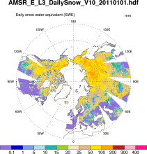 Snow Water Equivalent (AMSR-E)
Years of record
- to
The Advanced Microwave Scanning Radiometer-Earth Observing System (AMSR-E) distributes daily, weekly, and monthly products which includes snow water equivalent. Note: "On 04 October 2011, the AMSR-E instrument on board the Aqua satellite stopped producing data due to a problem with the rotation of its antenna."
-
Formats
- HDF-EOS
-
Timestep
- Daily, Monthly, Weekly
-
Domain
- NH - Northern Hemisphere
-
Collections
- N/A
Experts contributing reviews
- N/A
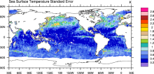 SST (AMSR-E): Sea Surface Temperature from Remote Sensing Systems
Years of record
- to
High resolution (0.25°) SSTs were derived from the AMSR-E, a passive microwave radiometer flying on NASA's AQUA satellite. Remote Sensing Systems distributes the data in high spatial and temporal (daily, weekly, monthly) resolutions for both daytime and nighttime averages. Monthly versions are available on a 1°x1° grid from JPL PO-DAAC as well as the CMIP5 obs4MIPS…
Experts contributing reviews
- N/A
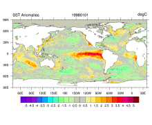 SST data: NOAA High-resolution (0.25x0.25) Blended Analysis of Daily SST and Ice, OISSTv2
Years of record
- to
"NOAA’s Optimum Interpolation Sea Surface temperature (OISST, also known as Reynolds’ SST) is a series of global analysis products, including the weekly OISST on a 1° grid to the more recent daily on a ¼° grid. An SST analysis is a spatially gridded product created by interpolating and extrapolating data, resulting in a smoothed complete field. OISST provides global…
Main variables and Earth System components
Cryosphere Sea Ice Concentration Ocean SST - sea surface temperatureExperts contributing reviews
- Banzon, Viva, Reynolds, Richard
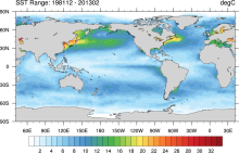 SST data: NOAA Optimal Interpolation (OI) SST Analysis, version 2 (OISSTv2) 1x1
Years of record
- to
The NOAA Optimal Interpolation SST analysis provides global, spatially complete SSTs on a weekly and monthly basis for 1982-present.
Experts contributing reviews
- Banzon, Viva, Reynolds, Richard