Tropical Moored Buoy System: TAO, TRITON, PIRATA, RAMA (TOGA)
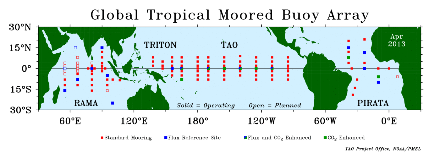
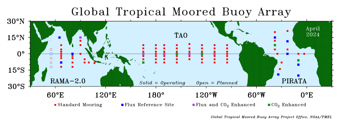
The Tropical Ocean Global Atmosphere program (TOGA) is a component of the World Climate Research Programme (WCRP) aimed specifically at the prediction of climate phenomena on time scales of months to years. In order to achieve the TOGA goals, a strategy of large-scale, long-term monitoring of the upper ocean and the atmosphere has been developed. In particular, several moored bouy projects have been developed. The Global Tropical Moored Buoy Array is a multi-national effort to provide data in real-time for climate research and forecasting. Major components include the TAO/TRITON array in the Pacific, PIRATA in the Atlantic, and RAMA in the Indian Ocean. The TAO array (renamed the TAO/TRITON array on 1 January 2000) consists of approximately 70 moorings in the Tropical Pacific Ocean; PIRATA use ~20 bouys; and, RAMA uses ~23 bouys.
Cite this page
Acknowledgement of any material taken from or knowledge gained from this page is appreciated:
National Center for Atmospheric Research Staff (Eds). Last modified "The Climate Data Guide: Tropical Moored Buoy System: TAO, TRITON, PIRATA, RAMA (TOGA).” Retrieved from https://climatedataguide.ucar.edu/climate-data/tropical-moored-buoy-system-tao-triton-pirata-rama-toga on 2026-07-21.
Citation of datasets is separate and should be done according to the data providers' instructions. If known to us, data citation instructions are given in the Data Access section, above.
Acknowledgement of the Climate Data Guide project is also appreciated:
Schneider, D. P., C. Deser, J. Fasullo, and K. E. Trenberth, 2013: Climate Data Guide Spurs Discovery and Understanding. Eos Trans. AGU, 94, 121–122, https://doi.org/10.1002/2013eo130001
Key Figures

Global Tropical Moored Bouy Array (source: http://www.pmel.noaa.gov/tao/oceansites/images/map_lg.gif)
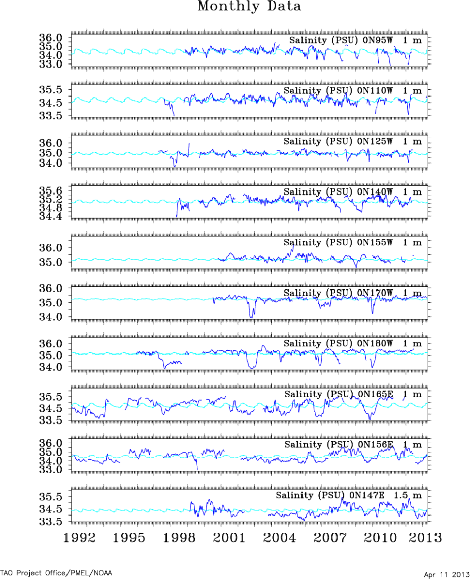
Monthly time series of salinity at all TAO/TRITON bouy locations along the equator. Image created using the online tool at http://www.pmel.noaa.gov/tao/disdel/disdel-pir.html.
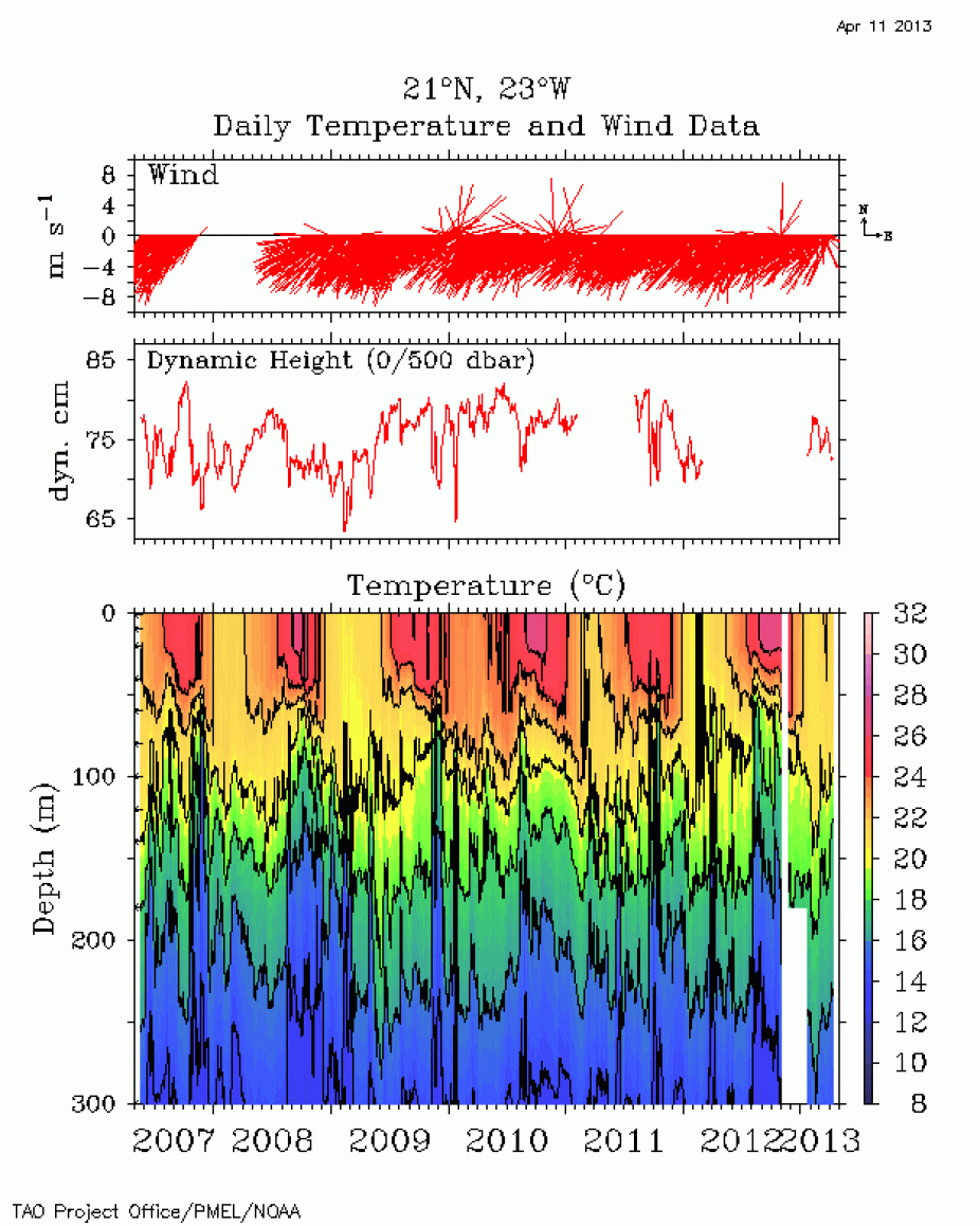
PIRATA: real time download of daily of temperature, wind, dynamic height and temperature with depth (source http://www.pmel.noaa.gov/pirata/21n23w.html)

PIRATA: real time download of daily of sea surface temperature, wind components, relative humidity, air temperature ans sea temperature with depth (source http://www.pmel.noaa.gov/pirata/21n23w.html)
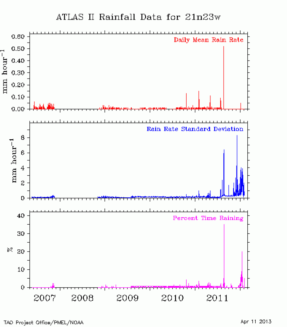
PIRATA: real time download of daily precipitation. (source http://www.pmel.noaa.gov/pirata/21n23w.html)
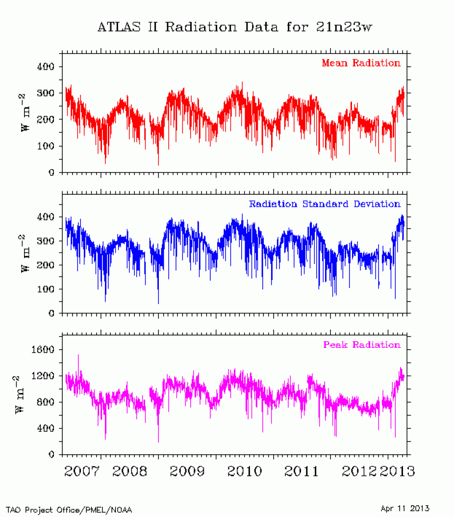
PIRATA: real time download of daily of radiation (source http://www.pmel.noaa.gov/pirata/21n23w.html)

PIRATA: real time download of salinity with depth (source http://www.pmel.noaa.gov/pirata/21n23w.html)
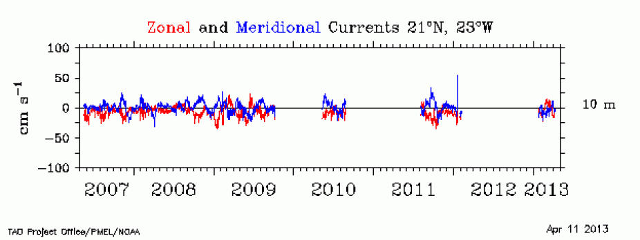
PIRATA: real time download of current speed(source http://www.pmel.noaa.gov/pirata/21n23w.html)
Other Information
- McPhaden et al (2009): The Research Moored Array for African-Asian-Australian Monsoon Analysis and Prediction. Bull. Am. Meteorol. Soc., 90, 459-480
- Praveen et al (2012):TropFlux wind stresses over the tropical oceans: evaluation and comparison with other products
- Praveen et al (2012): TropFlux: Air-Sea Fluxes for the Global Tropical Oceans: Description and evaluation. Clim. Dynamics, 38, 1521-1543
- Drushka, KJ et al (2012): In situ observations of Madden–Julian Oscillation mixed layer dynamics in the Indian and Western Pacific Oceans. J. Climate, 25, 2306–2328
- Cronin et al (2012): Ocean reference stations. In Earth Observation, R.B. Rustamov and S.E. Salahova (eds.), InTech
- Prakash et al (2013): Comparison of TRMM Multisatellite Precipitation Analysis (TMPA)-3B43 version 6 and 7 products with rain gauge data from ocean buoys, Remote Sensing Letters, 4, 677-685
- McPhaden et al (2010): A TOGA retrospective. Oceanography, 23, 86-103