Climate data guide content with tag Sea Level Pressure
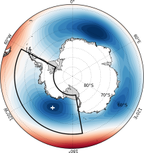 Amundsen Sea Low indices
Years of record
- to
The Amundsen Sea Low (ASL) is a climatological low pressure center located over the extreme southern Pacific Ocean, off the coast of West Antarctica. Atmospheric variability in this region is larger than anywhere else in the Southern Hemisphere, and exhibits significant correlations with both the Southern Annular Mode (SAM) and ENSO. Given its linkages to…
-
Timestep
- Monthly, Seasonal, Annual
-
Collections
- N/A
Experts contributing reviews
- Hosking, Scott
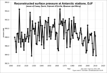 Antarctic Seasonal Pressure Reconstructions 1905-2013
Years of record
- to
This dataset consists of seasonally resolved timeseries of surface pressure at 18 Antarctic research stations, spanning 1905-2013. Routine meteorological observations began at most of these stations only around 1960, leaving a very short instrumental record on which to assess Antarctic climate variability and change. Surface pressure is one of the most…
-
Formats
- ascii, Spreadsheet
-
Timestep
- Seasonal
-
Domain
- Antarctic
-
Collections
- N/A
Experts contributing reviews
- N/A
 E-OBS: High-resolution gridded mean/max/min temperature, precipitation and sea level pressure for Europe & Northern Africa
Years of record
- to
E-OBS is a high spatial resolution daily gridded data that covers the European region and is based on the station data collated by the ECA&D initiative (Klein Tank et al., 2002). These data are supplied by many European National Meteorological Services and other data providers across Europe and the Middle East. The dataset spans the period 1 January 1950 to the…
Main variables and Earth System components
Atmosphere Air Temperature Maximum Air Temperature Minimum Air Temperature Precipitation Sea Level PressureExperts contributing reviews
- van der Schrier, Gerard
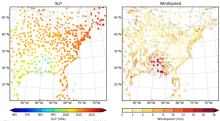 HadISD: Sub-daily, non-interpolated weather station data
Years of record
- to
HadISD ("Hadley Centre Integrated Surface Database") is a compendium of subdaily weather-station data developed by the UK Met Office that is based on NOAA NCEI's Integrated Surface Database but with various quality-control checks implemented to remove stations with excessive and obvious typographical or instrumental errors, as well as individual occurrences of these…
Main variables and Earth System components
Atmosphere Air Temperature at 2m Dew Point Temperature Precipitation Sea Level Pressure Storm data WindExperts contributing reviews
- Raymond, Colin
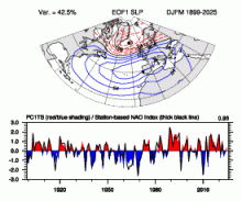 Hurrell North Atlantic Oscillation (NAO) Index (PC-based)
Years of record
- to
The principal component (PC)-based indices of the North Atlantic Oscillation (NAO) are the time series of the leading Empirical Orthogonal Function (EOF) of SLP anomalies over the Atlantic sector, 20°-80°N, 90°W-40°E. These indices are used to measure the NAO throughout the year, tracking the seasonal movements of the Icelandic low and Azores high. These movements…
-
Formats
- ascii
-
Timestep
- Monthly, Seasonal, Annual
-
Domain
- Atlantic Ocean
-
Collections
- Climate Analysis Section (CAS) Data Catalog
Experts contributing reviews
- Hurrell, James, Phillips, Adam
 Hurrell North Atlantic Oscillation (NAO) Index (station-based)
Years of record
- to
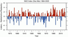
The winter (December thru March) station-based index of the NAO is based on the difference of normalized sea level pressure (SLP) between Lisbon, Portugal and Stykkisholmur/Reykjavik, Iceland since 1864. Positive values of the NAO index are typically associated with stronger-than-average westerlies over the middle latitudes, more intense weather systems over…
-
Formats
- ascii
-
Timestep
- Monthly, Seasonal, Annual
-
Domain
- Atlantic Ocean
-
Collections
- Climate Analysis Section (CAS) Data Catalog
Experts contributing reviews
- Hurrell, James, Phillips, Adam
 Hurrell wintertime SLP-based Northern Annular Mode (NAM) Index
Years of record
- to
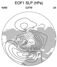
The NAM (or Arctic Oscillation) is defined as the first EOF of NH (20°-90°N) winter SLP data. It explains 23% of the extended winter mean (December-March) variance, and it is clearly dominated by the NAO structure in the Atlantic sector. Although there are some subtle differences from the NAO regional pattern over the Atlantic and Arctic (see Figure 1 below), the main…
-
Formats
- ascii
-
Timestep
- Seasonal
-
Collections
- N/A
Experts contributing reviews
- Phillips, Adam
 ICOADS Surface Marine Weather Observations
Years of record
- N/A
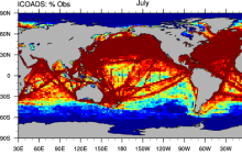
ICOADS (International Comprehensive Ocean-Atmosphere Data Set) is the most comprehensive archive of global marine surface climate observations available. Variables include SST, SLP, air temperature, wind speed, cloud amount, and others. There is no processing beyond initial quality control. ICOADS data are packaged in several different formats with different time…
Main variables and Earth System components
Atmosphere Air Temperature Budget Cloud Properties Latent & sensible heat flux Sea Level Pressure Specific Humidity Wind Ocean SST - sea surface temperatureExperts contributing reviews
- Deser, Clara
 Marshall Southern Annular Mode (SAM) Index (Station-based)
Years of record
- to
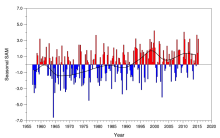
The station-based index of the Southern Annular Mode (SAM) is based on the zonal pressure difference between the latitudes of 40S and 65S. As such, the SAM index measures a "see-saw" of atmospheric mass between the middle and high latitudes of the Southern Hemisphere. Positive values of the SAM index correspond with stronger-than-average westerlies over the…
-
Formats
- ascii
-
Timestep
- N/A
-
Collections
- N/A
Experts contributing reviews
- Marshall, Gareth
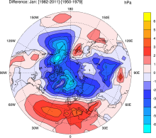 NCAR Sea Level Pressure
Years of record
- to
NCAR Sea Level Pressure is a gridded analysis of SLP based on land station reports, covering 1899 to present for latitudes 30°N-90°N. Quality controlled raw data plus empirical corrections for changes in instrumentation and station location.
-
Timestep
- N/A
-
Domain
- NH - Northern Hemisphere
-
Collections
- Climate Analysis Section (CAS) Data Catalog
Experts contributing reviews
- Hurrell, James, Trenberth, Kevin
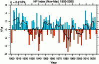 North Pacific (NP) Index by Trenberth and Hurrell; monthly and winter
Years of record
- to
The North Pacific Index (NP index or NPI) is the area-weighted sea level pressure over the region 30°N-65°N, 160°E-140°W. The NP index is defined to measure interannual to decadal variations in the atmospheric circulation. The dominant atmosphere-ocean relation in the North Pacific is one where atmospheric changes lead changes in sea surface temperatures by one to two…
-
Formats
- ascii
-
Timestep
- Monthly, Seasonal
-
Collections
- Climate Analysis Section (CAS) Data Catalog
Experts contributing reviews
- Hurrell, James, Phillips, Adam
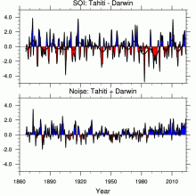 Southern Oscillation Indices: Signal, Noise and Tahiti/Darwin SLP (SOI)
Years of record
- to
The Southern Oscillation Index (SOI) is a time series used to characterize the large scale sea level pressure (SLP) patterns in the tropical Pacific. Monthly mean SLP at Tahiti [T] and Darwin [D] are used. An optimal SOI can be constructed. It consists of [T-D] which is a measure of the large scale phenomena while [T+D] is a measure of small scale and/or…
-
Timestep
- Monthly
-
Domain
- Australia, Pacific Ocean, Tropics
-
Collections
- Climate Analysis Section (CAS) Data Catalog
Experts contributing reviews
- Trenberth, Kevin
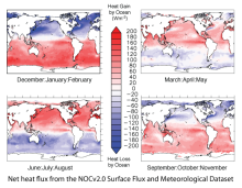 Surface Flux and Meteorological Dataset: National Oceanography Centre (NOC) V2.0
Years of record
- to
The National Oceanography Centre (NOC) Version 2.0 Surface Flux and Meteorological Dataset is a monthly mean gridded dataset of marine surface measurements and derived fluxes constructed using optimal interpolation. Input for the period 1973 to 2006 are ICOADS Release 2.4 ship data and the update from 2007 to 2014 uses ICOADS Release 2.5. The dataset is presented…
-
Formats
- netCDF
-
Timestep
- Monthly
-
Domain
- Global
-
Collections
- Climate Data Record
Experts contributing reviews
- Kent, Elizabeth
 Tropical Moored Buoy System: TAO, TRITON, PIRATA, RAMA (TOGA)
Years of record
- to
The Tropical Ocean Global Atmosphere program (TOGA) is a component of the World Climate Research Programme (WCRP) aimed specifically at the prediction of climate phenomena on time scales of months to years. In order to achieve the TOGA goals, a strategy of large-scale, long-term monitoring of the upper ocean and the atmosphere has been developed. In particular, several…
Main variables and Earth System components
Atmosphere Air Temperature Precipitation Radiation Relative Humidity Sea Level Pressure Wind Ocean Absolute Dynamic Topography (ADT) Ocean Heat Content SST - sea surface temperature Salinity Sub Surface Salinity Sub Surface Temperature u, v current componentsExperts contributing reviews
- N/A