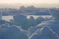
Walsh and Chapman Northern Hemisphere Sea Ice
Key Strengths
Key Limitations
none
Expert Developer Guidance
The temporal and spatial inhomogeneities in the data sources that went into the construction of this dataset require that any historical analysis of the data is done with caution and an understanding of the limitations of the data.
There are three periods for which the sources of the data change fundamentally:
1972-1998: Satellite period - hemispheric coverage, state-of-the-art data accuracy
1953-1971: Hemispheric observations - complete coverage from a variety of sources. The observational reliability varies with each source, but is generally accurate.
1870-1952: Climatology with increasing amounts of observed data throughout the period.
Because most of the direct observations of sea ice (1870-1971 period) are from ships at sea, they are generally the most complete near the ice edge. The conditions north of the ice edge are often assumed to be 100% covered during this period. The satellite era has shown otherwise with concentrations between 70-90% frequently occurring well north of the ice edge in the post-1972 data. For this reason, we recommend using a measure of ice extent, when doing historical comparisons of hemispheric sea ice coverage for periods which include data prior to 1972. This is done by assuming that all grid points with ice concentrations greater than some threshold (15% is commonly used) is assumed completely covered by sea ice.
Regional or grid point analyses may benefit by using the concentration data as it is distributed but the completeness of the historical record will vary regionally. Please contact Bill Chapman (chapman@atmos.uiuc.edu) if you have a question regarding the inventory of data included in this dataset for a specific region.
Cite this page
Acknowledgement of any material taken from or knowledge gained from this page is appreciated:
Chapman, William & National Center for Atmospheric Research Staff (Eds). Last modified "The Climate Data Guide: Walsh and Chapman Northern Hemisphere Sea Ice.” Retrieved from https://climatedataguide.ucar.edu/climate-data/walsh-and-chapman-northern-hemisphere-sea-ice on 2026-06-06.
Citation of datasets is separate and should be done according to the data providers' instructions. If known to us, data citation instructions are given in the Data Access section, above.
Acknowledgement of the Climate Data Guide project is also appreciated:
Schneider, D. P., C. Deser, J. Fasullo, and K. E. Trenberth, 2013: Climate Data Guide Spurs Discovery and Understanding. Eos Trans. AGU, 94, 121–122, https://doi.org/10.1002/2013eo130001
Other Information
- Chapman, W.L. and J.E. Walsh (1991): Long-Range Prediction of Regional Sea Ice Anomalies in the Arctic. "Weather and Forecasting", 6(2), pp. 271-288.
- Kelly, P. M. 1979: An arctic sea ice data set, 1901-1956. Glaciological Data, Report GD-5: Workshop on Snow Cover and Sea Ice Data. World Data Center-A for Glaciology [Snow and Ice], 101-106.
- Technical Report of the Japan Meteorological Agency (JMA) No. 109 (ISSN 0447-3868) titled "Report on 30 years of Observation of Sea Ice" by Marine Department, JMA. Published by JMA, Tokyo, February 1988.
- Walsh, J.E. (1978): A data set on Northern Hemisphere sea ice extent. World Data Center-A for Glaciology (Snow and Ice), "Glaciological Data, Report GD-2", part 1, pp. 49 - 51.
- Walsh, J.E. (1978): A data set on Northern Hemisphere sea ice extent. World Data Center-A for Glaciology (Snow and Ice), "Glaciological Data, Report GD-2", part 1, pp. 49 - 51.
- Walsh, J.E. and C.M. Johnson (1979): Analysis of Arctic sea ice fluctuations 1953-77. "Journal of Physical Oceanography", 9(3), p. 580-591.