Sea Ice Concentration data from HadISST
Key Strengths
Key Limitations
Met Office, Hadley Centre. HadISST 1.1 - Global sea-Ice coverage and SST (1870-Present), [Internet]. NCAS British Atmospheric Data Centre, 2006, Date of citation,. Available from http://badc.nerc.ac.uk/view/badc.nerc.ac.uk__ATOM__dataent_hadisst
NCAR RDA: "The data for this study are from the Research Data Archive (RDA) which is maintained by the Computational and Information Systems Laboratory (CISL) at the National Center for Atmospheric Research (NCAR). NCAR is sponsored by the National Science Foundation (NSF). The original data are available from the RDA (http://rda.ucar.edu) in dataset number ds277.3."
Rayner, N. A.; Parker, D. E.; Horton, E. B.; Folland, C. K.; Alexander, L. V.; Rowell, D. P.; Kent, E. C.; Kaplan, A. (2003) Global analyses of sea surface temperature, sea ice, and night marine air temperature since the late nineteenth century, J. Geophys. Res., Vol. 108, No. D14, 4407 10.1029/2002JD002670
Cite this page
Acknowledgement of any material taken from or knowledge gained from this page is appreciated:
National Center for Atmospheric Research Staff (Eds). Last modified "The Climate Data Guide: Sea Ice Concentration data from HadISST.” Retrieved from https://climatedataguide.ucar.edu/climate-data/sea-ice-concentration-data-hadisst on 2026-05-30.
Citation of datasets is separate and should be done according to the data providers' instructions. If known to us, data citation instructions are given in the Data Access section, above.
Acknowledgement of the Climate Data Guide project is also appreciated:
Schneider, D. P., C. Deser, J. Fasullo, and K. E. Trenberth, 2013: Climate Data Guide Spurs Discovery and Understanding. Eos Trans. AGU, 94, 121–122, https://doi.org/10.1002/2013eo130001
Key Figures
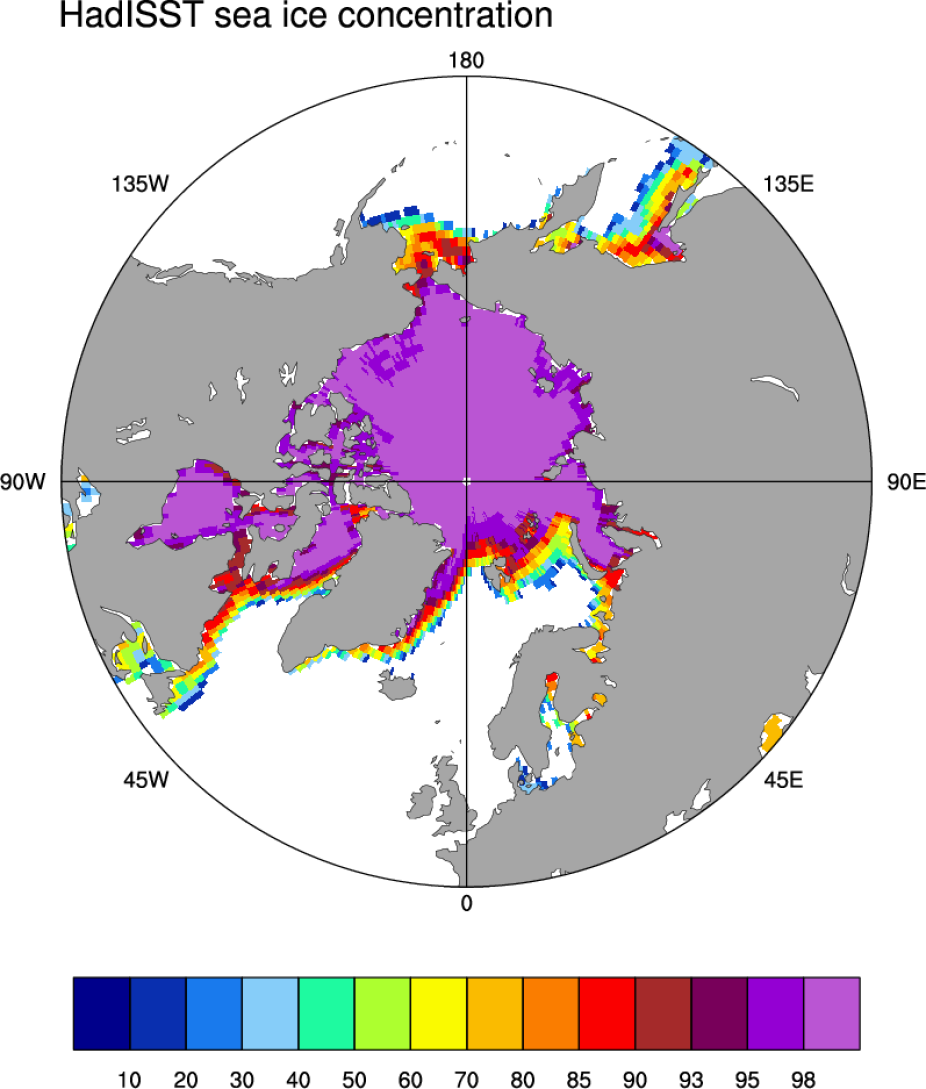
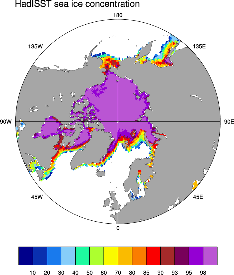
Average Arctic sea ice concentration for March 2003-2007 from the HadISST data set. (Figure by D. Schneider, NCAR).
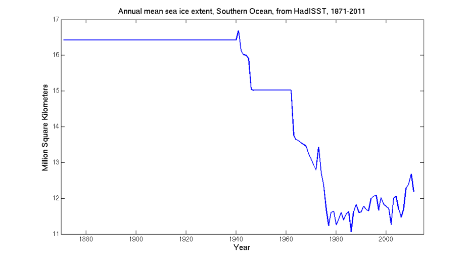
Annual Antarctic sea ice extent for 1871-2011 from the HadiSST 1.1 data set. 1871-1939 and 1947-1962 are covered by two climatologies. National Ice Center Charts were used for 1973-1978. Passive microwave satellite data begin in 1978. See Rayner et al (2003). Even during this period, there are discontinuities. In particular, SSMI degraded in early 2009 and NCEP switched to AMSR-E, resulting in spuriously high values for 2009-2011 (see Screen, 2011). (Figure by D. Schneider, NCAR).