NDVI and EVI: Vegetation Indices (MODIS)

MODIS vegetation indices, produced on 16-day and monthly intervals and at multiple spatial resolutions, provide consistent spatial and temporal comparisons of vegetation canopy greenness, a composite property of leaf area, chlorophyll and canopy structure. Two vegetation indices are derived from atmospherically-corrected reflectance in the red, near-infrared, and blue wavebands; the normalized difference vegetation index (NDVI), which provides continuity with NOAA's AVHRR NDVI time series record for historical and climate applications, and the enhanced vegetation index (EVI), which minimizes canopy-soil variations and improves sensitivity over dense vegetation conditions. The two products more effectively characterize the global range of vegetation states and processes.
The vegetation indices are retrieved from daily, atmosphere-corrected, bidirectional surface reflectance. The VI's use a MODIS-specific compositing method based on product quality assurance metrics to remove low quality pixels. From the remaining good quality VI values, a constrained view angle approach then selects a pixel to represent the compositing period (from the two highest NDVI values it selects the pixel that is closest-to-nadir). Because the MODIS sensors aboard Terra and Aqua satellites are identical, the VI algorithm generates each 16-day composite eight days apart (phased products) to permit a higher temporal resolution product by combining both data records. The MODIS VI product suite is now used successfully in all ecosystem, climate, and natural resources management studies and operational research as demonstrated by the ever increasing body of peer publications.
Key Strengths
NDVI and EVI at High resolution(s)
monthly, half-monthly, 'weekly', daily
Cite this page
Acknowledgement of any material taken from or knowledge gained from this page is appreciated:
National Center for Atmospheric Research Staff (Eds). Last modified "The Climate Data Guide: NDVI and EVI: Vegetation Indices (MODIS).” Retrieved from https://climatedataguide.ucar.edu/climate-data/ndvi-and-evi-vegetation-indices-modis on 2026-07-22.
Citation of datasets is separate and should be done according to the data providers' instructions. If known to us, data citation instructions are given in the Data Access section, above.
Acknowledgement of the Climate Data Guide project is also appreciated:
Schneider, D. P., C. Deser, J. Fasullo, and K. E. Trenberth, 2013: Climate Data Guide Spurs Discovery and Understanding. Eos Trans. AGU, 94, 121–122, https://doi.org/10.1002/2013eo130001
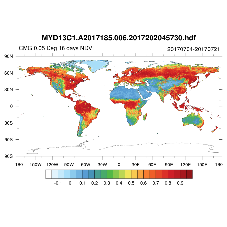
Key Figures

MODIS-NDVI: half-monthly: 4 July 2017 - 21 July 2017
MODIS-EVI: half-monthly: 4 July 2017 - 21 July 2017