CMORPH (CPC MORPHing technique): High resolution precipitation (60S-60N)
Key Strengths
Cite this page
Acknowledgement of any material taken from or knowledge gained from this page is appreciated:
National Center for Atmospheric Research Staff (Eds). Last modified "The Climate Data Guide: CMORPH (CPC MORPHing technique): High resolution precipitation (60S-60N).” Retrieved from https://climatedataguide.ucar.edu/climate-data/cmorph-cpc-morphing-technique-high-resolution-precipitation-60s-60n on 2026-07-07.
Citation of datasets is separate and should be done according to the data providers' instructions. If known to us, data citation instructions are given in the Data Access section, above.
Acknowledgement of the Climate Data Guide project is also appreciated:
Schneider, D. P., C. Deser, J. Fasullo, and K. E. Trenberth, 2013: Climate Data Guide Spurs Discovery and Understanding. Eos Trans. AGU, 94, 121–122, https://doi.org/10.1002/2013eo130001
Key Figures
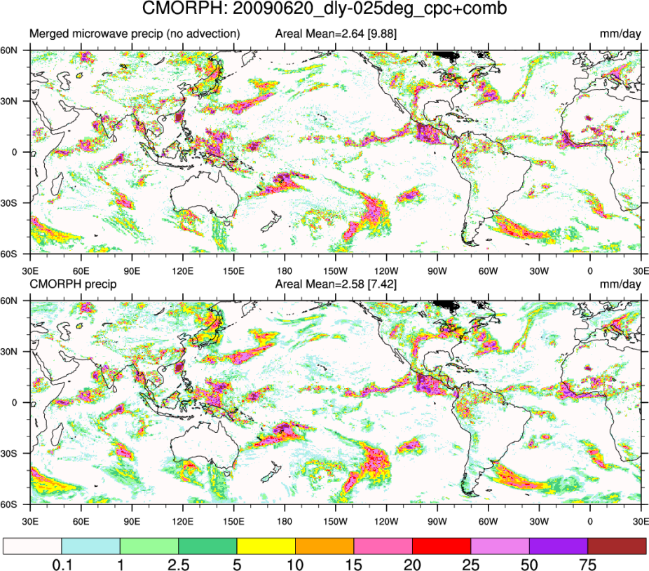
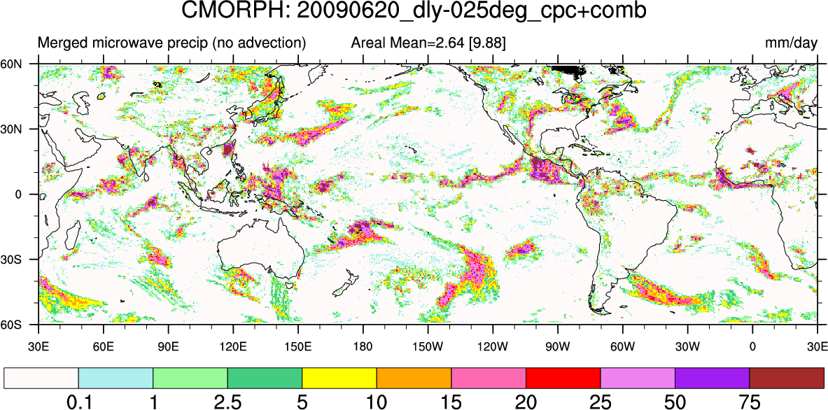
Sample CMORPH (0.25 x 0.25) without (top) and with (bottom) advection for June 20, 2009. [Climate Data Guide; D.Shea]
Other Information
- Joyce, Robert J., John E. Janowiak, Phillip A. Arkin, Pingping Xie, 2004: CMORPH: A Method that Produces Global Precipitation Estimates from Passive Microwave and Infrared Data at High Spatial and Temporal Resolution. J. Hydrometeor, 5, 487–503
- Ferraro, R. R., 1997: SSM/I derived global rainfall estimates for climatological applications. J. Geophys. Res., 102, 16 715–16 735.
- Ferraro, R. R., F. Weng, N. C. Grody and L. Zhao, 2000: Precipitation characteristics over land from the NOAA-15 AMSU sensor. Geophys. Res. Ltr., 27, 2669-2672