Climate data guide content with tag binary
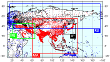 APHRODITE: Asian Precipitation - Highly-Resolved Observational Data Integration Towards Evaluation of Water Resources
Years of record
- to
APHRODITE’s (Asian Precipitation - Highly-Resolved Observational Data Integration Towards Evaluation) gridded precipitation is a set of long-term (1951 onward) continental-scale daily products that is based on a dense network of rain-gauge data for Asia including the Himalayas, South and Southeast Asia and mountainous areas in the Middle East. The gridded products are…
Experts contributing reviews
- Maeda, Mio, Yasutomi, Natsuko, Yatagai, Akiyo
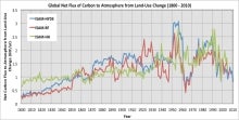 Carbon Emissions from Historical Land-Use and Land-Use Change
Years of record
- to
Annual net land-atmosphere carbon flux and net flux of carbon to the atmosphere due to land-use and land-use change (LULUC) are estimated using an integrated assessment model and three historical reconstructions of land use and land use conversion. The data span 1800-2010 and are aggregated for nine regions of the globe.
Main variables and Earth System components
Biosphere CO2 Land CO2 Land-Atmosphere flux Land Cover Type Land Use ConversionExperts contributing reviews
- Meiyappan, Prasanth
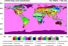 CERES: IGBP Land Classification
Years of record
- N/A
The International Geosphere–Biosphere Programme (IGBP) defines ecosystems surface classifications. The CERES (Clouds and Earth's Radiant Energy System)10-minute data can be used to derive the land categories.
Experts contributing reviews
- N/A
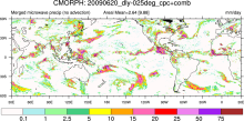 CMORPH (CPC MORPHing technique): High resolution precipitation (60S-60N)
Years of record
- to
"CMORPH (CPC MORPHing technique) produces global precipitation analyses at very high spatial and temporal resolution. This technique uses precipitation estimates that have been derived from low orbiter satellite microwave observations exclusively, and whose features are transported via spatial propagation information that is obtained entirely from geostationary satellite…
Experts contributing reviews
- N/A
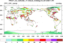 CPC Unified Gauge-Based Analysis of Global Daily Precipitation
Years of record
- to
A gauge-based analysis of daily precipitation has been constructed over the global land areas. Gauge reports from over 30,000 stations are collected from multiple sources including GTS, COOP, and other national and international agencies. Quality control is performed through comparisons with historical records and independent information from measurements at nearby…
Experts contributing reviews
- N/A
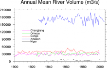 Freshwater Discharge: 1948-2004
Years of record
- to
"A dataset of historical monthly streamflow at the farthest downstream stations for the world’s 925 largest ocean-reaching rivers has been created for community use. Compared with previous studies, the new dataset has improved homogeneity and enables more reliable assessments of decadal and long-term changes in continental freshwater discharge into the oceans." The data…
-
Timestep
- Monthly
-
Domain
- Global
-
Collections
- Climate Analysis Section (CAS) Data Catalog
Experts contributing reviews
- N/A
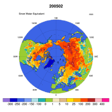 Global Monthly EASE-Grid Snow Water Equivalent Climatology: SSMR, SSMI
Years of record
- to
This data set comprises global, monthly satellite-derived snow water equivalent (SWE) climatologies from November 1978 through May 2007, and is updated with more recent data periodically. Global data are gridded to the Northern and Southern 25 km Equal-Area Scalable Earth Grids (EASE-Grids). Global snow water equivalent is derived from Scanning Multichannel Microwave…
-
Formats
- binary
-
Timestep
- Monthly
-
Collections
- N/A
Experts contributing reviews
- N/A
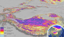 Global Permafrost Zonation Index Map
Years of record
- N/A
This data set contains a global (excluding Antarctica) 1 km map of permafrost zonation. It is an estimate of to what degree permafrost exists in a region nearly everywhere, or only in the most favorable conditions. These local conditions affecting permafrost occurrence will partly exhibit regional trends (e.g. mean snow cover characteristics or continentality), partly…
Experts contributing reviews
- Gruber, Stephan
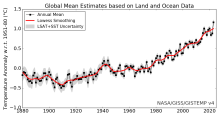 Global surface temperature data: GISTEMP: NASA Goddard Institute for Space Studies (GISS) Surface Temperature Analysis
Years of record
- to
NASA Goddard's Global Surface Temperature Analysis (GISTEMP) combines land surface air temperatures from GHCN-M version 4 with SSTs of the ERSSTv5 analysis into a comprehensive, global surface temperature data set spanning 1880 to the present at monthly resolution, on a 2x2 degree latitude-longitude grid. As such, it is one of the main data sets used to monitor global…
Main variables and Earth System components
Atmosphere Air Temperature Ocean SST - sea surface temperature-
Timestep
- Monthly
-
Domain
- Global
Experts contributing reviews
- Lenssen, Nathan
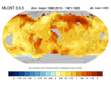 Global surface temperature data: MLOST: NOAA Merged Land-Ocean Surface Temperature Analysis
Years of record
- to
NOAA's Merged Land-Ocean Surface Temperature Analysis (MLOST) combines land surface air temperatures primarily from the Global Historical Climatology Network, Monthly (GHCN-M) version 3 with SSTs of the ERSSTv3b analysis into a comprehensive global surface temperature data set spanning 1880 to the present at monthly resolution, on a 5x5 degree latitude-longitude grid.…
Main variables and Earth System components
Atmosphere Air Temperature Ocean SST - sea surface temperature-
Timestep
- Monthly
-
Domain
- Global
Experts contributing reviews
- N/A
 Global surface temperature: Maximum Likelihood Estimates of Temperatures using HadCRUT5 (Version 1.2)
Years of record
- to
The Maximum Likelihood Estimates of Temperatures using HadCRUT5 Version 1.2 (HadCRU_MLE_v1.2) dataset provides global complete surface temperature estimates since 1850, with monthly 5°x5° resolution. It uses more sophisticated statistical models to fill data gaps in the non-infilled version of HadCRUT5. The statistical models used in HadCRU_MLE_v1.2 better…
Main variables and Earth System components
Atmosphere Air Temperature at 2m Ocean SST - sea surface temperatureExperts contributing reviews
- Chan, Duo
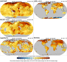 Global Temperature Data Sets: Overview & Comparison Table
Years of record
- to
Global surface temperature data sets are an essential resource for monitoring and understanding climate variability and long-term trends. The most commonly used data sets combine historical observations of near surface air temperatures at land stations with global data sets of sea surface temperatures (SST) obtained from a changing mix of ship-based and buoy…
Main variables and Earth System components
Atmosphere Air Temperature Air Temperature at 2m Ocean SST - sea surface temperature-
Timestep
- Climatology, Monthly
-
Domain
- Global
-
Collections
- Overview / Comparison page
Experts contributing reviews
- N/A
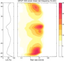 GPCP (Daily): Global Precipitation Climatology Project
Years of record
- to
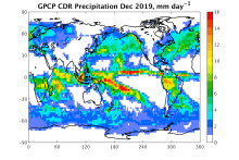
The 1DD product provides precipitation estimates on a 1-degree grid over the entire globe at 1-day (daily) for the period October 1996 - present. Both the Pentad and 1DD products are consistent with the Version 2 monthly product in the sense that the Pentad and 1DD approximately sum to the monthly SG estimate. All three precipitation products are produced by optimally…
Experts contributing reviews
- Pendergrass, Angeline
 GPCP (Monthly): Global Precipitation Climatology Project
Years of record
- to
Data from rain gauge stations, satellites, and sounding observations have been merged to estimate monthly rainfall on a 2.5-degree global grid from 1979 to the present. The careful combination of satellite-based rainfall estimates provides the most complete analysis of rainfall available to date over the global oceans, and adds necessary spatial detail to the rainfall…
-
Timestep
- Climatology, Monthly
-
Domain
- Global
Experts contributing reviews
- Pendergrass, Angeline, Wang, Jian-Jian
 ICOADS Surface Marine Weather Observations
Years of record
- N/A
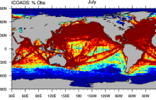
ICOADS (International Comprehensive Ocean-Atmosphere Data Set) is the most comprehensive archive of global marine surface climate observations available. Variables include SST, SLP, air temperature, wind speed, cloud amount, and others. There is no processing beyond initial quality control. ICOADS data are packaged in several different formats with different time…
Main variables and Earth System components
Atmosphere Air Temperature Budget Cloud Properties Latent & sensible heat flux Sea Level Pressure Specific Humidity Wind Ocean SST - sea surface temperatureExperts contributing reviews
- Deser, Clara
 ISCCP: International Satellite Cloud Climatology Project
Years of record
- to
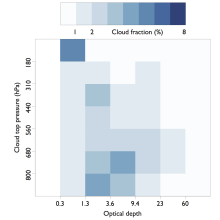
The International Satellite Cloud Climatology Project (ISCCP) makes use of routine observations by operational weather satellites to provide a long-term (1983-2009), gridded, global record of cloud properties. ISCCP uses observations in the visible and infrared window portions of the spectrum to determine cloud optical thickness and cloud top temperature, from which the…
-
Timestep
- Climatology, Sub-daily, Monthly
-
Domain
- Global
Experts contributing reviews
- Pincus, Robert
 Japanese Ocean Flux Data sets with Use of Remote Sensing Observations (J-OFURO2)
Years of record
- to
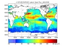
These ocean surface flux data sets are derived primarily using data from multiple satellites. The COARE 3.0 bulk algorithm [Fairall et al. (2003)] is used in J-OFURO2 for the estimation of sensible and latent heat fluxes.
Main variables and Earth System components
Atmosphere Specific Humidity Wind Stress Latent & sensible heat flux Ocean Surface FluxExperts contributing reviews
- N/A
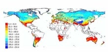 Landscape surface freeze/thaw status based on passive microwave remote sensing
Years of record
- to
A global data set of the frozen state of the land surface (free-thaw (FT) status) has been developed spanning 1979-present at a daily timestep and 25 x 25 km spatial resolution. Based on passive microwave remote sensing, the FT parameter is closely related to the surface energy budget, hydrologic cycle, trace gas exchanges, vegetation growth, and terrestrial carbon…
-
Timestep
- Daily
-
Domain
- Global
-
Collections
- Climate Data Record
Experts contributing reviews
- Kimball, John
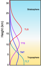 MSU/AMSU Atmospheric Temperature Climate Data Record, Remote Sensing Systems (RSS)
Years of record
- to
A long (30-year+) data set of atmospheric temperatures for 4 tropopsheric and lower stratopsheric layers has been derived from brightness temperatures measured by the Microwave Sounding Unit (MSU) and Advanced Microwave Sounding Unit (AMSU). This page describes the data sets developed by Remote Sensing Systems (RSS); other options exist for comparisons. One of the most…
-
Timestep
- Monthly
-
Domain
- Global
-
Collections
- Climate Data Record
Experts contributing reviews
- Mears, Carl
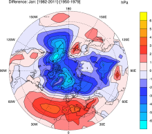 NCAR Sea Level Pressure
Years of record
- to
NCAR Sea Level Pressure is a gridded analysis of SLP based on land station reports, covering 1899 to present for latitudes 30°N-90°N. Quality controlled raw data plus empirical corrections for changes in instrumentation and station location.
-
Timestep
- N/A
-
Domain
- NH - Northern Hemisphere
-
Collections
- Climate Analysis Section (CAS) Data Catalog
Experts contributing reviews
- Hurrell, James, Trenberth, Kevin
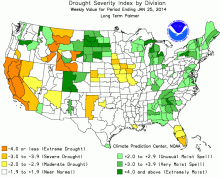 Palmer Drought Severity Index (PDSI)
Years of record
- N/A
The Palmer Drought Severity Index (PDSI) uses readily available temperature and precipitation data to estimate relative dryness. It is a standardized index that generally spans -10 (dry) to +10 (wet). Maps of operational agencies like NOAA typically show a range of -4 to +4, but more extreme values are possible. The PDSI has been reasonably successful at quantifying…
-
Timestep
- Monthly
-
Domain
- Global
-
Collections
- Climate Analysis Section (CAS) Data Catalog
Experts contributing reviews
- Dai, Aiguo, Bui, Sang, Lenssen, Nathan
 Pan-Arctic Ice Ocean Modeling and Assimilation System (PIOMAS)
Years of record
- to
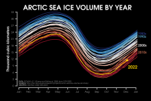
The Pan-Arctic Ice-Ocean Modeling and Assimilation System (PIOMAS) is a reanalysis data set that uses a coupled ice and ocean model to provide daily and monthly estimates of Arctic sea-ice thickness. The data is publicly available from January 1979 to in near-real time. The model is developed and maintained by the Polar Science Center (PSC) in the Applied Physics…
Experts contributing reviews
- Labe, Zachary
 Permafrost: Circum-Arctic Map of Permafrost and Ground Ice Conditions
Years of record
- N/A
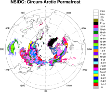
The circumpolar permafrost and ground ice data contribute to a unified international data set that depicts the distribution and properties of permafrost and ground ice in the Northern Hemisphere (20°N to 90°N). The re-gridded data set shows discontinuous, sporadic, or isolated permafrost boundaries.
-
Timestep
- Climatology
-
Domain
- NH - Northern Hemisphere
-
Collections
- N/A
Experts contributing reviews
- N/A
 PERSIANN-CDR: Precipitation Estimation from Remotely Sensed Information using Artificial Neural Networks - Climate Data Record
Years of record
- to
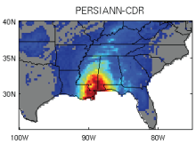
The Precipitation Estimation from Remotely Sensed Information using Artificial Neural Networks- Climate Data Record (PERSIANN-CDR) provides daily rainfall estimates at a spatial resolution of 0.25 degrees in the latitude band 60S - 60N from 1983 to the near-present. The precipitation estimate is produced using the PERSIANN algorithm on GridSat-B1 infrared…
-
Timestep
- Sub-daily, Daily
-
Domain
- Global
-
Collections
- Climate Data Record
Experts contributing reviews
- Ashouri, Hamed, Gehne, Maria
 QuikSCAT: near sea-surface wind speed and direction
Years of record
- to
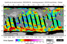
The QuikSCAT mission was intended to obtain sea-surface wind speed and direction data under all weather and cloud conditions over Earth's oceans. SeaWinds, an active radar scatterometer, is the main instrument on the QuikSCAT satellite. The microwave backscatter measured by SeaWinds is dependent on the surface roughness of the ocean, which in turn is related to wind…
Experts contributing reviews
- Ricciardulli, Lucrezia
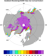 Sea Ice Concentration data from NASA Goddard and NSIDC based on Bootstrap algorithm
Years of record
- to
Bootstrap sea ice refers to a well-known algorithm used to estimate sea ice concentration from passive microwave brightness temperatures. It can be applied to data from many satellite instruments, such as SMMR, SSMI, and AMSR-E. This page discusses the algorithm itself and the long-term data set ("NSIDC 0079, version 2") produced by J. Comiso and distributed by NSIDC.…
-
Timestep
- Daily, Monthly
-
Collections
- N/A
Experts contributing reviews
- N/A
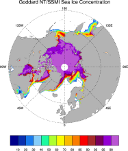 Sea Ice Concentration data from NASA Goddard and NSIDC based on NASA Team algorithm
Years of record
- to
NASA Team sea ice refers to a well-known algorithm used to estimate sea ice concentration from passive microwave brightness temperatures. This page discusses the algorithm itself and the long-term data set ("NSIDC 0051") produced by scientists at NASA Goddard and distributed by NSIDC. The NASA Team data are very widely used and are a key input into other data sets…
-
Timestep
- Daily, Monthly
-
Collections
- Diagnostic Data Sets, NCAR-DOE-CESM, seaicediagnostics
Experts contributing reviews
- N/A
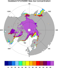 Sea ice concentration data from NASA Goddard based on SSMI and NASA Team (NT2) algorithm
Years of record
- to
The NASA Team 2 (NT2) / SSMI data set of Arctic and Antarctic sea ice concentration is available at daily timesteps and 25km spatial resolution for 1992-2008. NT2, an extension of the original NASA Team algorithm, uses SSMI 85GHz channels to help resolve ambiguity between low ice concentrations and areas with strong surface effects (due to snow layering and glazing).…
Experts contributing reviews
- N/A
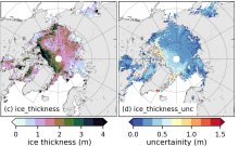 Sea Ice Thickness Data Sets: Overview & Comparison Table
Years of record
- to
While satellite observations of sea ice extent and concentration are available from 1979, long-term high quality (daily and high spatial resolution) observations of sea ice thickness remain limited as a result of few satellite and in situ observations. Reconstructions using numerous observational sources show a 65% decline in annual mean sea ice thickness in the central…
Experts contributing reviews
- Labe, Zachary, Tilling, Rachel
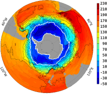 Southern Ocean State Estimate (SOSE)
Years of record
- to
The Southern Ocean State Estimate (SOSE) is a model-generated best fit to Southern Ocean observations. As such, it provides a quantitatively useful climatology of the mean-state of the Southern Ocean. Technically, SOSE is a solution to the MITgcm. SOSE is a gridded dataset at 1/6 ° horizontal resolution, available at timesteps from daily to annually.…
Main variables and Earth System components
Ocean 3D Velocity Bottom pressure SST - sea surface temperature Salinity Sub Surface Temperature mixed layer depth sea surface height u, v current components Wind Stress-
Formats
- binary
-
Timestep
- Daily, Monthly, Weekly, Annual
-
Collections
- N/A
Experts contributing reviews
- Mazloff, Matthew
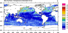 SST (AMSR-E): Sea Surface Temperature from Remote Sensing Systems
Years of record
- to
High resolution (0.25°) SSTs were derived from the AMSR-E, a passive microwave radiometer flying on NASA's AQUA satellite. Remote Sensing Systems distributes the data in high spatial and temporal (daily, weekly, monthly) resolutions for both daytime and nighttime averages. Monthly versions are available on a 1°x1° grid from JPL PO-DAAC as well as the CMIP5 obs4MIPS…
Experts contributing reviews
- N/A
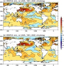 SST Data: NOAA Extended Reconstruction SSTs Version 6 (ERSSTv6)
Years of record
- to
The NOAA Extended Reconstruction Sea Surface Temperature version 6 (ERSSTv6) is a global, spatially complete SST data at monthly 2°×2° resolutions based on in situ observations for 1850-present. Version 6 is based upon statistical interpolation of the ICOADS release 3.0.2 SST data. Argo float data are also used in the recent years (since ~2000). The data are distributed…
Experts contributing reviews
- Huang, Boyin, Yin, Xungang
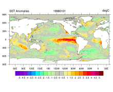 SST data: NOAA High-resolution (0.25x0.25) Blended Analysis of Daily SST and Ice, OISSTv2
Years of record
- to
"NOAA’s Optimum Interpolation Sea Surface temperature (OISST, also known as Reynolds’ SST) is a series of global analysis products, including the weekly OISST on a 1° grid to the more recent daily on a ¼° grid. An SST analysis is a spatially gridded product created by interpolating and extrapolating data, resulting in a smoothed complete field. OISST provides global…
Main variables and Earth System components
Cryosphere Sea Ice Concentration Ocean SST - sea surface temperatureExperts contributing reviews
- Banzon, Viva, Reynolds, Richard
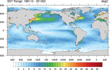 SST data: NOAA Optimal Interpolation (OI) SST Analysis, version 2 (OISSTv2) 1x1
Years of record
- to
The NOAA Optimal Interpolation SST analysis provides global, spatially complete SSTs on a weekly and monthly basis for 1982-present.
Experts contributing reviews
- Banzon, Viva, Reynolds, Richard
 Stratospheric Ozone: Randel & Wu 2007
Years of record
- to
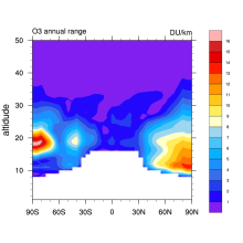
This is a monthly, zonal-mean ozone profile data set spanning 1979–2005 for altitudes from the tropopause up to 50 km. Interannual variability is based on a combination of SAGE (Stratospheric Aerosol and Gas Experiment) satellite profile measurements and polar ozonesondes. The interannual anomalies were added to a climatology from Fortuin and Kelder (1998). …
-
Formats
- binary
-
Timestep
- Monthly
-
Domain
- Global
-
Collections
- Boundary Conditions
Experts contributing reviews
- Randel, Bill