CPC Unified Gauge-Based Analysis of Global Daily Precipitation

Key Strengths
Key Limitations
Cite this page
Acknowledgement of any material taken from or knowledge gained from this page is appreciated:
National Center for Atmospheric Research Staff (Eds). Last modified "The Climate Data Guide: CPC Unified Gauge-Based Analysis of Global Daily Precipitation.” Retrieved from https://climatedataguide.ucar.edu/climate-data/cpc-unified-gauge-based-analysis-global-daily-precipitation on 2026-07-21.
Citation of datasets is separate and should be done according to the data providers' instructions. If known to us, data citation instructions are given in the Data Access section, above.
Acknowledgement of the Climate Data Guide project is also appreciated:
Schneider, D. P., C. Deser, J. Fasullo, and K. E. Trenberth, 2013: Climate Data Guide Spurs Discovery and Understanding. Eos Trans. AGU, 94, 121–122, https://doi.org/10.1002/2013eo130001
Key Figures
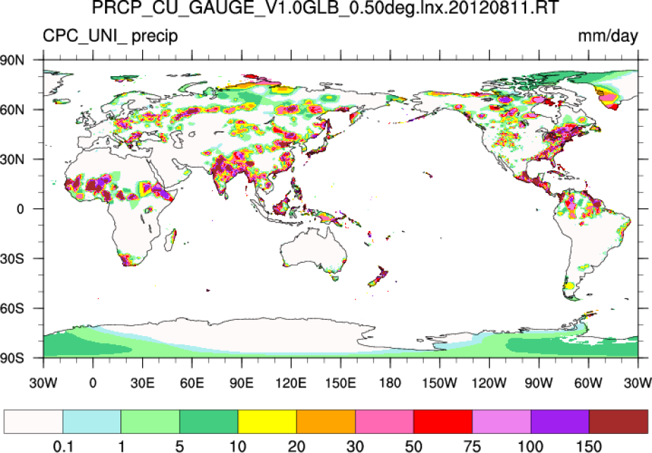
CPC-Unified daily guage based precipitation estimates for 11 August 2012. [Climate Data Guide; D. Shea]
Other Information
- Xie, P., A. Yatagai, M. Chen, T. Hayasaka, Y. Fukushima, C. Liu, and S. Yang (2007), A gauge-based analysis of daily precipitation over East Asia, J. Hydrometeorol., 8, 607. 626
- Chen, M., W. Shi, P. Xie, V. B. S. Silva, V E. Kousky, R. Wayne Higgins, and J. E. Janowiak (2008), Assessing objective techniques for gauge-based analyses of global daily precipitation, J. Geophys. Res., 113, D04110
- Mingyue Chen, Wei Shi, Pingping Xie, Viviane B. S. Silva, Vernon E. Kousky, R. Wayne Higgins, John E. Janowiak. (2008) Assessing objective techniques for gauge-based analyses of global daily precipitation. Journal of Geophysical Research 113:D4
- Xie, P (2010): CPC unified gauge-based analysis of global daily precipitation