Global surface temperature data: MLOST: NOAA Merged Land-Ocean Surface Temperature Analysis
NOAA's Merged Land-Ocean Surface Temperature Analysis (MLOST) combines land surface air temperatures primarily from the Global Historical Climatology Network, Monthly (GHCN-M) version 3 with SSTs of the ERSSTv3b analysis into a comprehensive global surface temperature data set spanning 1880 to the present at monthly resolution, on a 5x5 degree latitude-longitude grid. As such, it is one of the main data sets used to monitor global and regional temperature variability and trends. Like GISTEMP, interpolation of the station records is performed to provide broad spatial coverage, however, the methodology is unique. Land and ocean domains are treated separately. For both domains, high and low-frequency variations are reconstructed separately using empirical orthogonal functions, and these signals are combined and blended with the original records. The final step involves combining the land and ocean data sets into one; over coastal regions land and ocean values are weighted in proportion to the amount of land or ocean in the 5x5 degree box. Data-sparse areas are masked to prevent reliance on the highly smoothed reconstruction estimates. Sea ice areas are also set to missing.
Key Strengths
Key Limitations
Cite this page
Acknowledgement of any material taken from or knowledge gained from this page is appreciated:
National Center for Atmospheric Research Staff (Eds). Last modified "The Climate Data Guide: Global surface temperature data: MLOST: NOAA Merged Land-Ocean Surface Temperature Analysis.” Retrieved from https://climatedataguide.ucar.edu/climate-data/global-surface-temperature-data-mlost-noaa-merged-land-ocean-surface-temperature on 2026-07-10.
Citation of datasets is separate and should be done according to the data providers' instructions. If known to us, data citation instructions are given in the Data Access section, above.
Acknowledgement of the Climate Data Guide project is also appreciated:
Schneider, D. P., C. Deser, J. Fasullo, and K. E. Trenberth, 2013: Climate Data Guide Spurs Discovery and Understanding. Eos Trans. AGU, 94, 121–122, https://doi.org/10.1002/2013eo130001
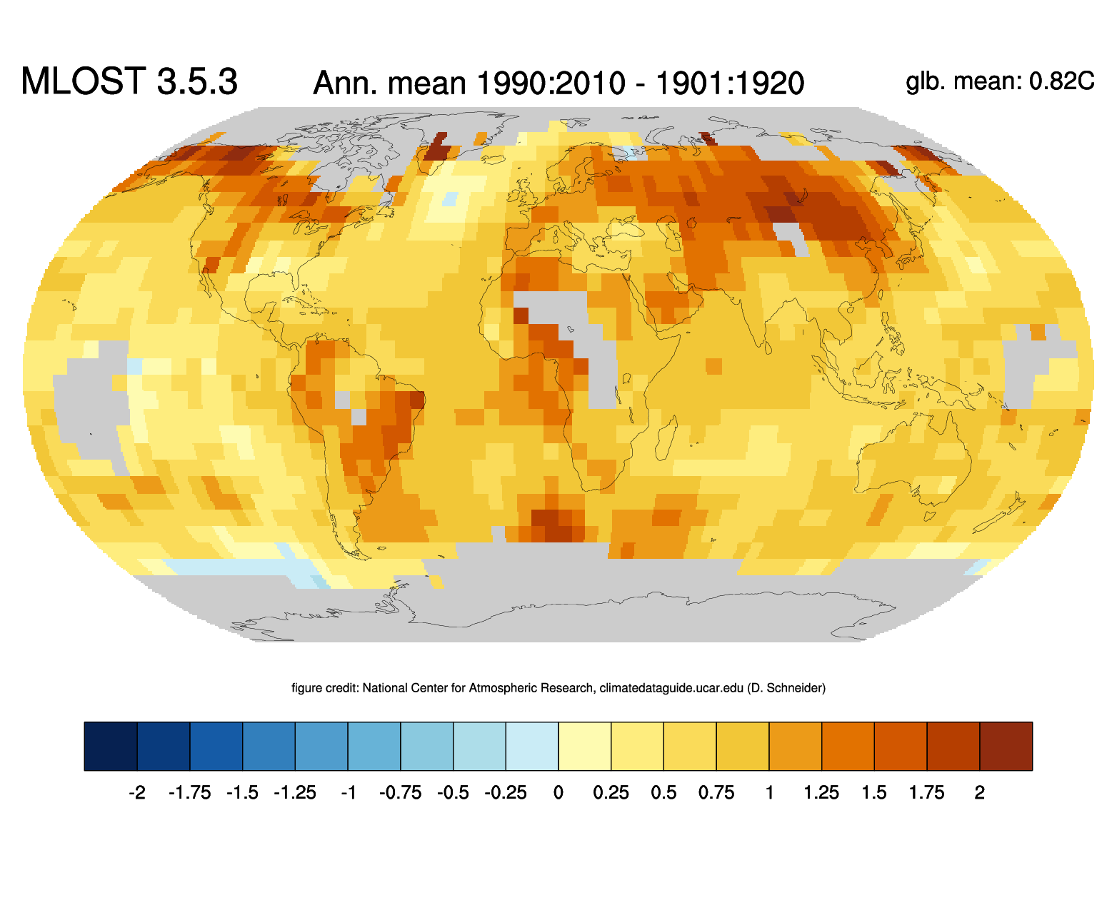
Key Figures
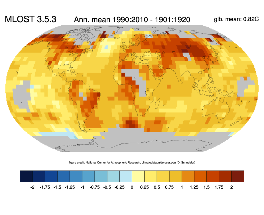
Change of annual mean temperatures between 1901:1920 and 1991:2010 based on the NOAA MLOST dataset. Credit: ClimateDataGuide, NCAR
Other Information
- Vose, Russell S., and Coauthors, 2012: NOAA's Merged Land–Ocean Surface Temperature Analysis. Bull. Amer. Meteor. Soc., 93, 1677–1685.
- Smith, Thomas M., Richard W. Reynolds, Thomas C. Peterson, Jay Lawrimore, 2008: Improvements to NOAA’s Historical Merged Land–Ocean Surface Temperature Analysis (1880–2006). J. Climate, 21, 2283–2296.