Climate data guide content with tag Europe
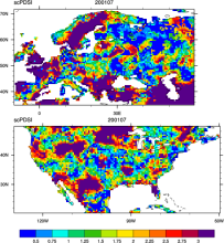
 CRU sc-PDSI (self-calibrating PDSI) over Europe & North America
Years of record
- to
Maps of the monthly self-calibrating Palmer drought severity index (SCPDSI) have been calculated for the period 1901–2002 for the contiguous United States (20°–50°N and 130°–60°W) and Europe (35°–70°N, 10°W–60°E) with a spatial resolution of 0.5° × 0.5°
-
Formats
- ascii
-
Timestep
- Monthly
-
Domain
- Europe, North America
-
Collections
- N/A
Experts contributing reviews
- N/A
 E-OBS: High-resolution gridded mean/max/min temperature, precipitation and sea level pressure for Europe & Northern Africa
Years of record
- to
E-OBS is a high spatial resolution daily gridded data that covers the European region and is based on the station data collated by the ECA&D initiative (Klein Tank et al., 2002). These data are supplied by many European National Meteorological Services and other data providers across Europe and the Middle East. The dataset spans the period 1 January 1950 to the…
Main variables and Earth System components
Atmosphere Air Temperature Maximum Air Temperature Minimum Air Temperature Precipitation Sea Level PressureExperts contributing reviews
- van der Schrier, Gerard
 Surface Solar Radiation Data Set - Heliosat (SARAH) -Edition 1
Years of record
- to
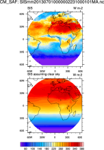
"The Surface Solar Radiation Data Set - Heliosat (SARAH) is a satellite-based climatology of the solar surface irradiance (SIS), the surface direct normalized irradiance (DNI) and the effective cloud albedo (CAL) derived from satellite observations of the visible channels of the MVIRI and SEVIRI instruments onboard the geostationary Meteosat satellites. The data are…
-
Formats
- netCDF
-
Timestep
- Sub-daily, Daily, Monthly
-
Collections
- Climate Data Record
Experts contributing reviews
- N/A