Climate data guide content with tag Antarctic
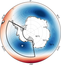 Amundsen Sea Low indices
Years of record
- to
The Amundsen Sea Low (ASL) is a climatological low pressure center located over the extreme southern Pacific Ocean, off the coast of West Antarctica. Atmospheric variability in this region is larger than anywhere else in the Southern Hemisphere, and exhibits significant correlations with both the Southern Annular Mode (SAM) and ENSO. Given its linkages to…
-
Timestep
- Monthly, Seasonal, Annual
-
Collections
- N/A
Experts contributing reviews
- Hosking, Scott
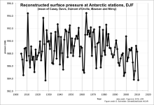 Antarctic Seasonal Pressure Reconstructions 1905-2013
Years of record
- to
This dataset consists of seasonally resolved timeseries of surface pressure at 18 Antarctic research stations, spanning 1905-2013. Routine meteorological observations began at most of these stations only around 1960, leaving a very short instrumental record on which to assess Antarctic climate variability and change. Surface pressure is one of the most…
-
Formats
- ascii, Spreadsheet
-
Timestep
- Seasonal
-
Domain
- Antarctic
-
Collections
- N/A
Experts contributing reviews
- N/A
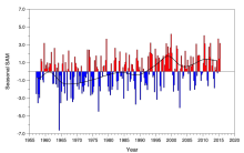 Marshall Southern Annular Mode (SAM) Index (Station-based)
Years of record
- to
The station-based index of the Southern Annular Mode (SAM) is based on the zonal pressure difference between the latitudes of 40S and 65S. As such, the SAM index measures a "see-saw" of atmospheric mass between the middle and high latitudes of the Southern Hemisphere. Positive values of the SAM index correspond with stronger-than-average westerlies over the…
-
Formats
- ascii
-
Timestep
- N/A
-
Collections
- N/A
Experts contributing reviews
- Marshall, Gareth
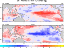 Merged Hadley-NOAA/OI Sea Surface Temperature & Sea-Ice Concentration (Hurrell et al, 2008)
Years of record
- to
The merged Hadley-OI sea surface temperature (SST) and sea ice concentration (SIC) data sets were specifically developed as surface forcing data sets for AMIP style uncoupled simulations of the Community Atmosphere Model (CAM). The Hadley Centre's SST/SIC version 1.1 (HADISST1), which is derived gridded, bias-adjusted in situ observations, were merged with the NOAA-…
Main variables and Earth System components
Cryosphere Sea Ice Concentration Ocean SST - sea surface temperature-
Formats
- netCDF
-
Timestep
- Monthly
Experts contributing reviews
- N/A
 NSIDC Sea Ice Index
Years of record
- to
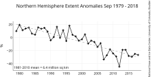
The NSIDC Sea Ice Index is a suite of easy-to-use sea ice analyses to track changes in Arctic and Antarctic sea ice. The product is produced and supported by the NOAA at NSIDC group and consists of browse imagery and data text files (CSV or Excel format). The input data is from two sources distributed by the NASA NSIDC Distributed Active Archive Center (DAAC): (1) Sea…
Experts contributing reviews
- Meier, Walter
 Sea Ice Concentration Climate Data Record from OSI SAF
Years of record
- to
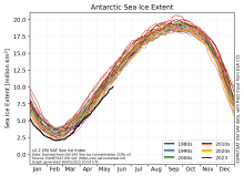
The Ocean and Sea Ice Satellite Applications Facility (OSI SAF) of EUMETSAT provides sea ice concentration products for the Arctic and Antarctic based on satellite passive microwave data. The concentration value is expressed as the fractional percentage of the ice cover in a given grid cell. Since 2023, OSI-450-a and OSI-430-a constitute the third fully…
-
Formats
- netCDF
-
Timestep
- Daily
-
Collections
- N/A
Experts contributing reviews
- Aaboe, Signe, Lavergne, Thomas
 Sea Ice Concentration data from AMSR-E, AMSR2 & SSMIS, U Bremen and U Hamburg ASI algorithm
Years of record
- to
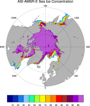
The sea ice data derived from AMSR-E using the ARTIST sea ice (ASI) algorithm offer a factor of 4 finer spatial resolution than most sea ice data sets from passive microwave satellite instruments. ASI is based on the difference of vertically and horizontally polarized brightness temperatures at 89 GHz; this difference is independent of temperature but depends on…
-
Timestep
- Daily
-
Collections
- N/A
Experts contributing reviews
- N/A
 Sea Ice Concentration data from HadISST
Years of record
- to
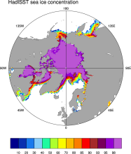
Spanning 1871-present at monthly timesteps, HadISST provides the longest gridded sea ice data available for both the Arctic and Antarctic. It is a 1° x 1° spatially infilled data set that is It is intended as a consistent analyses for input into SST analyses or as boundary conditions for models. Version 1.1 is the currently available data set and is the one described…
-
Timestep
- Monthly
-
Collections
- Boundary Conditions
Experts contributing reviews
- N/A
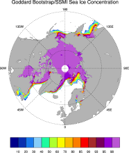 Sea Ice Concentration data from NASA Goddard and NSIDC based on Bootstrap algorithm
Years of record
- to
Bootstrap sea ice refers to a well-known algorithm used to estimate sea ice concentration from passive microwave brightness temperatures. It can be applied to data from many satellite instruments, such as SMMR, SSMI, and AMSR-E. This page discusses the algorithm itself and the long-term data set ("NSIDC 0079, version 2") produced by J. Comiso and distributed by NSIDC.…
-
Timestep
- Daily, Monthly
-
Collections
- N/A
Experts contributing reviews
- N/A
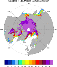 Sea Ice Concentration data from NASA Goddard and NSIDC based on NASA Team algorithm
Years of record
- to
NASA Team sea ice refers to a well-known algorithm used to estimate sea ice concentration from passive microwave brightness temperatures. This page discusses the algorithm itself and the long-term data set ("NSIDC 0051") produced by scientists at NASA Goddard and distributed by NSIDC. The NASA Team data are very widely used and are a key input into other data sets…
-
Timestep
- Daily, Monthly
-
Collections
- Diagnostic Data Sets, NCAR-DOE-CESM, seaicediagnostics
Experts contributing reviews
- N/A
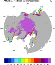 Sea Ice Concentration data from NASA Goddard and NSIDC using AMSR-E and NASA TEAM2 (NT2) algorithm
Years of record
- to
The AMSR-E/NASA Team 2 (NT2) data set of Arctic and Antarctic sea ice concentration is available at daily timesteps and 12.5 km (optionally 25km) spatial resolution for 2002-2011. NT2, an extension of the original NASA Team algorithm, uses AMSR-E 89GHz channels to help resolve ambiguity between low ice concentrations and areas with strong surface effects (due to snow…
Experts contributing reviews
- N/A
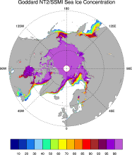 Sea ice concentration data from NASA Goddard based on SSMI and NASA Team (NT2) algorithm
Years of record
- to
The NASA Team 2 (NT2) / SSMI data set of Arctic and Antarctic sea ice concentration is available at daily timesteps and 25km spatial resolution for 1992-2008. NT2, an extension of the original NASA Team algorithm, uses SSMI 85GHz channels to help resolve ambiguity between low ice concentrations and areas with strong surface effects (due to snow layering and glazing).…
Experts contributing reviews
- N/A
 Sea Ice Concentration data from NOAA OI
Years of record
- to
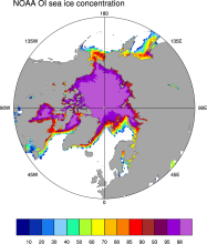
The NOAA Optimal Interpolation (OI) v2 sea ice data set contains gridded, weekly or monthly resolution sea ice concentration estimates for both the Northern and Southern Hemispheres. It is intended as a consistent analyses for input into SST analyses (and is the basis for calculating SSTs in sea ice zones for the OI SST data) or as boundary conditions for atmospheric…
-
Formats
- netCDF
-
Timestep
- Monthly, Weekly
-
Collections
- Boundary Conditions
Experts contributing reviews
- N/A
 Sea Ice Concentration data: Overview, Comparison table and graphs
Years of record
- N/A
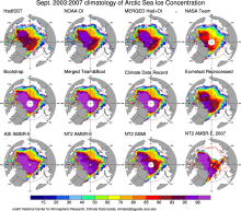
Sea ice concentration is both an indicator and driver of changes high-latitude climate with strong societal and ecological importance. It is a key boundary condition for atmospheric models (including those used in atmospheric reanalyses) and a benchmark for coupled climate models. As such, numerous methods have been developed to estimate sea ice concentration. The most…
-
Formats
- N/A
-
Timestep
- N/A
-
Collections
- Overview / Comparison page
Experts contributing reviews
- N/A
 Sea Ice Concentration: NOAA/NSIDC Climate Data Record
Years of record
- to
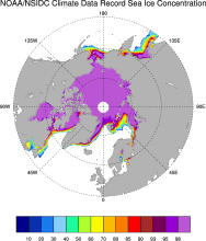
The NOAA/NSIDC Climate Data Record (CDR) of sea ice concentration is available at 25 x 25 km spatial resolution in daily or monthly timesteps for 1987-2014. It provides a consistent interpretation of sea ice for the satellite record, with the intent of being suitable for studies of climate variability and change. The CDR is produced by an automated and independent…
-
Formats
- netCDF
-
Timestep
- Daily, Monthly
-
Collections
- Climate Data Record
Experts contributing reviews
- Meier, Walter
 Sea Ice Thickness Data Sets: Overview & Comparison Table
Years of record
- to
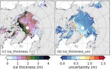
While satellite observations of sea ice extent and concentration are available from 1979, long-term high quality (daily and high spatial resolution) observations of sea ice thickness remain limited as a result of few satellite and in situ observations. Reconstructions using numerous observational sources show a 65% decline in annual mean sea ice thickness in the central…
Experts contributing reviews
- Labe, Zachary, Tilling, Rachel
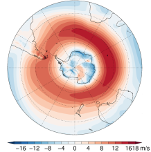 Southern Hemisphere westerly jet strength and position
Years of record
- to
The dynamics of the Southern Hemisphere westerly jet are described in terms of two indices, jet strength and jet latitude. Here, these indices are defined using the ERA-Interim reanalysis, although other datasets, including climate models, could be used. Although closely linked with the Southern Annular Mode (SAM) Index, these indices more precisely capture…
-
Formats
- ascii
-
Timestep
- Seasonal, Annual
-
Collections
- N/A
Experts contributing reviews
- Bracegirdle, Thomas J.
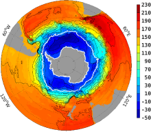 Southern Ocean State Estimate (SOSE)
Years of record
- to
The Southern Ocean State Estimate (SOSE) is a model-generated best fit to Southern Ocean observations. As such, it provides a quantitatively useful climatology of the mean-state of the Southern Ocean. Technically, SOSE is a solution to the MITgcm. SOSE is a gridded dataset at 1/6 ° horizontal resolution, available at timesteps from daily to annually.…
Main variables and Earth System components
Ocean 3D Velocity Bottom pressure SST - sea surface temperature Salinity Sub Surface Temperature mixed layer depth sea surface height u, v current components Wind Stress-
Formats
- binary
-
Timestep
- Daily, Monthly, Weekly, Annual
-
Collections
- N/A
Experts contributing reviews
- Mazloff, Matthew