AIRS (Atmospheric InfraRed Sounder): Version 6 Level 2
Teaser image

Main content
AIRS Version 6 Level 2 data represent a significant improvement over AIRS Version 5 Level 2 products in terms of greater stability, yield, and quality. Several algorithmic improvements have been made by the AIRS Project in conjunction with the AIRS Science Team. Improvements include: (a) Improved soundings of Tropospheric and Sea Surface Temperatures, day and night; (b) Improvements are larger with increasing cloud cover; (c) Improved retrievals of surface spectral emissivity, day and night; (d) Most of the spurious temperature bias trend seen in earlier versions has been removed; (e) Substantially improved retrieval yield (number of soundings accepted for output) for climate studies; (f) AIRS-Only retrievals with comparable accuracy to AIRS/AMSU retrievals; and (g) More realistic hemispheric seasonal variability and global distribution of Carbon Monoxide. Retrievals from AIRS are being used as a component of the Collaborative Climate Model and Observational Data Services (CCMODS) project to identify and correct biases in modeled physical processes occurring at many spatial or temporal scales.
Three of the significant changes for the Version 6 L3 data include:
- L3 support products which contain profile data at 100 vertical levels are now available.
- A TqJoint grid is available, which contains gridded data for a common set of temperature and water vapor observations.
- Water vapor and trace gas products are now reported both as layer and level quantities.
Key Strengths
Key Strengths
High resolution (13km at nadir)
Key Limitations
Key Limitations
Individual satellite swaths can be noisy.
Please cite data sources, following the data providers' instructions
Dataset DOIs
None
Hosted Climate Index Files
None
Data Access
Usage Restrictions
None
Key Figures
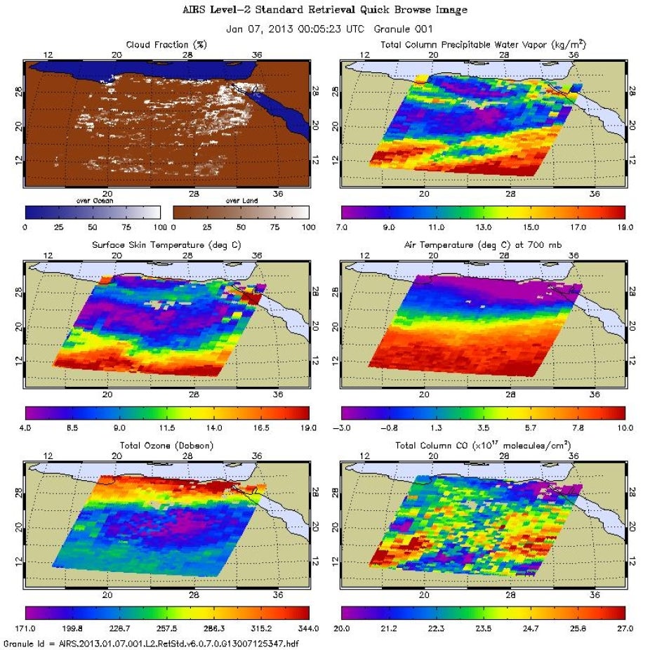
AIRS Level 2 quick browse image for Jan. 7, 2013
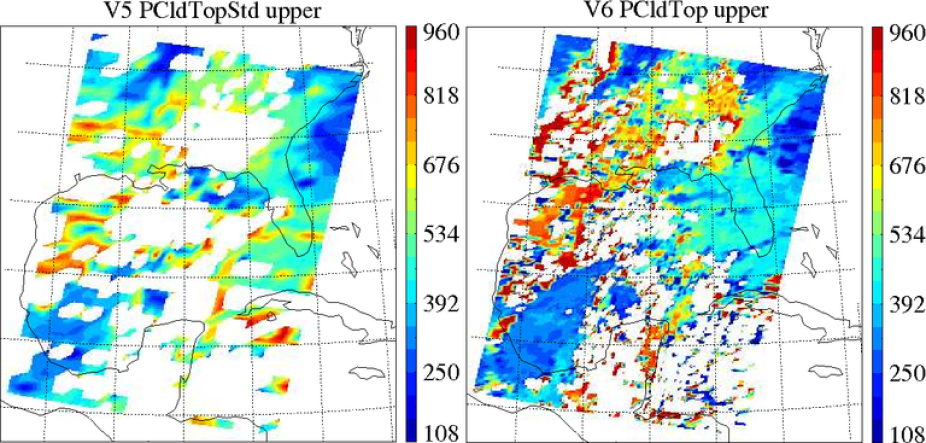
A side-by-side comparison of Version 5 PCldTopStd and Version 6 PCldTop shows the improved resolution of the AIRS Cloud retrieval in Version 6 which is now at the AIRS resolution (~13 km) rather the AMSU resolution (~45 km). Source: http://disc.sci.gsfc.nasa.gov/datareleases/aqua-airs-version-6-near-rea…

These figures show a side-by -side comparison of AIRS NRT Version 5 (left panel) and Version 6 (right panel) total column CO converted to mixing ratio. Source: http://disc.sci.gsfc.nasa.gov/datareleases/aqua-airs-version-6-near-rea…
Other Information
Earth system components and main variables
Type of data product
Dataset collections
None
Years of record
to
Data time period extended
Yes, data set is extended
Timestep
Sub-daily
Domain
Input Data
None
Vertical Levels:
Missing Data Flag
None
Ocean or Land
None
Spatial Resolution
None
Model Resolution (reanalysis)
None
Data Assimilation Method
None
Model Vintage (reanalysis)
None