Climate data guide content with tag HDF
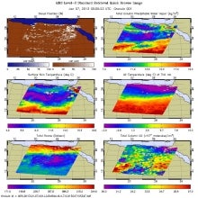 AIRS (Atmospheric InfraRed Sounder): Version 6 Level 2
Years of record
- to
AIRS Version 6 Level 2 data represent a significant improvement over AIRS Version 5 Level 2 products in terms of greater stability, yield, and quality. Several algorithmic improvements have been made by the AIRS Project in conjunction with the AIRS Science Team. Improvements include: (a) Improved soundings of Tropospheric and Sea Surface Temperatures, day and night…
Main variables and Earth System components
Atmosphere Aerosols Air Temperature CO Geopotential Height Ozone: Tropospheric Precipitable water Specific HumidityExperts contributing reviews
- N/A
 IMERG precipitation algorithm and the Global Precipitation Measurement (GPM) Mission
Years of record
- to
IMERG (Integrated Multi-satellitE Retrievals for the Global Precipitation Measurement) is NASA's updated precipitation algorithm, while the Global Precipitation Measurement (GPM) mission is an international satellite mission launched by NASA and JAXA on Feb. 27, 2014. The GPM is a follow on to the TRMM satellite mission. NASA have applied the IMERG algorithm to both…
Experts contributing reviews
- Huffman, George J., Tan, Jackson
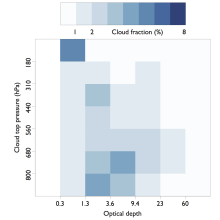 ISCCP: International Satellite Cloud Climatology Project
Years of record
- to
The International Satellite Cloud Climatology Project (ISCCP) makes use of routine observations by operational weather satellites to provide a long-term (1983-2009), gridded, global record of cloud properties. ISCCP uses observations in the visible and infrared window portions of the spectrum to determine cloud optical thickness and cloud top temperature, from which the…
-
Timestep
- Climatology, Sub-daily, Monthly
-
Domain
- Global
Experts contributing reviews
- Pincus, Robert
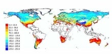 Landscape surface freeze/thaw status based on passive microwave remote sensing
Years of record
- to
A global data set of the frozen state of the land surface (free-thaw (FT) status) has been developed spanning 1979-present at a daily timestep and 25 x 25 km spatial resolution. Based on passive microwave remote sensing, the FT parameter is closely related to the surface energy budget, hydrologic cycle, trace gas exchanges, vegetation growth, and terrestrial carbon…
-
Timestep
- Daily
-
Domain
- Global
-
Collections
- Climate Data Record
Experts contributing reviews
- Kimball, John
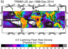 Lightning data from the TRMM and ISS Lightning Image Sounder (LIS): Towards a global lightning Climate Data Record
Years of record
- to
The Lightning Imaging Sensor (LIS) is an optically based spaceborne lightning detection instrument that has been hosted on two different platforms – the Tropical Rainfall Measuring Mission satellite (TRMM; 1998-2015; Kummerow et al. 1998) and the International Space Station (ISS; 2017-present; Blakeslee et al. 2020). Relative to TRMM LIS, which covered ±38 latitude, ISS…
Experts contributing reviews
- Lang, Timothy
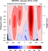 NASA MERRA
Years of record
- to
The Modern Era Retrospective-Analysis for Research and Applications (MERRA) was undertaken by NASA’s Global Modeling and Assimilation Office with two primary objectives: to place observations from NASA’s Earth Observing System satellites into a climate context and to improve upon the hydrologic cycle represented in earlier generations of reanalyses. MERRA was generated…
Main variables and Earth System components
Atmosphere Air Temperature Geopotential Height Precipitable water Water Vapor-
Timestep
- Sub-daily, Monthly
-
Domain
- Global
Experts contributing reviews
- N/A
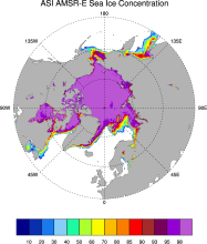 Sea Ice Concentration data from AMSR-E, AMSR2 & SSMIS, U Bremen and U Hamburg ASI algorithm
Years of record
- to
The sea ice data derived from AMSR-E using the ARTIST sea ice (ASI) algorithm offer a factor of 4 finer spatial resolution than most sea ice data sets from passive microwave satellite instruments. ASI is based on the difference of vertically and horizontally polarized brightness temperatures at 89 GHz; this difference is independent of temperature but depends on…
-
Timestep
- Daily
-
Collections
- N/A
Experts contributing reviews
- N/A
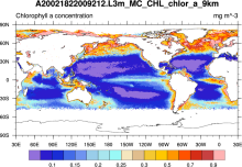 SeaWIFS: ocean bio-optical and carbon properties
Years of record
- to
The purpose of the Sea-viewing Wide Field-of-view Sensor (SeaWiFS) Project is to provide quantitative data on global ocean bio-optical properties and to assess the oceans' role in the global carbon cycle. SeaWiFS data are being used to help clarify the magnitude and variability of chlorophyll and primary production by marine phytoplankton, and to determine the…
-
Formats
- HDF
-
Timestep
- Climatology, Daily, Monthly, Seasonal, Annual
-
Domain
- Global
-
Collections
- Carbon cycle
Experts contributing reviews
- N/A
 TRMM: Tropical Rainfall Measuring Mission
Years of record
- to
The Tropical Rainfall Measuring Mission (TRMM) is a joint space mission between NASA and Japan's National Space Development Agency designed to monitor and study tropical and subtropical precipitation and the associated release of energy. The mission uses 5 instruments: Precipitation Radar (PR), TRMM Microwave Imager (TMI), Visible Infrared Scanner (VIRS), Clouds &…
-
Timestep
- Sub-daily, Daily, Monthly
-
Domain
- Tropics
-
Collections
- Climate Analysis Section (CAS) Data Catalog, Obs4MIPS
Experts contributing reviews
- Huffman, George J., Pendergrass, Angeline
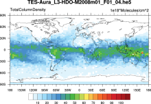 Water Isotopes from Satellites
Years of record
- to
Summary of 7 satellite-derived products providing a global snapshot of water isotope distribution in 3D, with good information on zonal gradients and seasonality.
Experts contributing reviews
- Risi, Camille