AVISO: Satellite derived Sea Surface Height above Geoid
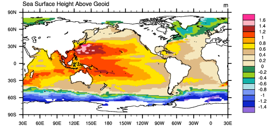
The sea surface height relative to the geoid (the mean ocean surface of the Earth if the ocean is at rest) is derived from TOPEX/Poseidon, Envisat, Jason-1, and OSTM/Jason-2 altimetry measurements. Altimetry is a technique for measuring height. Satellite altimetry measures the time taken by a radar pulse to travel from the satellite antenna to the surface and back to the satellite receiver. Combined with precise satellite location data, altimetry measurements yield sea-surface heights. This AVISO dataset was created by binning and averaging monthly values on 1 degree grids.
AVISO stands for "Archiving, Validation and Interpretation of Satellite Oceanographic data".
Cite this page
Acknowledgement of any material taken from or knowledge gained from this page is appreciated:
National Center for Atmospheric Research Staff (Eds). Last modified "The Climate Data Guide: AVISO: Satellite derived Sea Surface Height above Geoid.” Retrieved from https://climatedataguide.ucar.edu/climate-data/aviso-satellite-derived-sea-surface-height-above-geoid on 2026-02-15.
Citation of datasets is separate and should be done according to the data providers' instructions. If known to us, data citation instructions are given in the Data Access section, above.
Acknowledgement of the Climate Data Guide project is also appreciated:
Schneider, D. P., C. Deser, J. Fasullo, and K. E. Trenberth, 2013: Climate Data Guide Spurs Discovery and Understanding. Eos Trans. AGU, 94, 121–122, https://doi.org/10.1002/2013eo130001
Key Figures
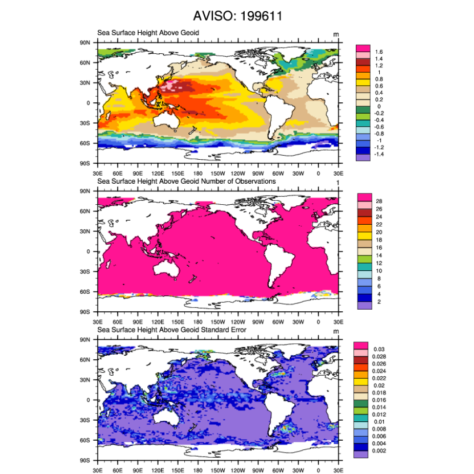
AVISO: Sea surface height above Geoid; number of observations and the standard error (November, 1996). [Climate Data Guide; D. Shea]