Climate data guide content with tag GeoTIFF
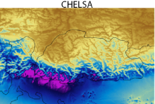 CHELSA high-resolution land surface temperature and precipitation
Years of record
- to
The Climatologies at high resolution for the Earth's land surface (CHELSA) dataset contains high spatial resolution monthly climatologies of mean, maximum and minimum temperatures and mean precipitation, representing the period 1979-2013. CHELSA is essentially a statistical downscaling of the ERA-Interim reanalysis, with the temperature downscaling based on mean…
Experts contributing reviews
- Karger, Dirk
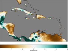 CHIRPS: Climate Hazards InfraRed Precipitation with Station data (version 2)
Years of record
- to
Note: CHIRPS v2 has been superseded by CHIRPS v3 as of June 2025. Climate Hazards Group InfraRed Precipitation with Station data (CHIRPS) is a quasi-global (50S - 50N), land-only rainfall dataset with a range of temporal and spatial resolutions depending on the region and the time period. Data can be found at 0.05 deg or 0.1 deg resolution, and can be found at 6-hourly…
Experts contributing reviews
- Touma, Danielle, Martinez, Carlos
 CHIRPS: Climate Hazards InfraRed Precipitation with Station data (Version 3)
Years of record
- to
Climate Hazards Group InfraRed Precipitation with Station data version 3 (CHIRPS v3)is a 1981-present, land-only, high resolution 0.05° gridded precipitation dataset. It combines thermal-infrared geostationary satellite-based estimates (CHIRP3), in situ observations from global, regional, and national meteorological networks, and a high-resolution climatology (CHPclim2…
Main variables and Earth System components
Precipitation-
Formats
- GeoTIFF
-
Timestep
- Climatology, Monthly, Annual, Pentad
-
Domain
- Africa, Global, South America
-
Collections
- N/A
Experts contributing reviews
- Alaso, Daniella
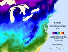 Daymet: Daily Surface Weather and Climatological Summaries
Years of record
- to
Daymet provides long-term, continuous, gridded estimates of daily weather and climatology variables by interpolating and extrapolating ground-based observations through statistical modeling techniques. The Daymet data products provide driver data for biogeochemical terrestrial modeling and have myriad applications in many Earth science, natural resource, biodiversity,…
Main variables and Earth System components
Atmosphere Maximum Air Temperature Minimum Air Temperature Precipitation Radiation Water Vapor Cryosphere Snow Water Equivalent-
Timestep
- Climatology, Daily
-
Domain
- North America
-
Collections
- N/A
Experts contributing reviews
- Thornton, Peter E
 IMERG precipitation algorithm and the Global Precipitation Measurement (GPM) Mission
Years of record
- to
IMERG (Integrated Multi-satellitE Retrievals for the Global Precipitation Measurement) is NASA's updated precipitation algorithm, while the Global Precipitation Measurement (GPM) mission is an international satellite mission launched by NASA and JAXA on Feb. 27, 2014. The GPM is a follow on to the TRMM satellite mission. NASA have applied the IMERG algorithm to both…
Experts contributing reviews
- Huffman, George J., Tan, Jackson
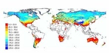 Landscape surface freeze/thaw status based on passive microwave remote sensing
Years of record
- to
A global data set of the frozen state of the land surface (free-thaw (FT) status) has been developed spanning 1979-present at a daily timestep and 25 x 25 km spatial resolution. Based on passive microwave remote sensing, the FT parameter is closely related to the surface energy budget, hydrologic cycle, trace gas exchanges, vegetation growth, and terrestrial carbon…
-
Timestep
- Daily
-
Domain
- Global
-
Collections
- Climate Data Record
Experts contributing reviews
- Kimball, John
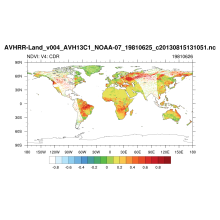 NDVI: Normalized-difference-vegetation-index: NOAA AVHRR
Years of record
- to
Normalized Difference Vegetation Index (NDVI) values are derived from surface reflectance data acquired by the Advanced Very High Resolution Radiometer (AVHRR) sensor. By applying knowledge gathered over time about instrument performance and sensor characteristics, the data are reprocessed to create consistent long-term records, allowing insight into changes in the…
Experts contributing reviews
- N/A
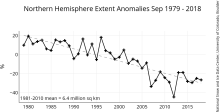 NSIDC Sea Ice Index
Years of record
- to
The NSIDC Sea Ice Index is a suite of easy-to-use sea ice analyses to track changes in Arctic and Antarctic sea ice. The product is produced and supported by the NOAA at NSIDC group and consists of browse imagery and data text files (CSV or Excel format). The input data is from two sources distributed by the NASA NSIDC Distributed Active Archive Center (DAAC): (1) Sea…
Experts contributing reviews
- Meier, Walter
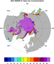 Sea Ice Concentration data from AMSR-E, AMSR2 & SSMIS, U Bremen and U Hamburg ASI algorithm
Years of record
- to
The sea ice data derived from AMSR-E using the ARTIST sea ice (ASI) algorithm offer a factor of 4 finer spatial resolution than most sea ice data sets from passive microwave satellite instruments. ASI is based on the difference of vertically and horizontally polarized brightness temperatures at 89 GHz; this difference is independent of temperature but depends on…
-
Timestep
- Daily
-
Collections
- N/A
Experts contributing reviews
- N/A