Land
Important land variables include soil moisture, vegetation coverage, surface radiation budgets and more. Overview pages summarize and compare selected datasets of a given variable.
To find a specific dataset or variable, jump to the search box below or click your desired variable from among the blue sub-category buttons.
To see only the datasets accompanied by expert commentaries, select the "Datasets with guidance" button when using the search box.
Dataset Overviews
Sub-categories
Climate datasets
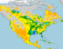
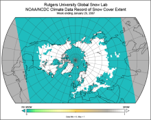 Snow Cover Extent (Northern Hemisphere) Climate Data Record, by Rutgers
Years of record
- to
The Snow Cover Extent Climate Data Record extends from the late 1960s to present. Historical analyses based on visual inspection have been digitized and combined with modern…
-
Timestep
- Monthly, Weekly
-
Domain
- North America
-
Collections
- Climate Data Record, Diagnostic Data Sets, NCAR-DOE-CESM, landdiagnostics
Experts contributing reviews
- Estilow, Thomas W. | Robinson, David
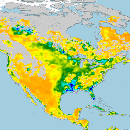
 SMAP-Derived 1-km Downscaled Surface Soil Moisture
Years of record
- to
This data product contains global daily 1 km resolution surface soil moisture (SM) derived from the Soil Moisture Active Passive (SMAP) L-band radiometer observations.…
-
Formats
- N/A
-
Timestep
- Daily
-
Domain
- Global
-
Collections
- N/A
Experts contributing reviews
- Lakshmi, Venkataraman | Fang, Bin
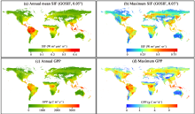 Global dataset of solar-induced chlorophyll fluorescence (GOSIF)
Years of record
- to
GOSIF is a global, gridded dataset of solar-induced chlorophyll fluorescence (SIF). SIF, an energy flux re-emitted by plants a few nanoseconds after light absorption,…
Main variables and Earth System components
Biosphere GPP: Gross Primary Production solar-induced chlorophyll fluorescence (SIF) Land Gross Primary Production-
Formats
- N/A
-
Timestep
- Monthly, Weekly
-
Domain
- Global
-
Collections
- N/A
Experts contributing reviews
- Xiao, Jingfeng | Li, Xing
 Soil Moisture Data Sets: Overview & Comparison Tables
Years of record
- N/A
Soil moisture is a state variable of the land that crosses the interfaces of several disciplines, including meteorology, hydrology, climatology and ecology. Soil moisture…
-
Formats
- N/A
-
Timestep
- N/A
-
Domain
- N/A
-
Collections
- Overview / Comparison page
Experts contributing reviews
- Dirmeyer, Paul
 Historical land-cover changes and land-use conversions global data set by Meiyappan and Jain
Years of record
- to
A set of three estimates of land-cover types and annual transformations of land use are provided on a global 0.5°x0.5° grid at annual timesteps. The longest of the three…
Main variables and Earth System components
Land Land Cover Type Land Use Conversion Vegetation CoverExperts contributing reviews
- Meiyappan, Prasanth
 Landscape surface freeze/thaw status based on passive microwave remote sensing
Years of record
- to
A global data set of the frozen state of the land surface (free-thaw (FT) status) has been developed spanning 1979-present at a daily timestep and 25 x 25 km spatial…
-
Timestep
- Daily
-
Domain
- Global
-
Collections
- Climate Data Record
Experts contributing reviews
- Kimball, John
 Making sense of data from Land Surface Models (LSMs)
Years of record
- N/A
The land surface is a dynamic and complex component of the Earth system, shaping climate and biogeochemical cycles and serving as the origin of many anthropogenic impacts on…
-
Formats
- N/A
-
Timestep
- N/A
-
Domain
- N/A
-
Collections
- N/A
Experts contributing reviews
- Mankin, Justin | Lesk, Corey
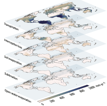 Global Land Evaporation Amsterdam Model (GLEAM)
Years of record
- to
The Global Land Evaporation Amsterdam Model (GLEAM) is a satellite remote sensing-based set of algorithms dedicated to the estimation of evaporation and soil moisture at…
Main variables and Earth System components
Biosphere land evaporation Land evapotranspiration Soil Moisture-
Formats
- N/A
-
Timestep
- Daily
-
Domain
- Global
-
Collections
- N/A
Experts contributing reviews
- Miralles, Diego | Koppa, Akash
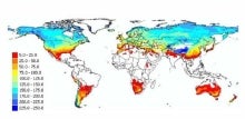
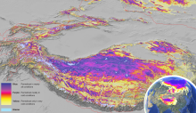 Global Permafrost Zonation Index Map
Years of record
- N/A
This data set contains a global (excluding Antarctica) 1 km map of permafrost zonation. It is an estimate of to what degree permafrost exists in a region nearly everywhere,…
Experts contributing reviews
- Gruber, Stephan
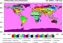 CERES: IGBP Land Classification
Years of record
- N/A
The International Geosphere–Biosphere Programme (IGBP) defines ecosystems surface classifications. The CERES (Clouds and Earth's Radiant Energy System)10-minute data can be…
Experts contributing reviews
- N/A
 LANDSAT
Years of record
- to
"The Landsat Program provides the longest continuous space-based record of Earth’s land in existence. Since 1972, Landsat satellites have collected measurements of Earth’s…
Main variables and Earth System components
Biosphere NPP: Net Primary Production Land Land Cover Type Vegetation Cover-
Formats
- N/A
-
Timestep
- Sub-daily
-
Domain
- Global
-
Collections
- Carbon cycle
Experts contributing reviews
- N/A